DENVER — A large temperature swing is in the forecast.
The Front Range could get up to 70 degrees on Sunday and then all the way down to possibly the single digits by Wednesday morning.
This is a very common occurrence on Colorado's Front Range.
Think of the jet stream as the container for cold northern air. The bigger the bend in that container gets, the bigger the temperature swing will be.
Colorado is often right at the transition point to get the biggest part of the swing.
The Forecast
As the jet bends up to the north on Sunday, high pressure and warm air will invade Colorado. Many areas around the Front Range could hit 70 degrees sometime around 2 p.m.
But then the jet stream snaps down quickly to the south on Monday, allowing the cold Canadian air to sweep across the state. We could get lows near 10 degrees by Tuesday morning.
That’s a 60-degree swing in two days.
The Record Books
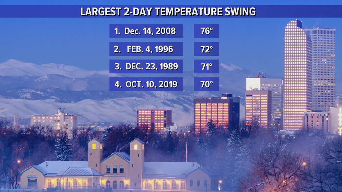
That would not be quite big enough to make the record books.
The biggest two-day swing in Denver history was in Dec. 2008 when we had a 76-degree drop.


Number four on that list just happened in October when we had a 70-degree drop in just two days.
Even if we use the highest and lowest temperature in the computer modeling, 72 degrees and 8 degrees, it would still not make the top 20 largest two-day swings.
There are also records for one-day swings, but this won't be anywhere near the top 20.
The temperature will continue to drop into Wednesday morning and could get into the single digits in the metro area, but that will be too far away from Sunday’s high temperature to be considered for the temperature swing records.
SUGGESTED VIDEOS | Science is Cool

