
COLORADO, USA — Colorado can be a really interesting place to study weather patterns.
And a group of Boulder-based forecasters just published their research about one of biggest weather stories in Colorado history: the wind and weather patterns on the day of the Marshall Fire.
“It's research looking at an analysis of weather conditions that caused the Marshall Fire,” explained Paul Schlatter, a meteorologist with the National Weather Service in Boulder, and part of the research team.
“One of the bottom lines of our research was that the existing numerical weather prediction models, those are the supercomputers that generate a weather forecast, are one of the best in the world resides in Boulder — and they did a very good job of predicting this event, at least 12 hours in advance. Further out in time it was more off-and-on for how well it was predicted. This was a very predictable event, at least within 12 hours of it actually happening — the wind itself.”
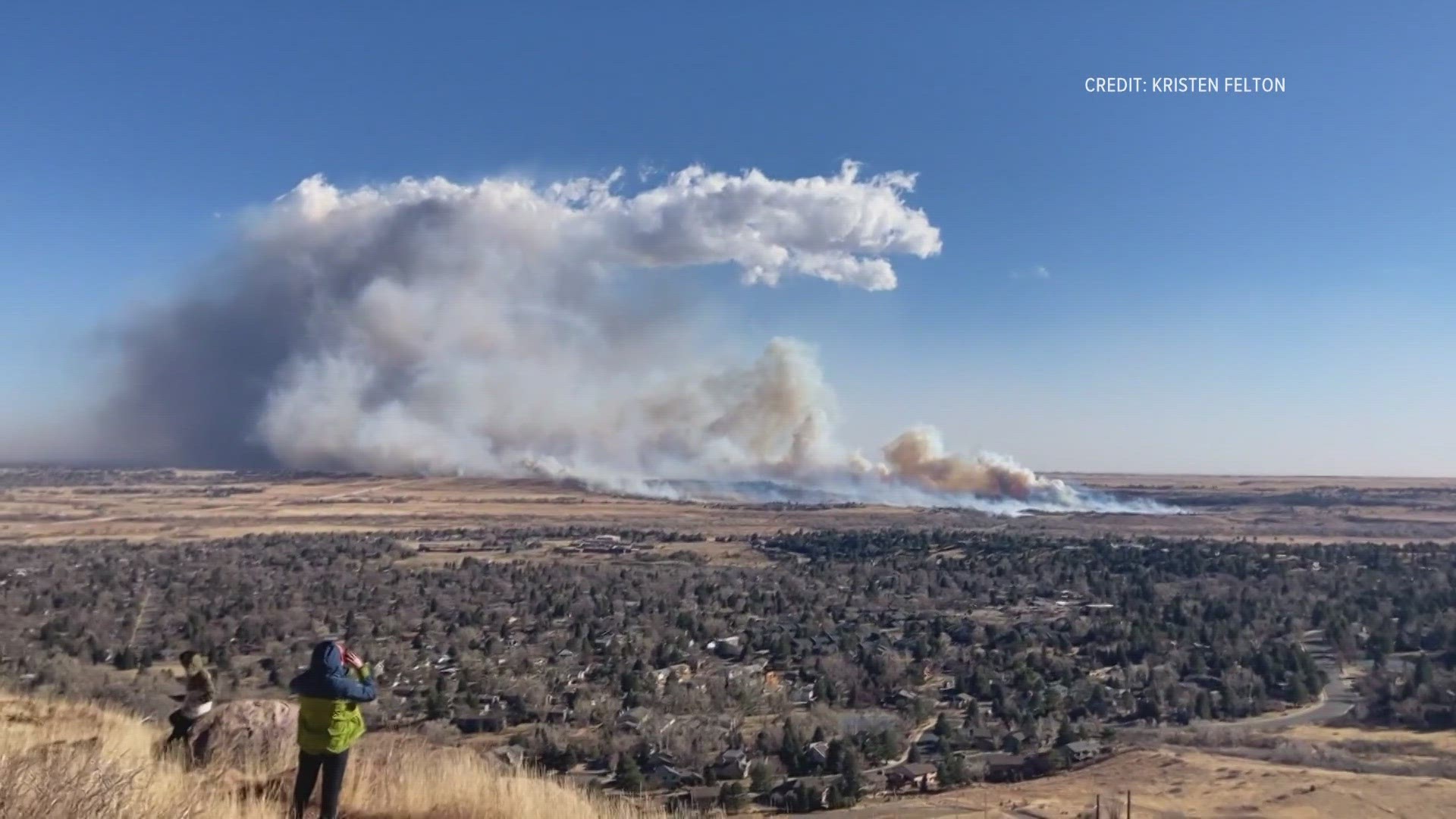
The research, published with the American Meteorological Society, details at length the wind conditions on that day, Dec. 30, 2021, that ultimately led to the most destructive wildfire in Colorado history.
“That was one of the more unique things about the winds that fueled the Marshall Fire,” Schlatter explained. “They went unabated for roughly 11 hours straight, with gusts at least 60 mph. And for several hours in there, gusts over 100 mph.”
He continued:
“Having that much wind, concentrated in that area, any fire that got started there was going to quickly get out of control. In other downslope wind events that we’ve also looked at closely, sometimes they’ll get a break. The winds will slack off for a bit, maybe 10-15 minutes, along that corridor where fire started. That was not the case with this one. It was constant, roughly 11 hours, of constant high and extreme winds.”
There were certainly high wind warnings that day. But there was not a Red Flag Warning – a specific type of fire risk warning that considers not just wind but also relative humidity. Researchers recommended a new approach moving forward.
“The Marshall Fire relative humidity was between 20-25% near where the fire started. The threshold for Red Flag is 15%,” Schlatter explained. “In hindsight, because of how severe the winds were, and who cares what relative humidity is when winds are that strong? Fires are going to spread. In the future, we plan to issue Red Flag Warnings for extreme cases like this, when wind is so strong, so what if relative humidity isn’t quite at that threshold for a Red Flag Warning. We’re just going to issue it anyway.”
Schlatter said this research serves as a good reminder for people who live in these areas of the risk of fire on windy days, especially the wildland urban interface along the Front Range.
“The winds aren’t going anywhere. It’s good to know it can happen then be prepared.”
SUGGESTED VIDEOS: Marshall Fire families