
DENVER — For most of eastern Colorado, Tuesday's snow event was on the lighter-to-moderate range, at least in terms of totals.
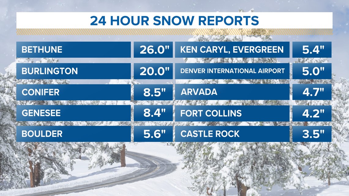
Most of the Denver area wound up with 4-6 inches of snow, with a few isolated higher amounts in the foothills west of the city. The same bore out for most of eastern Colorado, with one notable exception.
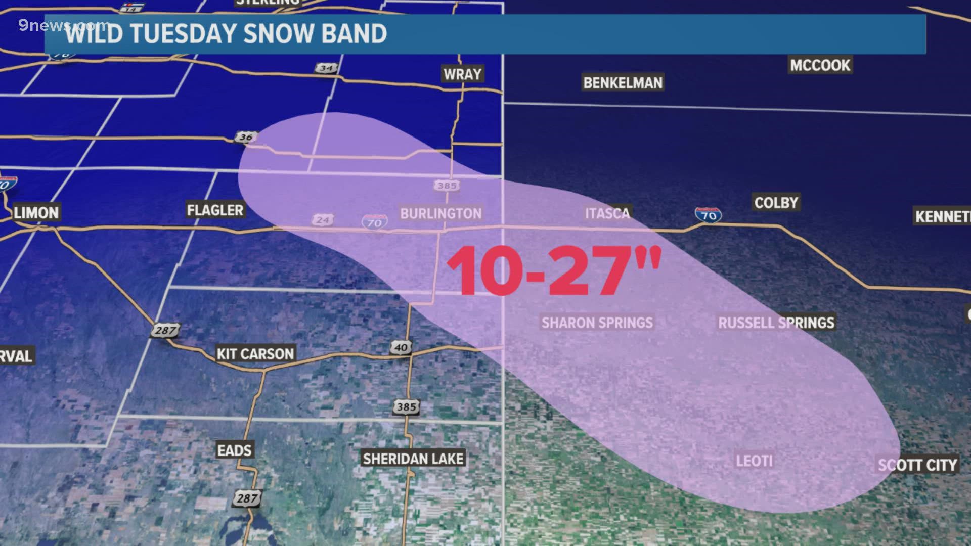
Bethune and Burlington each picked up at least 20 inches of snow, far more than most of the state saw. It came from a narrow stripe of extremely heavy snow that blasted a tiny 10-25 mile fraction of eastern Colorado for at least six hours.
So what caused this tiny snake-like band to sit over the same area for several hours on Tuesday?
> 9NEWS Meteorologists Cory Reppenhagen and Chris Bianchi chatted about this extreme event. Watch their conversation in the video player above.
Tuesday's snow came, in part, from cold, Arctic air spilling in from the northeast. As the cold air moved in from the east, it increased in elevation, thanks to rising terrain over eastern Colorado (upslope).
Meanwhile, the trough of low pressure pushed in winds generally from the west and southwest.
That led to a clash of air masses - right over far eastern Colorado and western Kansas. Neither air mass budged for hours on end, setting up the prolific band that unleashed feet of snow on a tiny portion of the state.
On top of the colliding air masses, the jet stream was roaring overhead, adding extra lift and energy to the snow band.
The results of all this were, well, profound.


SUGGESTED VIDEOS: Science & Weather