COLORADO, USA — Widespread rain looks likely this weekend across Colorado, mostly thanks to the summertime monsoon.
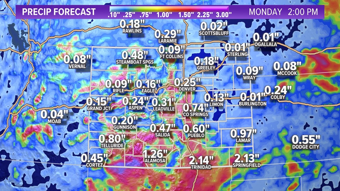
The heaviest rain will fall south of Interstate 70, though most of the state should get in on at least some rain over the next few days.
In northern Colorado, including the Front Range and Denver, the heaviest of the rain could come on Friday night with the passage of a sharp cold front. The front should lead to fairly widespread rainfall, perhaps impacting any outdoor watch parties for Game 5 of the Stanley Cup Final at Ball Arena.
Shower and storm chances will continue for the Front Range for both Saturday and Sunday, with much cooler temperatures to boot. Highs both days probably won't get out of the 70s in Denver -- about 10 degrees below the average for late June.


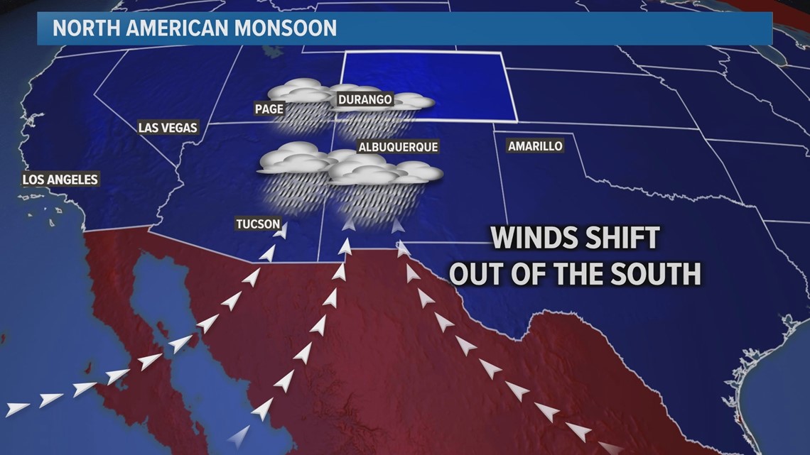
Most of this weekend's rain will come from the annual monsoon, the reversal in wind direction that draws up moisture from the Gulf of Mexico and the Pacific Ocean and triggers widespread summertime rainfall across the Southwest.
The monsoon tends to lead to heavier rainfall across southern parts of the state. There, some areas could see as much as 2-3 inches of generally needed rainfall, although some of those higher totals could lead to flooding and mudslides.


Flash flooding could be an issue in a few areas, especially in or near wildfire burn scars. Southern Colorado will have the highest risk for flooding, although burn scars statewide will have at least a limited threat of flash flooding on Friday, Saturday and Sunday.
Rain chances should lower for both Monday and Tuesday as the monsoonal flow gradually gives way to building high pressure. Temperatures will likely spike back into the 90s by the middle of next week.
SUGGESTED VIDEOS: Colorado Climate

