DENVER — Some people like snow, while some people hate it. Some like the heat, while others prefer the cold.
But for all the subjectivity in weather, there’s usually one constant: Everyone hates the wind.
That is, except on Tuesday.
Strong winds help accelerate snowmelt for a couple of reasons, and that means snow-covered side streets and sidewalks saw significant melting on Tuesday around the Denver area.
Denver woke up to its 13th straight day with at least three inches of snow on the ground on Tuesday, the longest such streak in nearly 11 years. But winds gusted as strong as 50 mph in the immediate Denver area, with gusts up to 60 mph in the nearby foothills. That started the process of really chipping away at the pesky snowpack that’s lingered over the Front Range ever since a late December snowstorm dropped a widespread 6-12 inches of snow around the metro area.
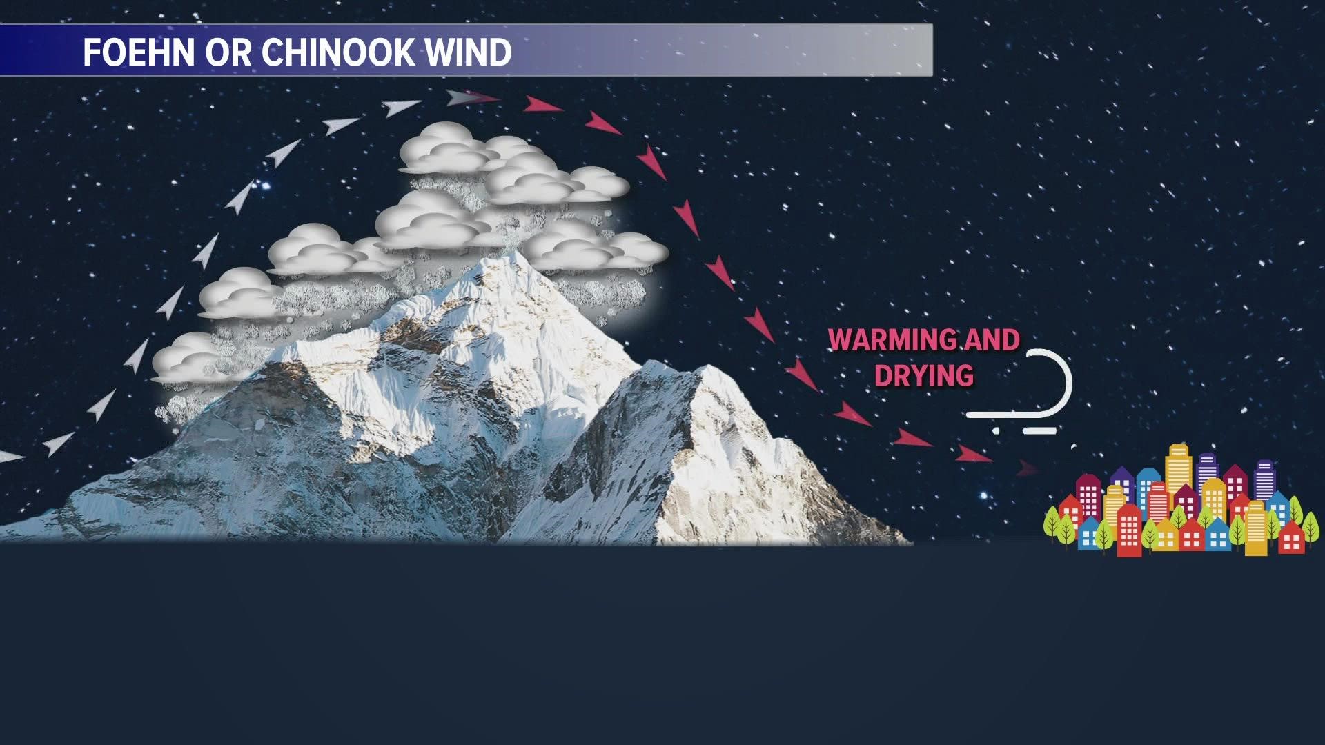
Tuesday’s Front Range winds were known as Chinook or Foehn winds. These types of wind downslope off the Rockies, drying and warming as they move down into the Denver area. Temperatures spiked to near 60 degrees in the Denver area on Tuesday afternoon, about 10-15 degrees above our seasonal average.
Those warming and drying winds are the main reason that Tuesday’s gusts helped accelerate our snowmelt. But there are other reasons as well.
The air just above the snow is typically very cold, helping the snow essentially insulate itself against warmer temperatures. The gusty winds, though, help push away that cold pocket of air near the surface and enhance snow melt.
Finally, the friction from the wind blowing over the snow helps create additional heat, further melting the snow. Think about rubbing your hands together and the heat that causes; the same general concept applies to wind blowing over snow.
There are other factors that can play a role in why strong winds can melt snowfall, but those are the primary ones impacting Tuesday’s accelerated melt.
We’ll get a brief break from the warmer temperatures on Wednesday, with a bit of snow likely in the Denver metro area. Accumulations will likely be an inch or less in the city.
Warmer temperatures return later this week, along with the potential for gusty winds as well. That could help further melt away our pesky snowpack.
SUGGESTED VIDEOS: Colorado Climate

