DENVER — The weather during the week of Thanksgiving will get very interesting, with the remnants of a bomb cyclone and a polar vortex within a seven-day span.
Bomb Cyclone Remnants
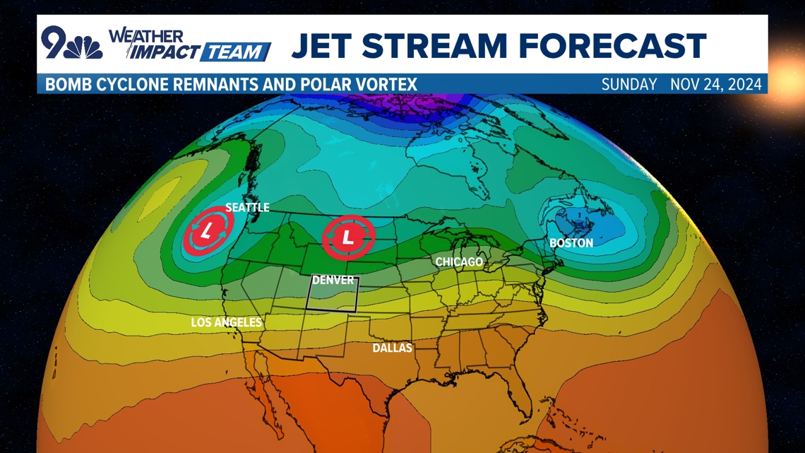
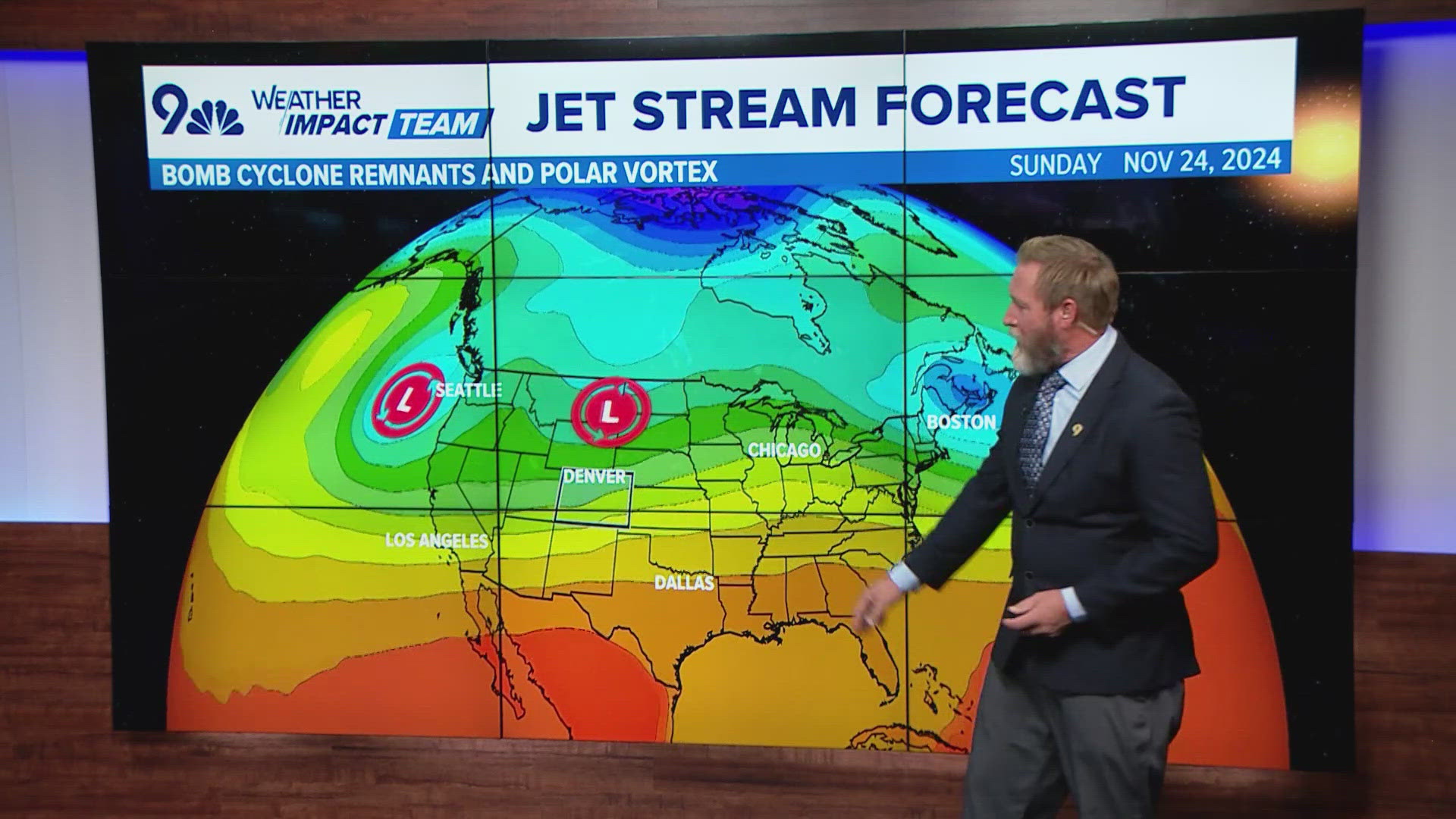
The remnants of a bomb cyclone that has been slamming the Pacific Northwest coast for several days will make its way to the east over the weekend. The main part of the system will be well north of Colorado, but it will drag a strong cold front across the state sometime late Sunday night into Monday morning.


This will only have moderate impacts on Colorado with some light mountain snow accumulation in the 1-6 inch range. There could also be a wave of snow showers across Denver and other parts of the Front Range, however no significant accumulation is expected.
Second Pacific Cyclone
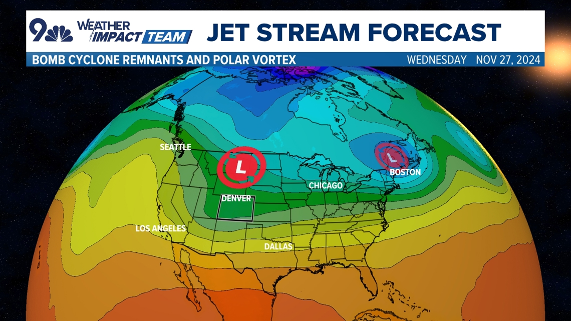
A second cyclone has formed in the Pacific Northwest in the same vicinity as the bomb cyclone, although this storm is slightly less powerful and did not achieve bomb cyclone intensity. It will however, have the opportunity to deliver a bigger impact to Colorado when it moves through our area on Wednesday.


That storm could mix in a little colder air that will start to move down from the North Pole at about the same time. If that times out right with some banding potential due to the jet stream orientation, Denver could be looking at another significant November snowstorm on the day before Thanksgiving.
Only one of the major forecast models is on board with the snowy solution in Denver, but the snow is trending up in other models lately. For now, the more likely scenario unfolding is for about 2-4 inches across the Denver area on Wednesday — stay tuned as this situation develops.
Polar Vortex
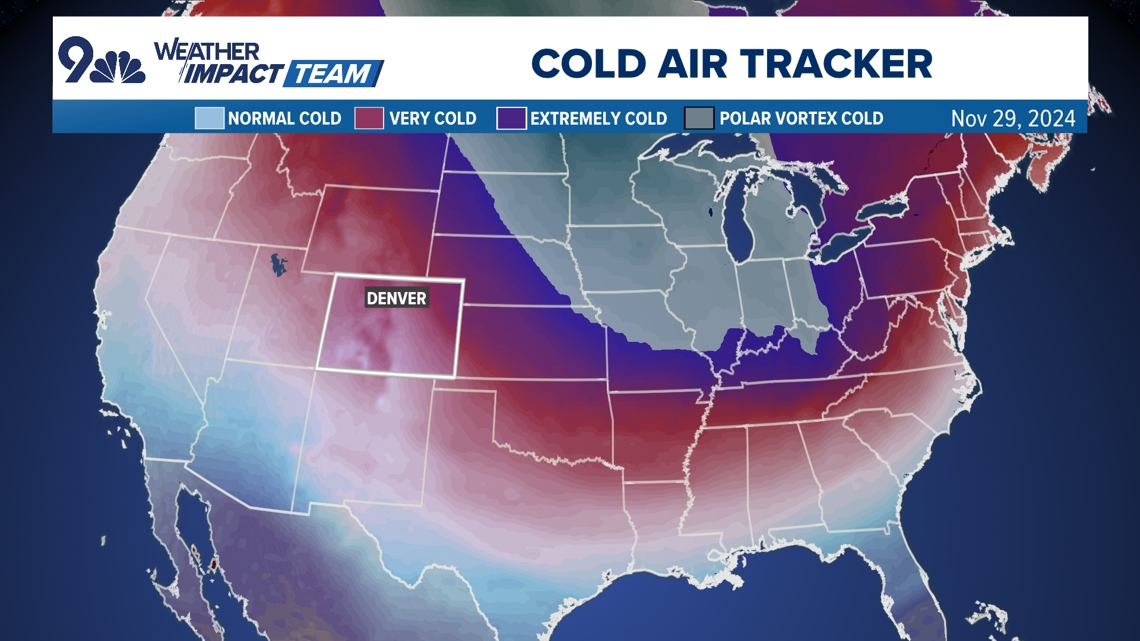
Then on Friday, a polar vortex intrusion is likely to interrupt post-Thanksgiving travel in the eastern states. Denver and other parts of northeast Colorado will likely remain very cold into next weekend, riding the edge of the polar vortex.
The polar vortex is a swirling mass of extremely cold air over the earth's North Pole, which is partially contained by the polar jet stream. An atmospheric setup after Thanksgiving will allow for that extreme cold to spill out over the United States with deep low pressure over New England and high pressure developing over the Great Basin.


Meteorologists used to just call them arctic cold fronts, but recently the term polar vortex has become widely used to describe a deep intrusion of extremely cold air coming from the polar vortex.
This cold will start to spill down on Thanksgiving day, with the bulk of the arctic air mass moving in on Friday and remaining through that Sunday. This front will cover most of the eastern states and the Great Lakes region with extreme cold reaching as far south as northern Georgia.
Heavy snow is also expected with this polar vortex from the Great Lakes to New England.
And by the way, this pattern will likely leave the door open for another polar vortex front to spill down over the eastern states by the following weekend.

