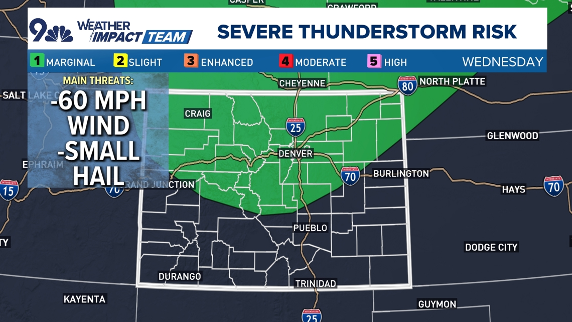
DENVER — Widespread showers and storms are expected across the Denver metro area and northern Colorado on Wednesday afternoon and evening.
Two waves of showers and storms will push through the metro area as a series of cold fronts work their way through the state. The first one will bring showers and storms between 2 and 5 p.m., and the second will lead to evening and even some overnight storms after 6 p.m.
The severe weather risk is low but not zero.
The risk for severe weather is mainly coming from damaging winds, although we could see some small hail in spots. That risk will increase as you go north from Denver, but there is a risk for some stronger storms in the metro area as well.


> Track the weather with our live radar.
Forecast
If you've been waiting for that fall-like weather, you'll get it Thursday with highs dropping into just the mid-70s in Denver, about 10 degrees below average for the first week of September. Morning showers and perhaps a rumble of thunder stick around for the morning, but we'll clear out fairly quickly during the day, and we should have some cooler sunshine back in the picture by the afternoon.
We could also see the mountains above 12,000 feet get their first widespread dusting of snow of the season Wednesday night.
That will give way to quickly warming and drying conditions, with highs back in the mid-80s by Friday, and we'll be near 90 degrees by Saturday and Sunday. That warm, dry weather looks to stick around well into next week, with only mountain showers and storms possible on Sunday, Monday, and Tuesday. We stay dry in the metro area.

