
DENVER — Denver was on a roll this winter with snowfall early on. November, December, and January were all snowier than average.
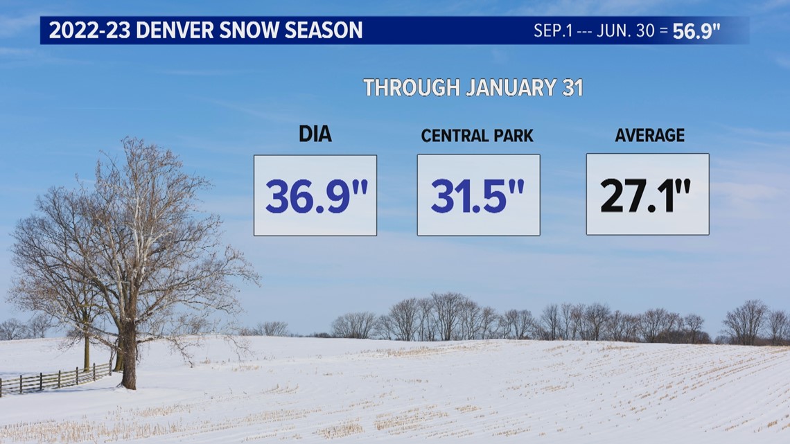
On Jan. 31, there was a total of 36.9 inches of snow at Denver International Airport, and the other official Denver weather station, Central Park, had 31.5.
Both of those numbers are above the combined Denver average of 27.1 inches. (That average also includes several locations in the downtown area from 1882 to 1949.)

But the overall winter weather pattern was in the process of shifting near Christmastime, and by the start of February, that new pattern had taken over completely.
The weather catchphrase in December and January was "polar vortex" as cold arctic air spilled down from the North Pole. That gave Denver ample snow opportunities.
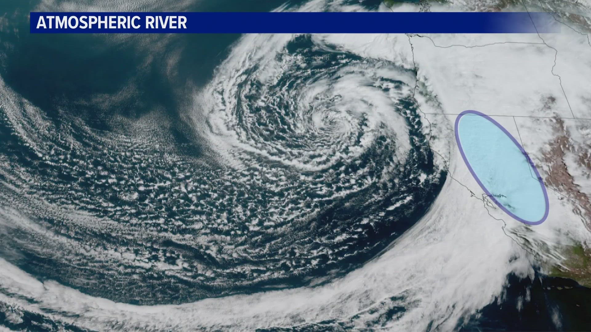
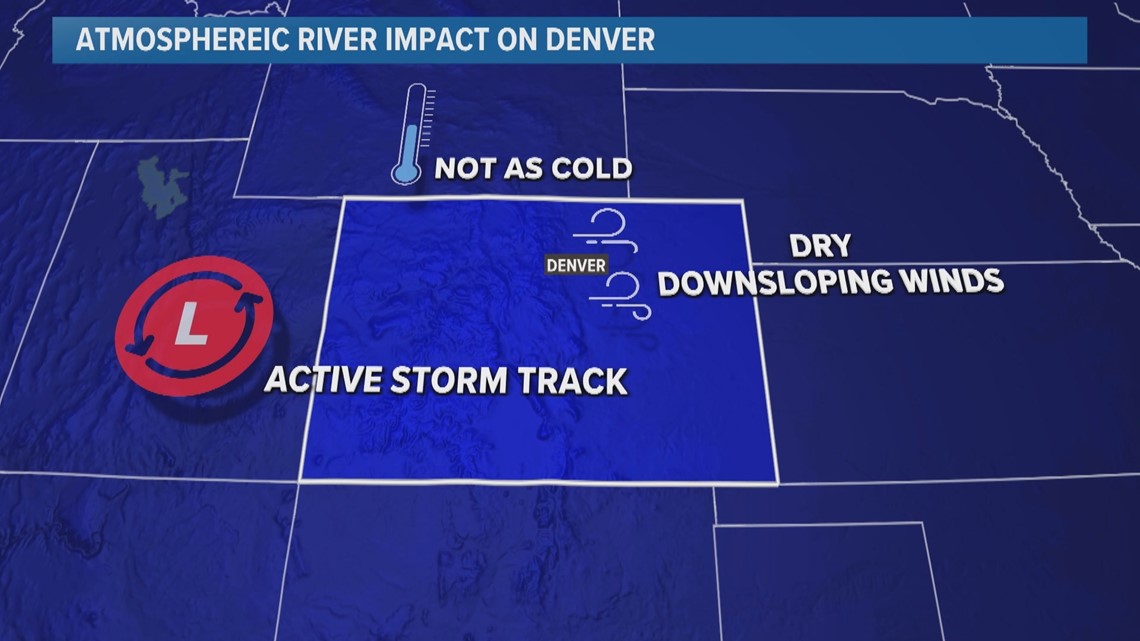
But by February, the new catchphrase was "atmospheric river." A new pattern had taken over that focused the snow right over the Sierra Nevadas in California.
That would still keep storms frequent in Denver, but the source air was not quite as cold as the arctic, and it brought more dry downsloping winds to the Front Range, meaning less snow.

Now the two official Denver weather stations are both below average, and would need some significant snow to reach Denver’s season average of 56.9 inches.
While the Denver area is running low on snowfall, areas to the north are still above. Here's the current total and the average through the middle of April.
- Boulder: 77.5" Average: 69.8"
- Loveland: 52.9" Average: 42.5"
- Fort Collins: 46.3" Average: 42.8"
- Greeley: 40.8" Average: 34.3"
The atmospheric river pattern does appear to be ending, and some colder air will be possible with this week’s storm system. But with the main part of the storm forecast to go to our north, big snow is not likely in Denver.
The way the early forecast stands, Denver would be lucky to get two or three inches out of the entire system, which goes from Wednesday through Friday morning.
There is a chance for some jet-induced snow banding, however, as it appears the jet will be located right over the top of Denver.
That will probably be Denver’s last chance for snow in April. There is one final cold front showing in the computer modeling, but the lowest temperature at this point is only forecast to be 33 degrees.
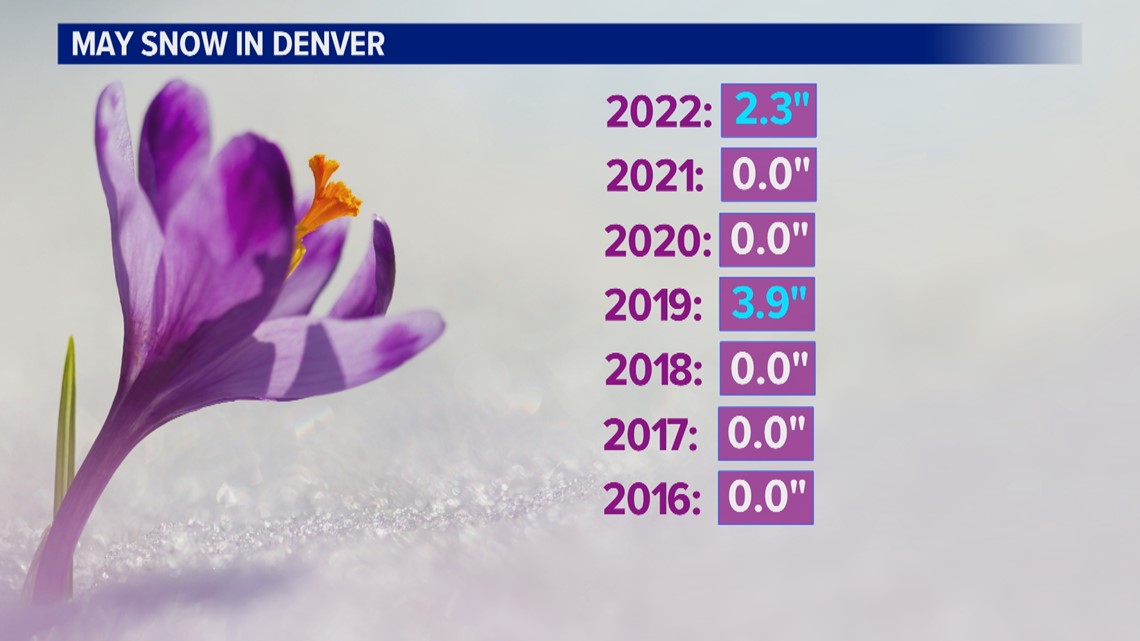
And snow accumulation in May does not come often. It almost always snows once or twice, but there's only been enough to accumulate twice in the last seven years.

Up higher in the suburbs, it's a different story. Wheat Ridge and Boulder have had snow accumulation in five of the last seven Mays.
SUGGESTED VIDEOS: Colorado Climate