DENVER — A spring snowstorm moved into Colorado early Easter Sunday and continued to dump snow for most of the day on Monday.
Here's a look at snow totals from around the state, according to the National Weather Service:
- Air Force Academy - 8.1 inches
- Aspen Springs – 17.8 inches
- Aurora - 2 inches
- Blue River – 7 inches
- Boulder – 16.6 inches
- Breckenridge - 10.8 inches
- Castle Pines - 4 inches
- Colorado Springs – 7 inches
- Cripple Creek - 2.8 inches
- Denver International Airport - 1 inch
- Edgewater - 2.8 inches
- Eldorado Springs - 19.3 inches
- Erie - 9.8 inches
- Estes Park - 8 inches
- Evergreen – 8.2 inches
- Florissant – 2.6 inches
- Fort Collins – 3 inches
- Genesee – 15.5 inches
- Golden - 12.8 inches
- Greeley - 5.1 inches
- Highlands Ranch - 3.1 inches
- Ken Caryl – 12.7 inches
- Lafayette - 11.3 inches
- Lakewood - 6.2 inches
- Leadville – 7.8 inches
- Littleton - 3.8 inches
- Louisville – 9.6 inches
- Longmont - 10 inches
- Loveland - 8.5 inches
- Loveland Pass – 5 inches
- Lyons - 10.5 inches
- Manitu Springs – 7.3 inches
- Meeker Park 11.5 inches
- Nederland -13 inches
- Niwot - 9.8 inches
- Northglenn - 10.5 inches
- Parker - 3.2 inches
- Southeast Breckenridge – 9 inches
- Southwest Boulder – 17.6 inches
- Stapleton – 2 inches
- Westminster – 13.3 inches
- Wheat Ridge - 6.4 inches
- Woodland Park – 1 inch
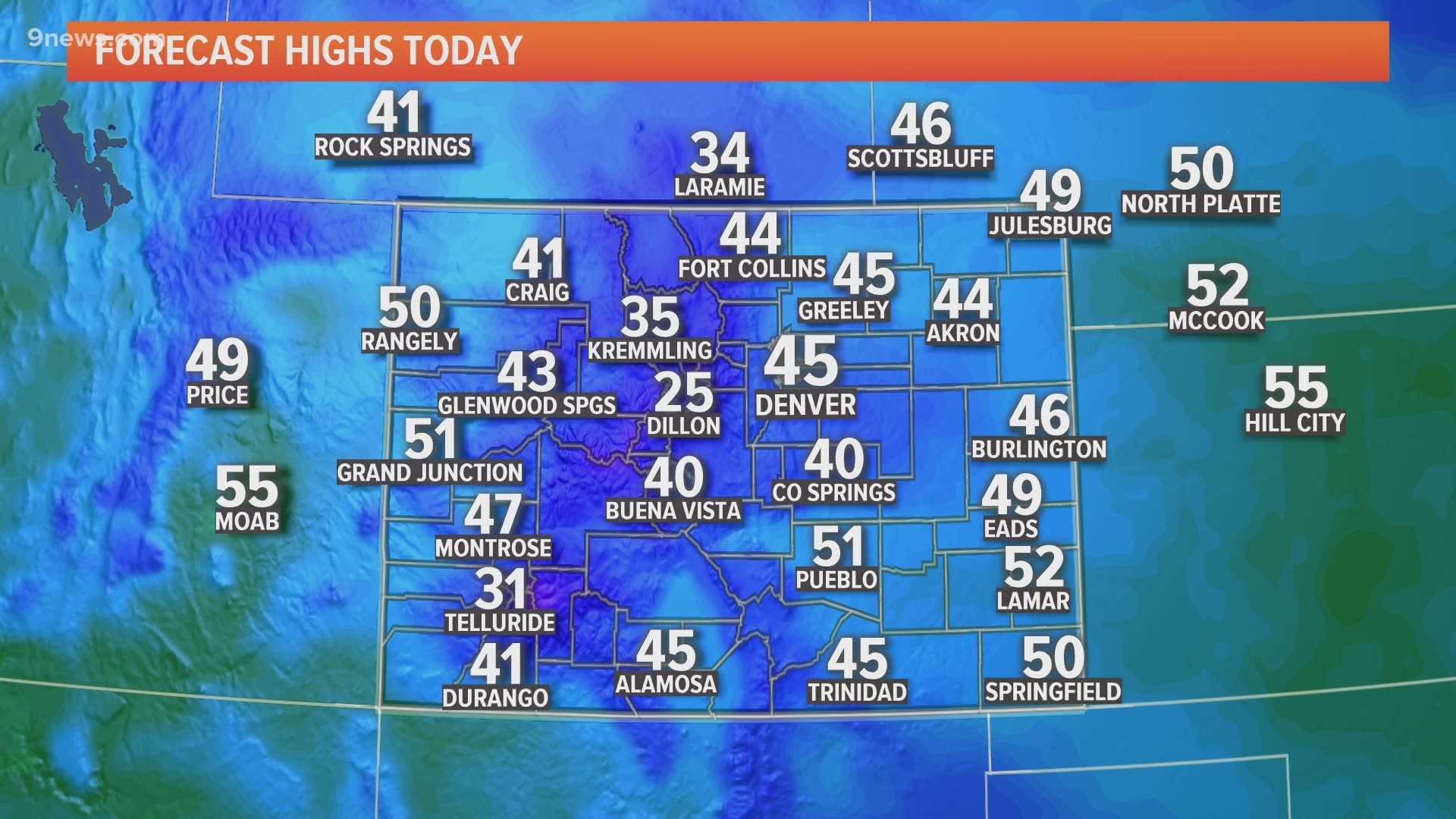
Denver hit a new record low for April 13 with a temperature of 15°. The previous record was 17° set in 1933.
After a more mild Tuesday and Wednesday, snow returns to the forecast again on Thursday.
RELATED: Sunny today, more snow on the way
SUGGESTED VIDEOS | Local stories from 9NEWS

