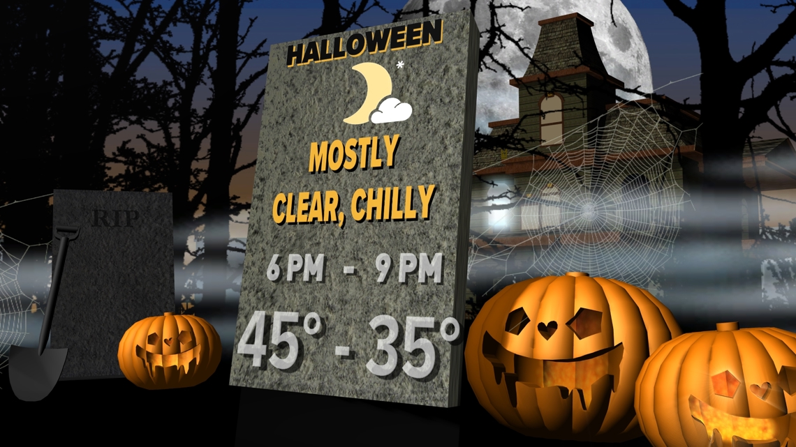
DENVER — A big cooldown will arrive in Colorado, just in time for Halloween.
The 9NEWS Weather Impact team is tracking the potential for a Weather Impact Day early next week.
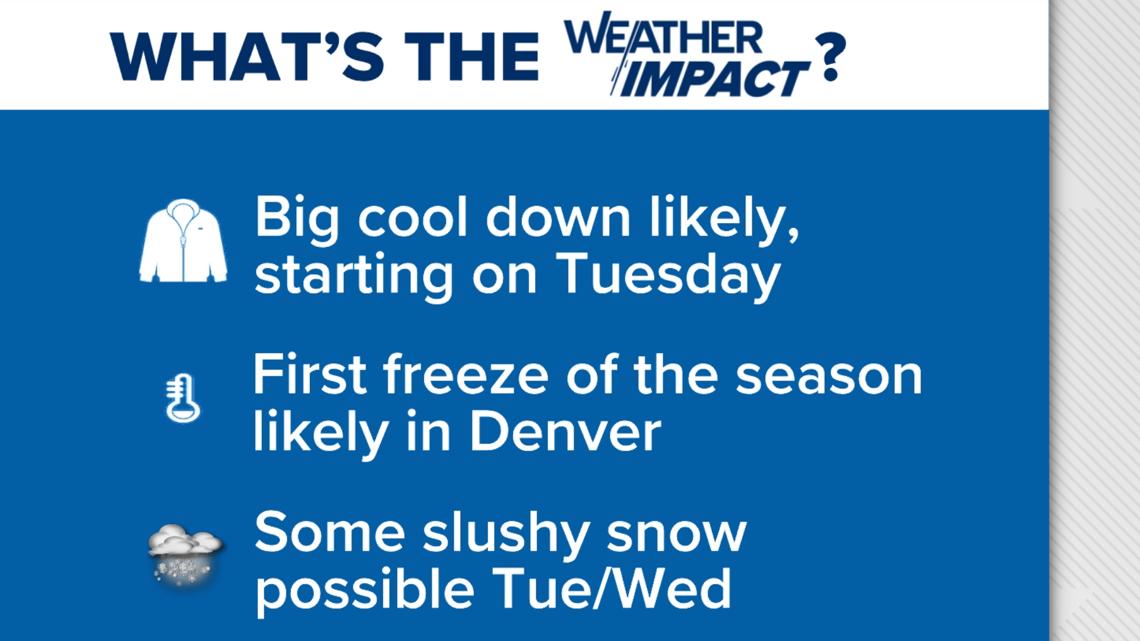
If the models hold, a strong storm will approach from the west, bringing Colorado a big cooldown starting on Tuesday. Denver will see a 50+ degree swing between Sunday and next Wednesday.
Denver has a high likelihood of seeing its first freeze of the season as well as a good chance at its first snow of the season.
The Front Range and eastern plains, including the Denver metro area, are likely to see rain initially before a possible flip to snow for Tuesday night or Wednesday morning. Snow amounts look minimal, with perhaps a bit of slush in Denver, but it might count as our first snow of the season.
Make sure to get those sprinklers blown out if you haven't already as Colorado could see a few days of sub-freezing temperatures for the first time this season next week.
The 9NEWS Weather Impact team will keep a close eye on that storm system, but in the meantime, enjoy the warmer weather while we've got it.

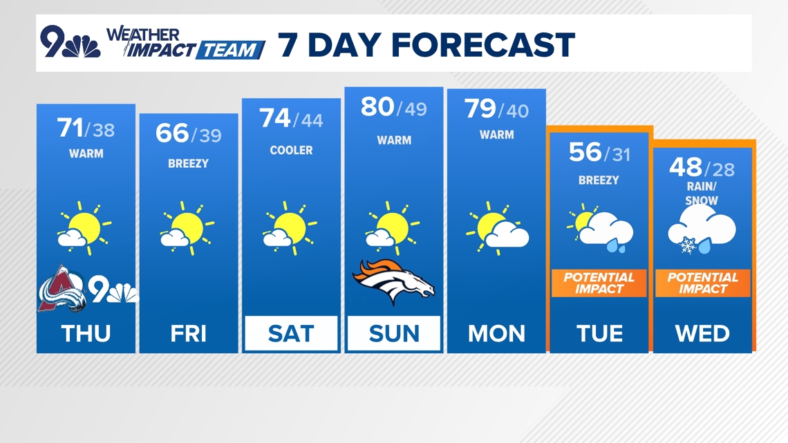
Denver forecast
THURSDAY: Mostly sunny, breezy, and warm, high 71. Mostly clear overnight, low 38.
FRIDAY: Mostly sunny and a bit cooler, high 66. Mostly clear overnight, low 39.
SATURDAY: Partly cloudy and warm, high 74. Partly cloudy overnight, low 44.
SUNDAY: Partly cloudy and warm, high 80. Partly cloudy overnight, low 49.
MONDAY: Mostly sunny and warm, high 79. Partly cloudy overnight, low 40.
TUESDAY: Partly cloudy and much cooler, with a chance of rain showers, high 56. Mostly cloudy, with a chance for rain or snow overnight, low 31.
WEDNESDAY: Mostly cloudy and chilly, with morning snow showers and afternoon sunshine, high 48. Mostly clear overnight, low 28.