DENVER — After several weeks of mild weather, winter weather has roared back into Colorado.
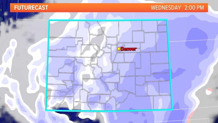
A cold front brought snow and colder temperatures to the higher elevations of Colorado Tuesday before moving into the Denver metro area and eastern plains early Wednesday.
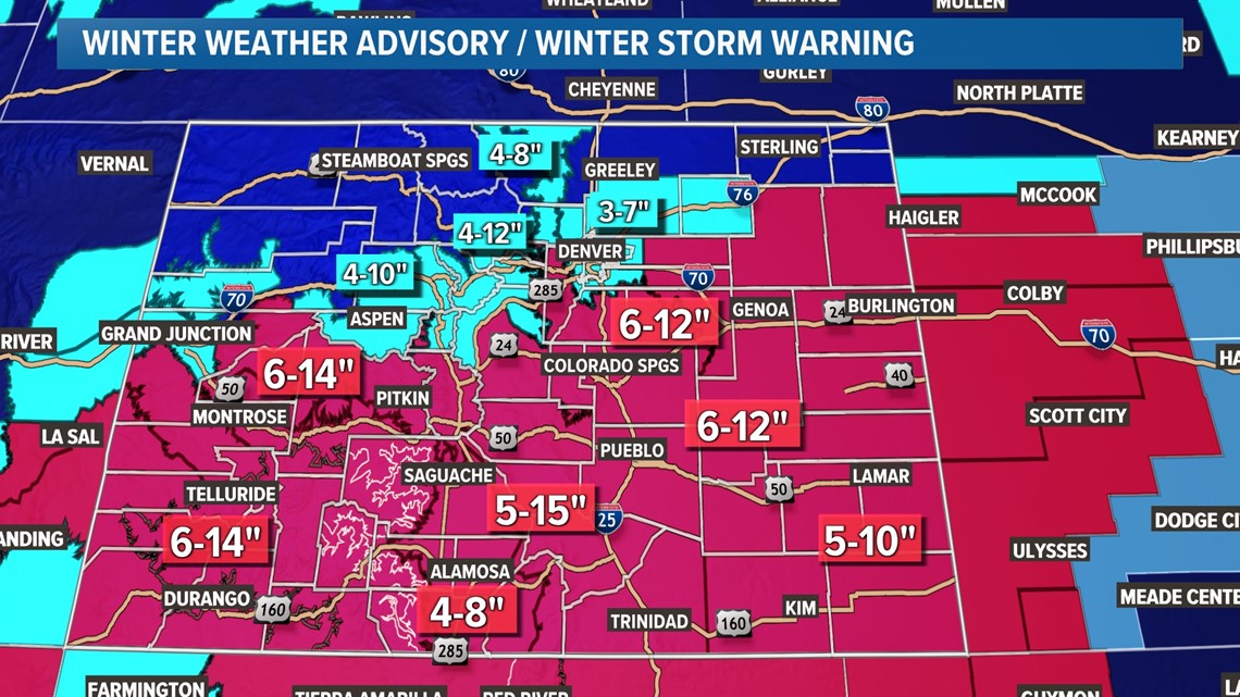
Winter Storm Warnings, Winter Weather Advisories, Avalanche Warnings and Dense Fog Advisories have been issued across Colorado.
Denver, Boulder and eastern Adams and Arapahoe counties are under a Winter Weather Advisory until midnight tonight.
More than three dozen schools, businesses and offices across Colorado are on delayed start, remote start or closed on Wednesday due to snow and windy conditions.
Hundreds of flights have been canceled or delayed at Denver International Airport (DIA) Wednesday.
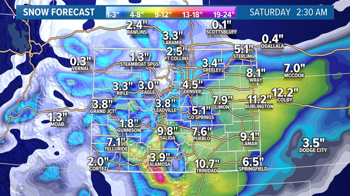
Snow is expected to fall in the Denver metro area throughout the day Wednesday. Most of the Denver area will likely end up with 3 to 6 inches of snow.
The heaviest snowfall will likely occur along the southern foothills, Palmer Divide and adjacent plains. The Palmer Divide between Denver and Colorado Springs will be susceptible to high snowfall amounts, as well as blowing snow.
A few lighter totals are possible north of Denver, including Fort Collins and Greeley, where 1 to 4 inches of snow is possible.
ALERTS: Latest weather alerts
FORECAST: Full forecast
Travel could be difficult Wednesday morning along the Interstate 25 and Interstate 70 corridors. The National Weather Service (NWS) said snow-covered roads will make travel hazardous and to plan on slippery road conditions.
One to 2 feet of snow could fall in the mountains of southwest Colorado. Travel could be very difficult to impossible.
The snow will wrap up on Wednesday evening in the Denver area between about 6 and 10 p.m.
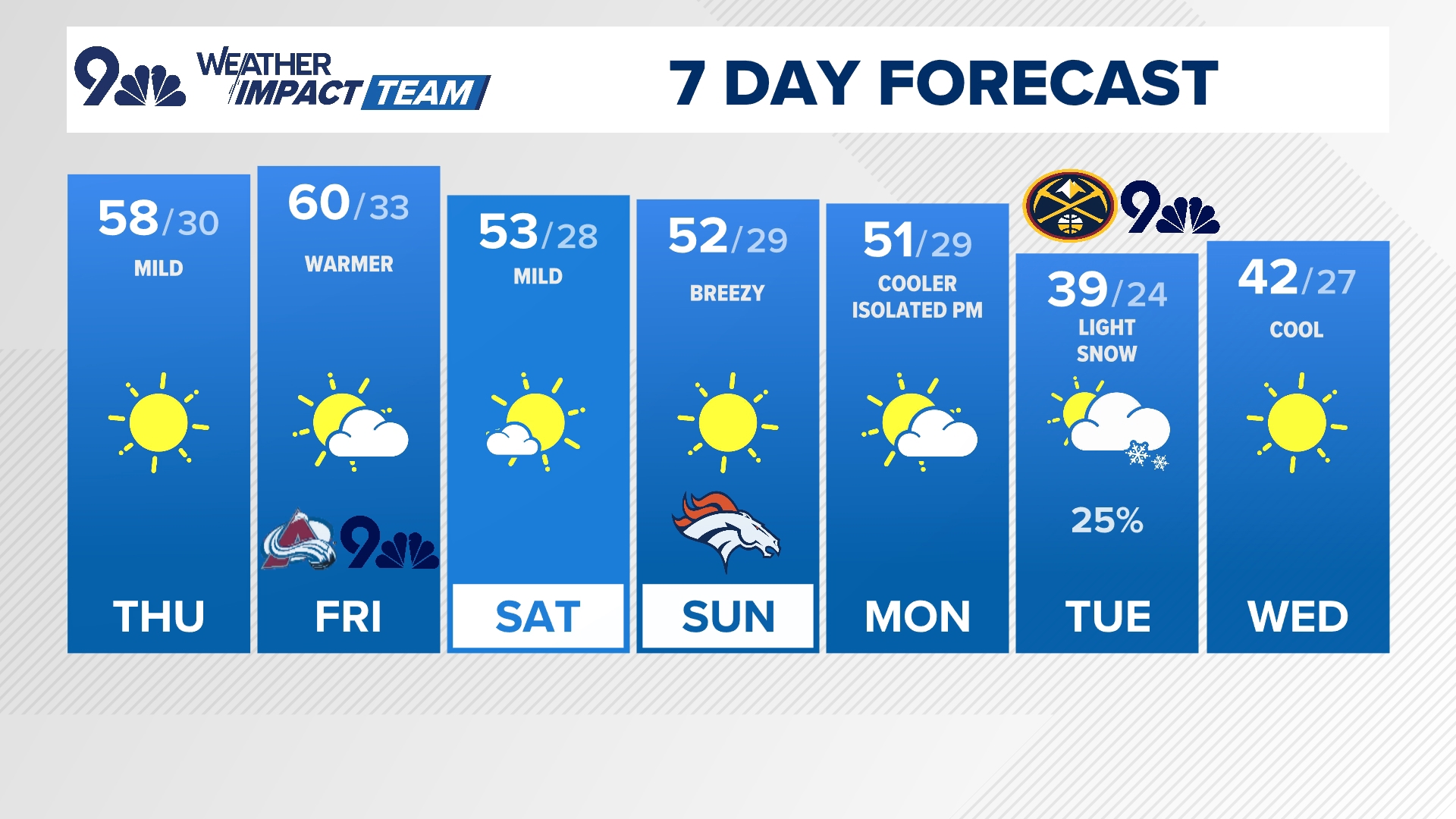
After the snow moves out of Colorado, a high pressure ridge will build providing a pleasant and mild weekend. Colorado's next chance for snow will come late Sunday night into Monday, though this looks like an overall lighter snow event right now.



SUGGESTED VIDEOS: Snow in Colorado


