COLORADO, USA — Winter hit Colorado hard for a couple weeks including two decent snowstorms on the Front Range, but a drier pattern is returning to Denver as northwest flow sets up for the next 10 days.
RELATED: Latest Denver forecast
JAN. 9 (Saturday)
Chance for snow at DIA: 10%
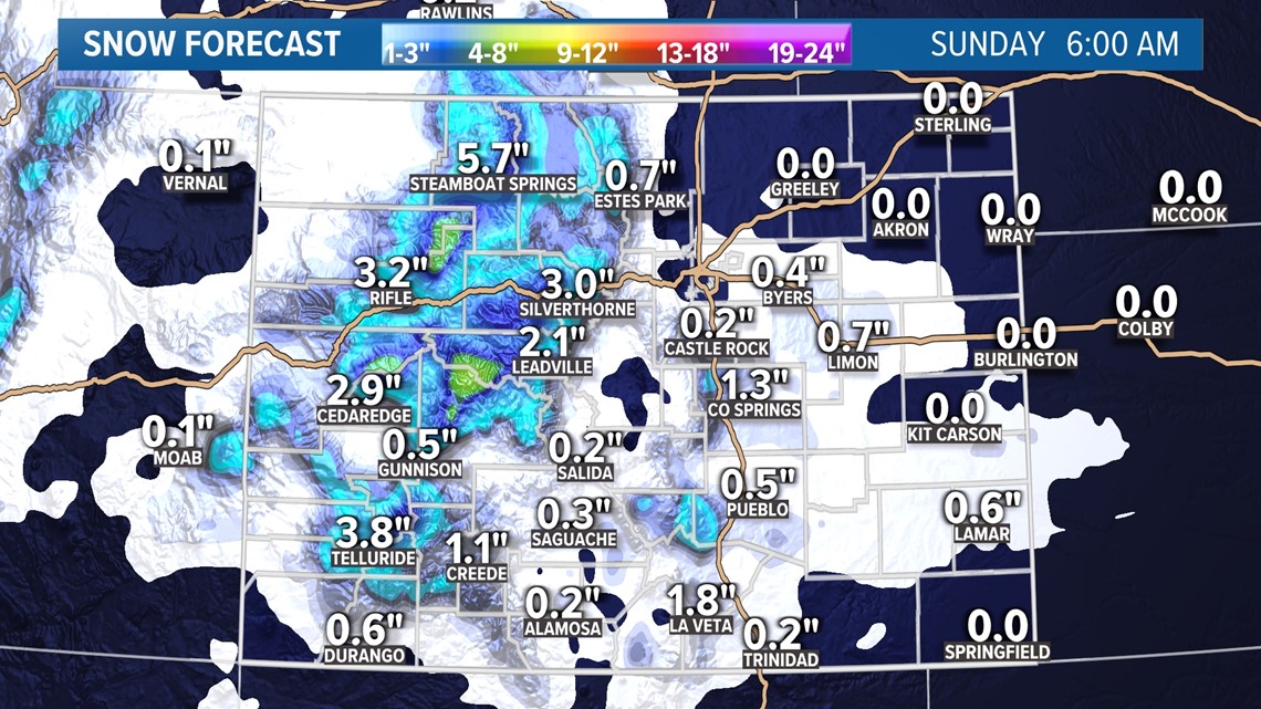
A weaker winter storm system is entering Colorado on Friday night and last through the day on Saturday.
There is a winter weather advisory out for 4-6 inches of snow in the Flat Tops from midnight to 3pm Saturday. 4-8 inches is expected in the Elkheads and Park Range.


Much lighter accumulation is likely in other parts of the mountains.
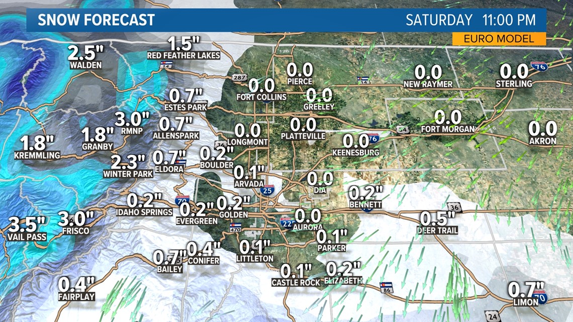
There will also be a chance for snow on the Front Range from early afternoon to about midnight. Models are showing some mixed rain/snow showers in the area but no accumulation in Denver. The south metro has a better chance to pick up a dusting. A couple of inches of snow accumulation is more likely in the foothills south of I-70, the Palmer Divide and Colorado Springs.
Both the GFS and the Euro show 3-4 inches around the Monument Hill area.


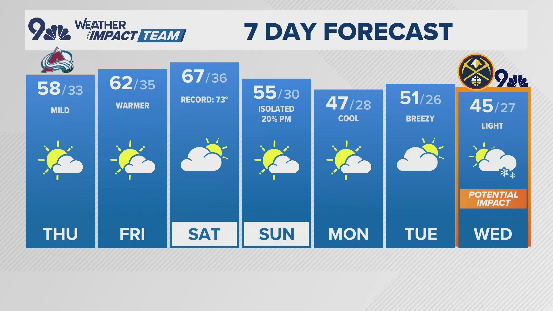
JAN. 11-13 (Tue-Thu)
Chance for snow at DIA: 0%
The models show a weak trough drifting to the north of Colorado Tuesday and then a more organized piece of energy to south on Wednesday.
These will not likely have any impact with snow to the Front Range but southern Colorado should watch these systems closer. Even the southeast plains will have a shot to pick up a few inches on Wednesday or Thursday.
JAN. 14-15
Chance for snow at DIA: 0%
Looks like another system could come by next weekend. Models have hinted at possible snow on the Front Range but the setup does not appear to be favorable for much more than a couple inches at best.
JAN. 18-19
Chance for snow at DIA: 0%
The GFS is at least showing a pattern switch back to something more favorable to the Front Range starting on Jan. 18. It's a ways out yet and not in range of the Euro yet.
SUGGESTED VIDEOS: Science & Weather


