DENVER — Tuesday is a Weather Impact Day in Colorado.
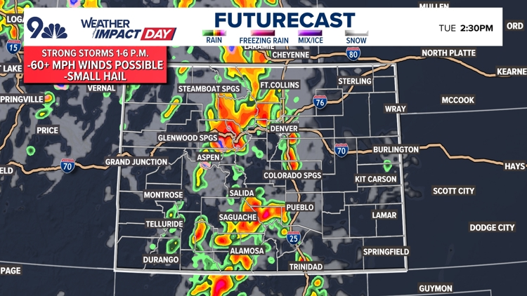
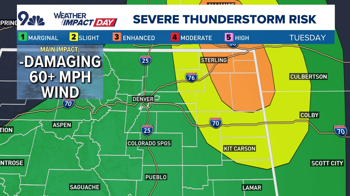
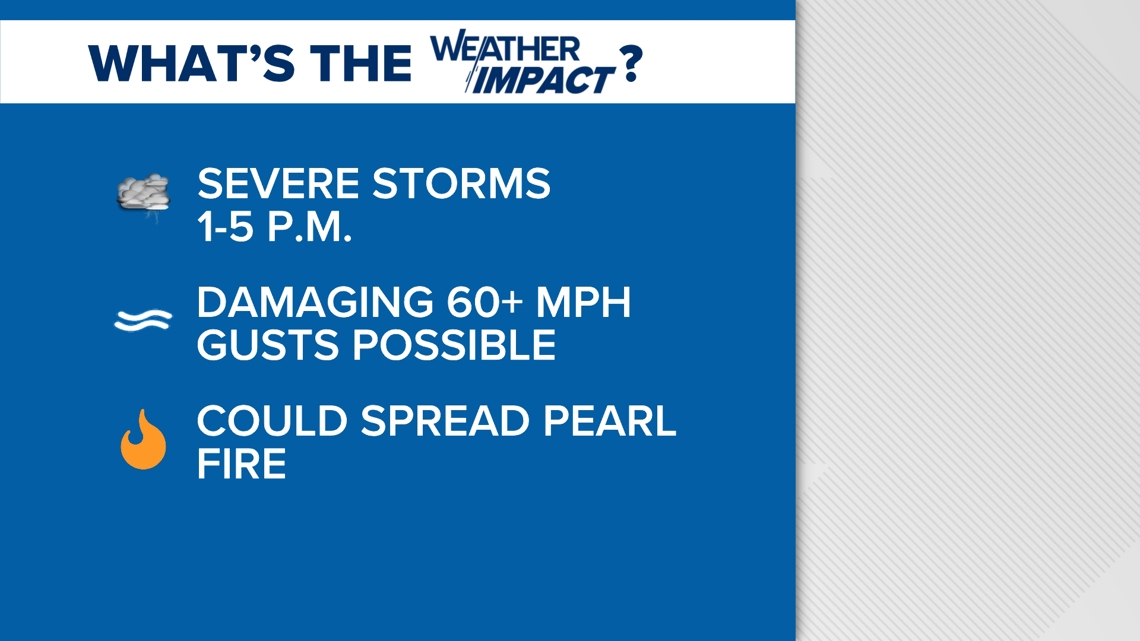
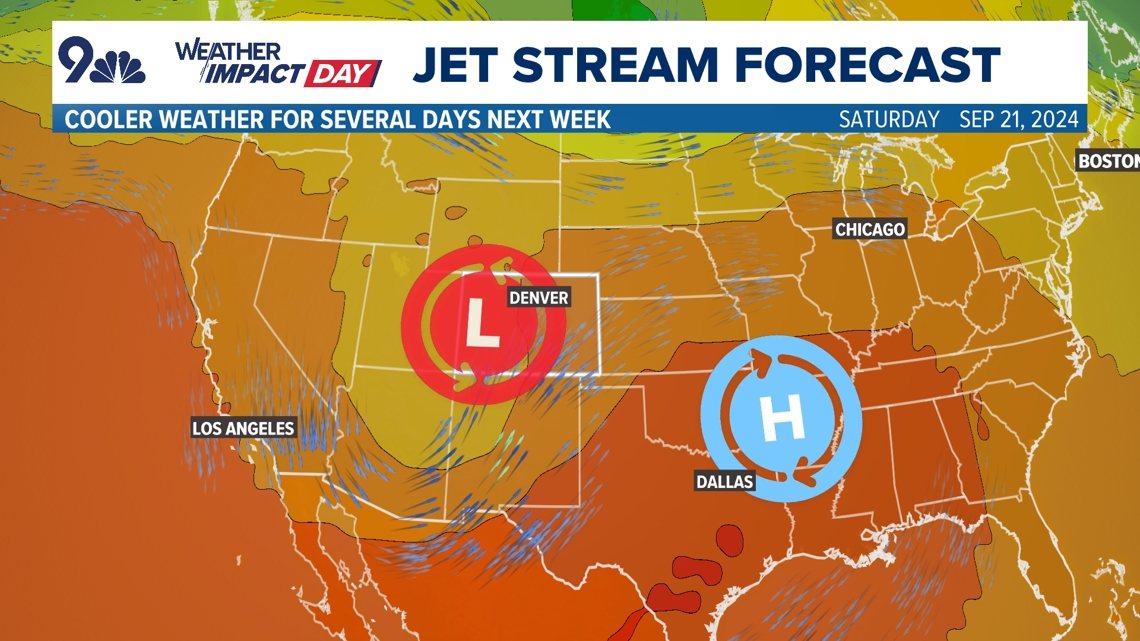
There is a potential for widespread 60+ mph winds across northern and eastern Colorado, including the Front Range, Tuesday afternoon. Over the northeast plains, winds to 70-80 mph will be possible.
Damaging 60+ mph winds will be almost exclusively the main hazard on Tuesday, with 50-60 mph gusts possible in Denver.
These strong storms are forecast to move through between 1-6 p.m. Tuesday, though it looks like the Denver area will probably see those storms closer to the early side of that window, maybe closer to 1-3 p.m.
Bring inside any patio furniture and strap down anything that might come loose outside.
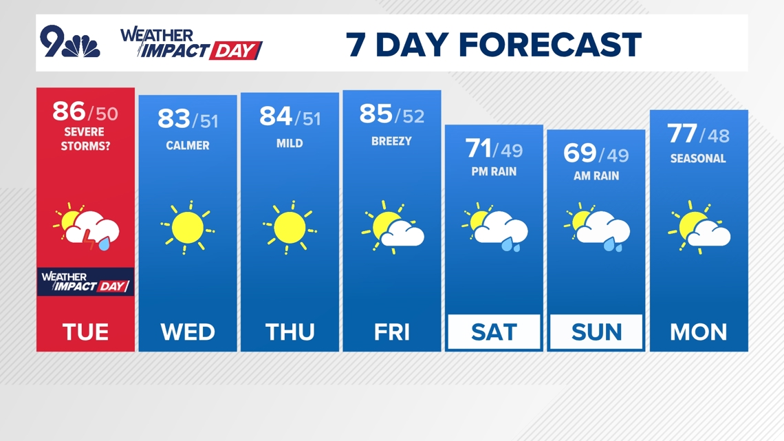
High temperatures will reach the mid-80s Tuesday before clouds rumble on in around noon in Denver, a few degrees above average.

Colorado's weather will be calmer on Wednesday, with a high in the low 80s (average high: 79°) and it'll stay dry through Friday ahead of the state's next big storm system. That storm will usher in much cooler weather and the potential for widespread heavy rain and mountain snow, mainly on Saturday and Sunday.
The computer forecast models aren't in good agreement about just how far south the next storm system will push, though there are growing hints this could be an impactful storm with heavier rain for lower elevations and some meaningful snow above 10,000 feet (perhaps lower) for this weekend.
Otherwise, temperatures will be the big story with the next storm system, with highs dropping into just the upper 60s and lower 70s for a high in Denver both days this weekend.
We'll keep you posted on that next storm over the coming days, but in the meantime, watch out for this afternoon's windy storms, they could be nasty.


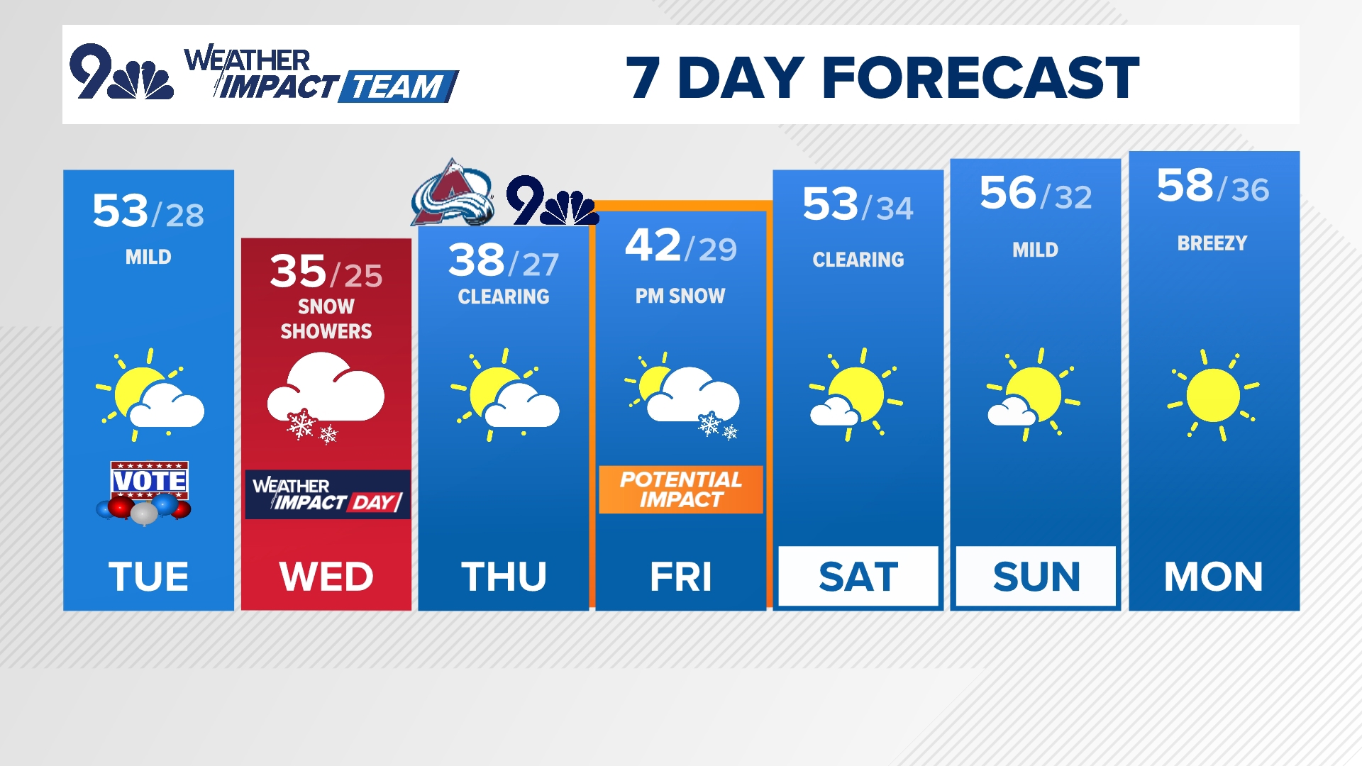
Denver forecast
TUESDAY: Afternoon storms with strong wind gusts likely, high 86. Partly cloudy overnight, low 50.
WEDNESDAY: Mostly sunny and slightly cooler, high 83. Mostly clear overnight, low 51.
THURSDAY: Mostly sunny and mild, high 84. Mostly clear overnight, low 51.
FRIDAY: Mostly sunny and mild, high 85. Turning cooler and mostly cloudy overnight, low 52.
SATURDAY: Mostly cloudy and much cooler with showers likely late in the day, high 71. Mostly cloudy overnight, low 49.
SUNDAY: Some morning showers lingering before clearing in the afternoon, high 69. Partly cloudy overnight, low 49.
MONDAY: Mostly sunny and slightly warmer, high 77. Partly cloudy overnight, low 48.

9NEWS Weather Impact Team
The 9NEWS Weather Impact Team of Kathy Sabine, Cory Reppenhagen, Laurann Robinson, Keely Chalmers and Chris Bianchi update the Denver weather forecast multiple times each day.
Bookmark this link to always have the latest forecast from 9NEWS. The team values your local weather reports and often features your photos and videos during weather segments in all newscasts.