DENVER — There is a three step alert process that 9NEWS uses to keep viewers ahead of severe weather: Convective outlooks, Watches, and Warnings. Here is a description of that process.
Convective Outlooks
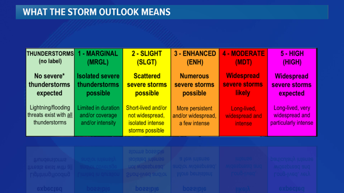
The first step in alerting viewers to possible severe weather is a forecast called a Convective Outlook. This usually gives viewers a 1 to 3 day warning before the development of severe weather.
Those outlooks are issued by the Storm Prediction Center in Norman, Oklahoma daily, and they rate severe weather potential on a scale from 1 to 5. The lowest threat, a 1, is called Marginal, a 2 is Slight, a 3 Enhanced, a 4 is Moderate, and a 5 is High.


Colorado gets a lot of Marginal and Slight risk days, but don’t let the title of those threat levels fool you. Marginal and Slight risk still means severe weather is likely, however isolated in nature. Many of these days end up leading our newscast with weather damage.
Watches
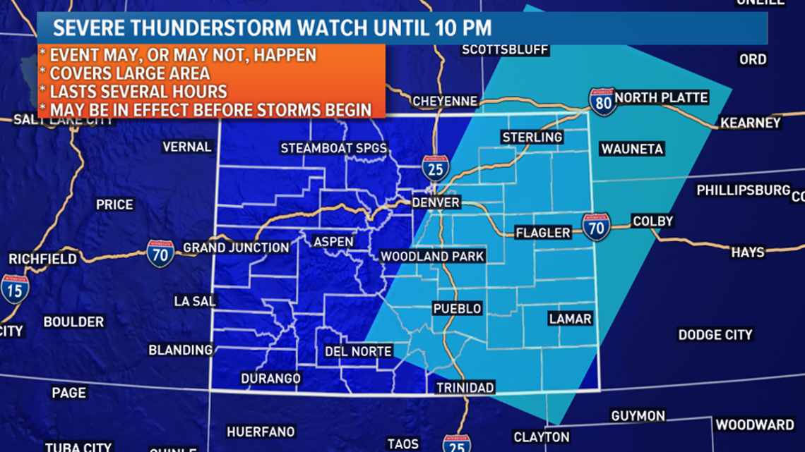
The next part of the alert system is called a Watch. These are also issued by the Storm Prediction Center in Oklahoma, but are only issued when widespread severe weather is expected, and the forecast has high confidence.
A Severe Thunderstorm Watch, a Tornado Watch, or a Flash Flood Watch will be issued for a large area, usually including several counties, about 4 to 8 hours before a major severe weather outbreak. This means that the confidence in dangerous weather occurring is high and gives you a chance to make some final preparations.


Warnings
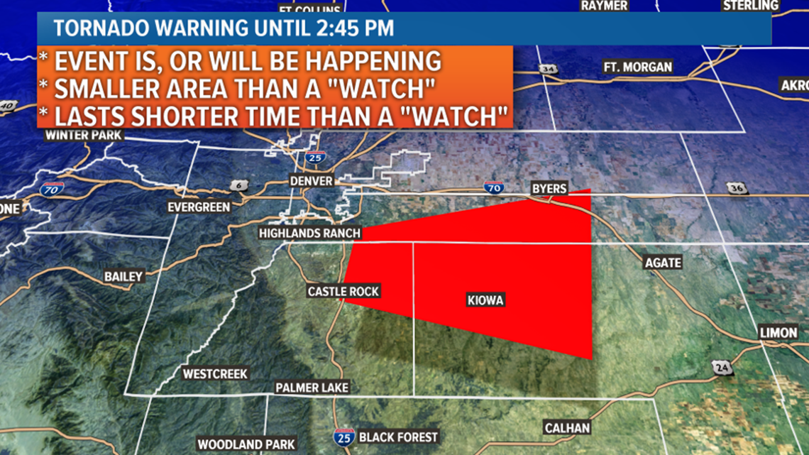
The last part of the alert process is called a Warning. They are issued by your local National Weather Service office, and mean severe weather is happening now, or it is eminent.
A Severe Thunderstorm Warning means that damaging hail, 1 inch in diameter or larger, or damaging wind gusts of 58 miles per hour or greater, are being produced.
The average lead time for a severe thunderstorm from time of warning to time of impact, is 17 minutes nationwide, but in Colorado, that lead time is only 13 and half minutes due to our location in the initiation area for severe weather, and the complex terrain and convergence zones that favor rapid thunderstorm development on the Front Range.


A Tornado Warning means that a tornado has been spotted, a funnel cloud that could become a tornado has been spotted, or that radar is indicating a tornado is possible. On average, you have less than 13 minutes lead time with a tornado warning.
The National Weather Service also issues Flash Flood Warnings, which mean that thunderstorm runoff is causing flooding on its way to drainage basins.
SUGGESTED VIDEOS | Science is cool

