DENVER — Finally.
After a virtually snow-less fall and start to winter, Denver could be looking at its first meaningful snowfall of the season on New Year's Eve and New Year's Day.
An area of low pressure will bring in the season's coldest temperatures yet and a meaningful amount of snow, starting early on Friday afternoon in Denver.
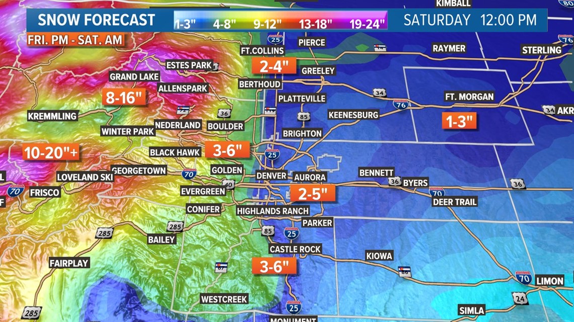
As of Wednesday night, 9NEWS weather called for a forecast of 3-6" of snowfall in the Denver area by the time the storm ends around midday on Saturday. There could be some locally higher amounts, especially in the foothills just west of the city and along the Palmer Divide.


Regardless of exact amounts, look for slick roadways and bitterly cold temperatures for both Friday night and Saturday morning. Temperatures will likely be in the single digits or teens for much of Friday night and Saturday morning, making any outdoor New Year's plans dangerously cold.
Some forecast challenges include temperatures as the snow first begins to fall on Friday afternoon. While temperatures will quickly fall behind a sharp cold front, it could be warm enough initially that some of the first snowflakes may not stick right away. That could lead to lower snowfall totals.
Also, the exact locations of the heavier bands of snow will determine who gets the higher-end snowfall totals.
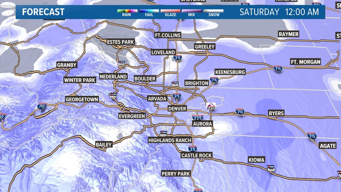
That said, it's very likely going to be snowing steadily throughout New Year's Eve and into New Year's morning.
Roads will be slick for New Year's Eve, and the coldest air of the season likely accompanies this system as well. Highs on New Year's Day (Saturday) probably only top out in the mid-20s in Denver.


As always, stay with 9NEWS for the latest on this as forecast totals and the forecast overall are likely to be adjusted over the next few days.
SUGGESTED VIDEOS: Severe Weather


