DENVER — There will be high winds and elevated wildfire danger across much of Colorado again Thursday, which will be the third straight day with such conditions.
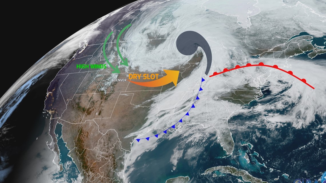
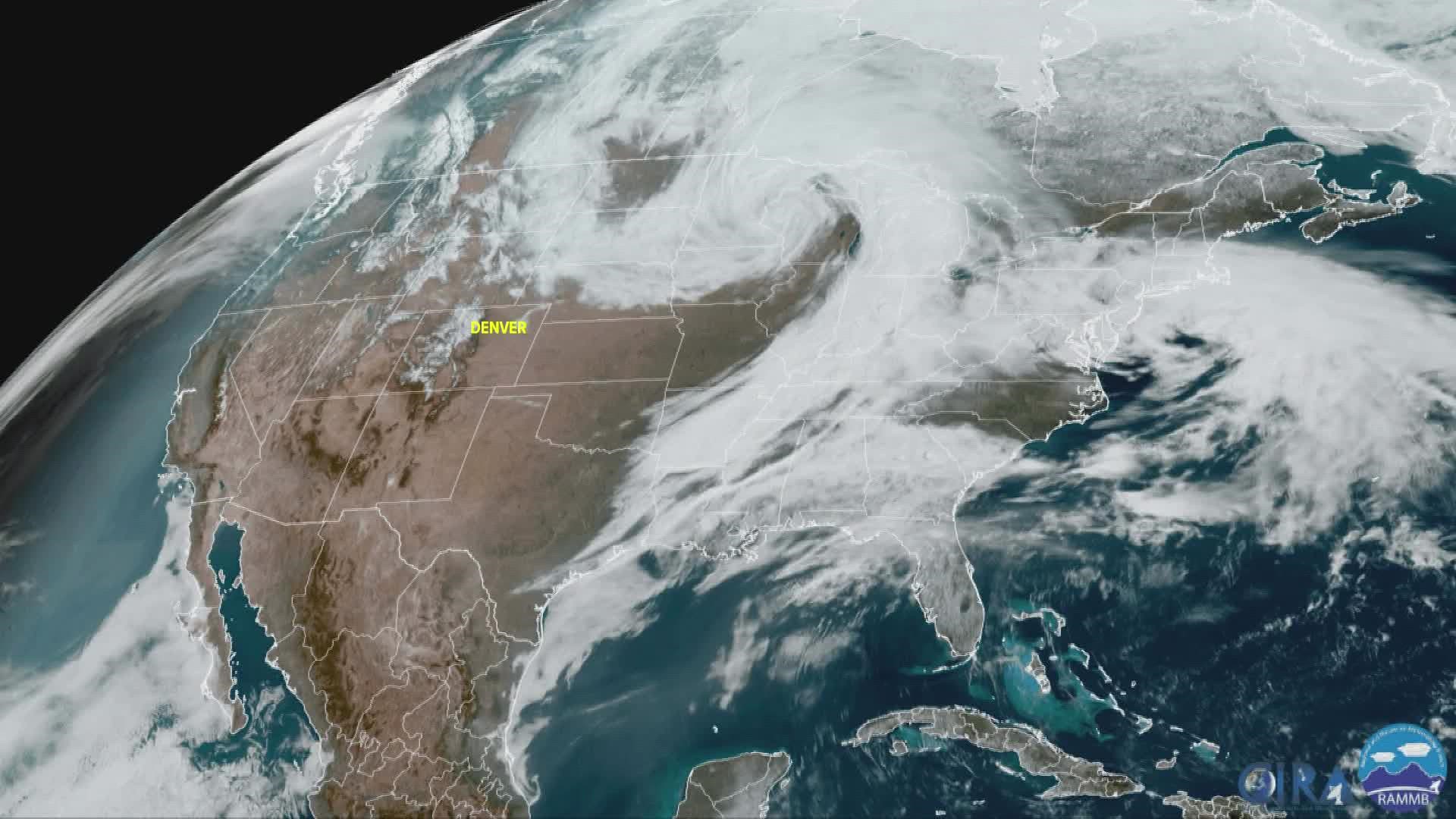
The storm system responsible for that weather was more than 750 miles away from Denver on Wednesday over the upper Midwest. It kind of looked like a hurricane spinning over that state of Wisconsin. While a hurricane is a tropical cyclone, this storm is called a mid-latitude cyclone.
The structure of the storm was very impressive seen from satellite. It had well defined comma cloud named for its distinct shape. A long tail which was the cold front, and a warm front extending out east of the storm.
There was also a clear dry slot, which has been responsible for the very low humidity in Colorado leading to three straight days of elevated fire weather.


Strong winds have been circulating around the storm system generally from the north and northwest over the state of Colorado. Those winds have been enhanced by something called the pressure gradient.
High pressure has been building over the Rockies, and the storm system is deep low pressure. Air moves from high to low pressure like a rock rolling down a hill. The steeper the gradient, the faster the wind blows.
The reason this high wind event is lasting so long is because that storm system is moving very slow. Blocked from moving east by a strong ridge of high pressure.
Robust and slow moving mid-latitude cyclones are common in the month of April. In fact, April is the windiest month of the year in Denver, using the average wind speed as a metric.

