BOULDER COUNTY, Colo. — September is the most tranquil weather month on Colorado's Front Range. It’s too early in the year to get a major snowstorm or blizzard and it’s too late to get a destructive tornado or damaging hailstorm – yet, the biggest floods in Colorado history have all happened in the months of May through August.
The flood event of September 2013 stands alone in Colorado history.
So of course, it took a unique meteorological beast to make such a mark in our record books. Here’s how the storm formed.
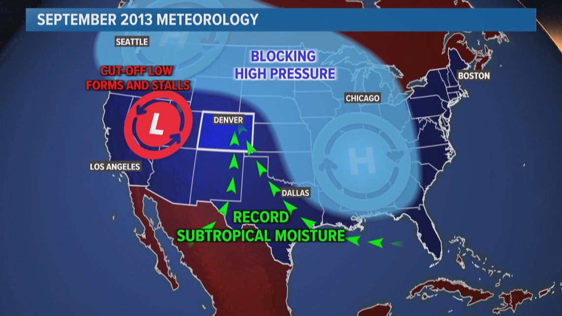
A low-pressure system over the Great Basin near southern Nevada got cut off from the jet stream and stalled out because high pressure east of Colorado was blocking it.


So, it slowly drifted to the north, pulling record amounts of subtropical moisture into Colorado. The Denver radiosonde observation set new daily records for precipitable water in six consecutive 12-hourly soundings, exceeding 25 mm in nearly all soundings during Sep. 10–16.
Upslope winds guided all that atmospheric water vapor into Colorado.
When moist air moves upslope on the Front Range, it hits the east facing slopes of mountains which focuses the moisture and rings it out of the atmosphere over the foothills.
That upslope was also enhanced by several small counterclockwise circulations that developed over the Denver metro area which channeled the air into Boulder County. This meteorological feature is often referred to as the "Denver Cyclone."
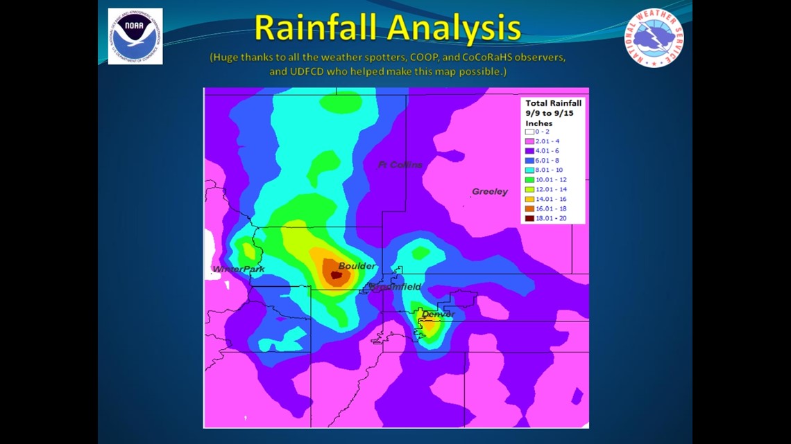
More than 18 inches of rain fell in the Boulder County foothills in just seven days with the bulk of it falling on Sept. 11 and 12.


The probability of a rainfall event like that unfolding is a once-in-500-to-1,000-years event. And that’s for any month, let alone the normally tranquil month of September.
Another September disaster that could be considered weather related was the 2020 wildfires. The fast-spreading nature of those fires were driven by unusually strong high winds events.

