COLORADO, USA — A cloudy day with wet snow flakes will round off a wild week in the weather department.
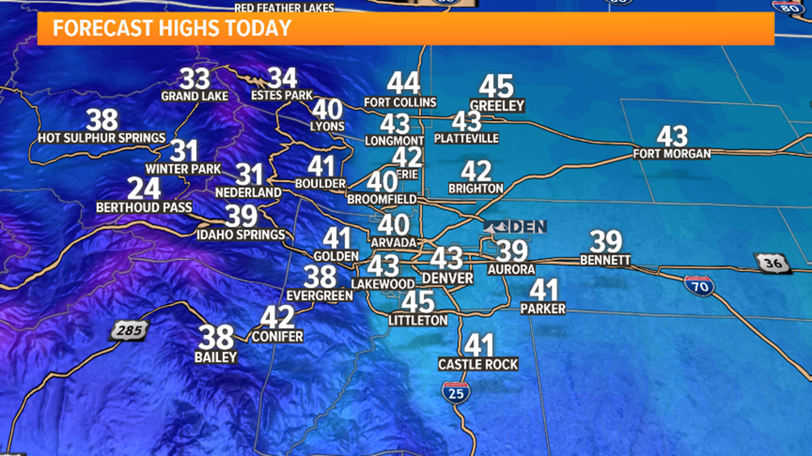
Temperatures were stubbornly slow to rise on Friday, so it looks like most of the Front Range will be stuck in the 30s. With the cooler temperatures, most of the shower activity will be wet snowflakes.
In the mountains and foothills, a quick 2-6 inches is possible if convective showers develop.
Not much accumulation is expected Friday along the Front Range, but a few spots may have a sloppy inch or two to shovel and roads could be slick Saturday morning.


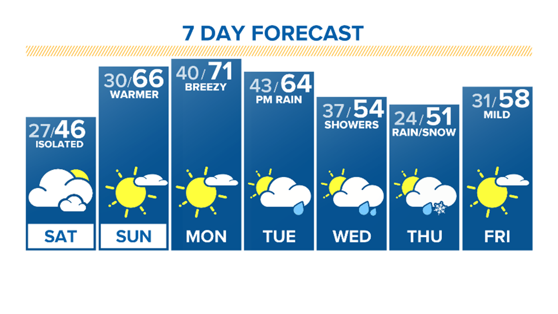
Saturday's forecast is looking similar, but warmer with a chance for a rain/snow mix — and maybe even some thunder — by Saturday afternoon.
Colorado will warm up for Sunday and Monday.


CLOSINGS | Closings and delays in Colorado
If you have a weather report, photo or video to share, you can contact the 9NEWS Weather Team in these ways:
- Upload your photos or video through YOUR TAKE: on9news.tv/yourtake
- Share updates on our Facebook wall: facebook.com/9weather
- Tweet your updates using the hashtag #9WX or tweet us at twitter.com/9NEWSWeather
TRAFFIC CENTER | Keep up on crashes and travel times here
READ MORE | Complete 7-day weather forecast
SEND | Weather photos, videos
9NEWS apps:
iTunes: http://on9news.tv/itunes Google Play: http://on9news.tv/1lWnC5n
The 9NEWS Weather team of Marty Coniglio, Kathy Sabine, Becky Ditchfield, Danielle Grant and Kylie Bearse update the Denver weather forecast multiple times each day. Bookmark this link to always have the latest forecast from 9NEWS. The team values your local weather reports and often features your photos and videos during weather segments in all newscasts.

