DENVER — Pikes Peak got hit with heavy snow on Sunday afternoon and then got dusted again on Monday. Several other mountain peaks in the area have also been dusted with snow this week.
The recent snow on the high mountain peaks might be bringing the hope of a snowy fall to many who might be weary of what has been one of the hottest summers ever recorded on the Front Range.
Late August, however, is a very normal time to receive that first snow above 11,000 feet, and it does not have any bearing on what may still lie ahead.
RELATED: More snow on Pikes Peak on Monday
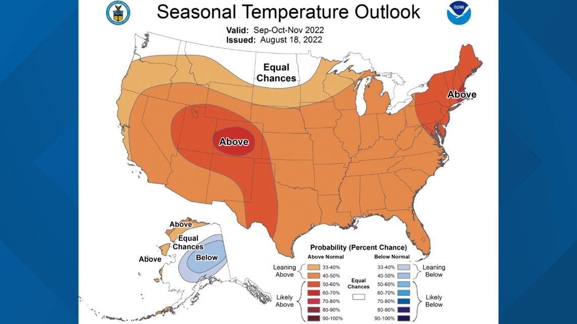
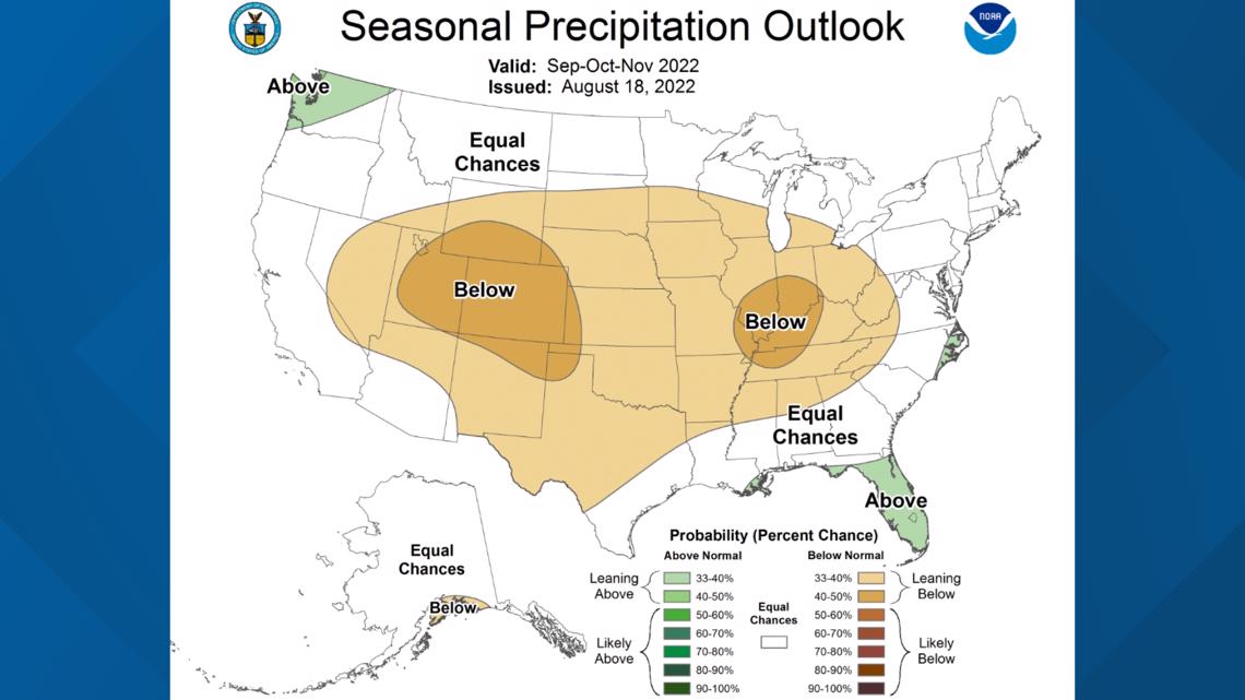
The official fall forecast from the climatologists at NOAA calls for it to be warmer and drier than average in Colorado. In meteorology, fall is all of September, October and November.
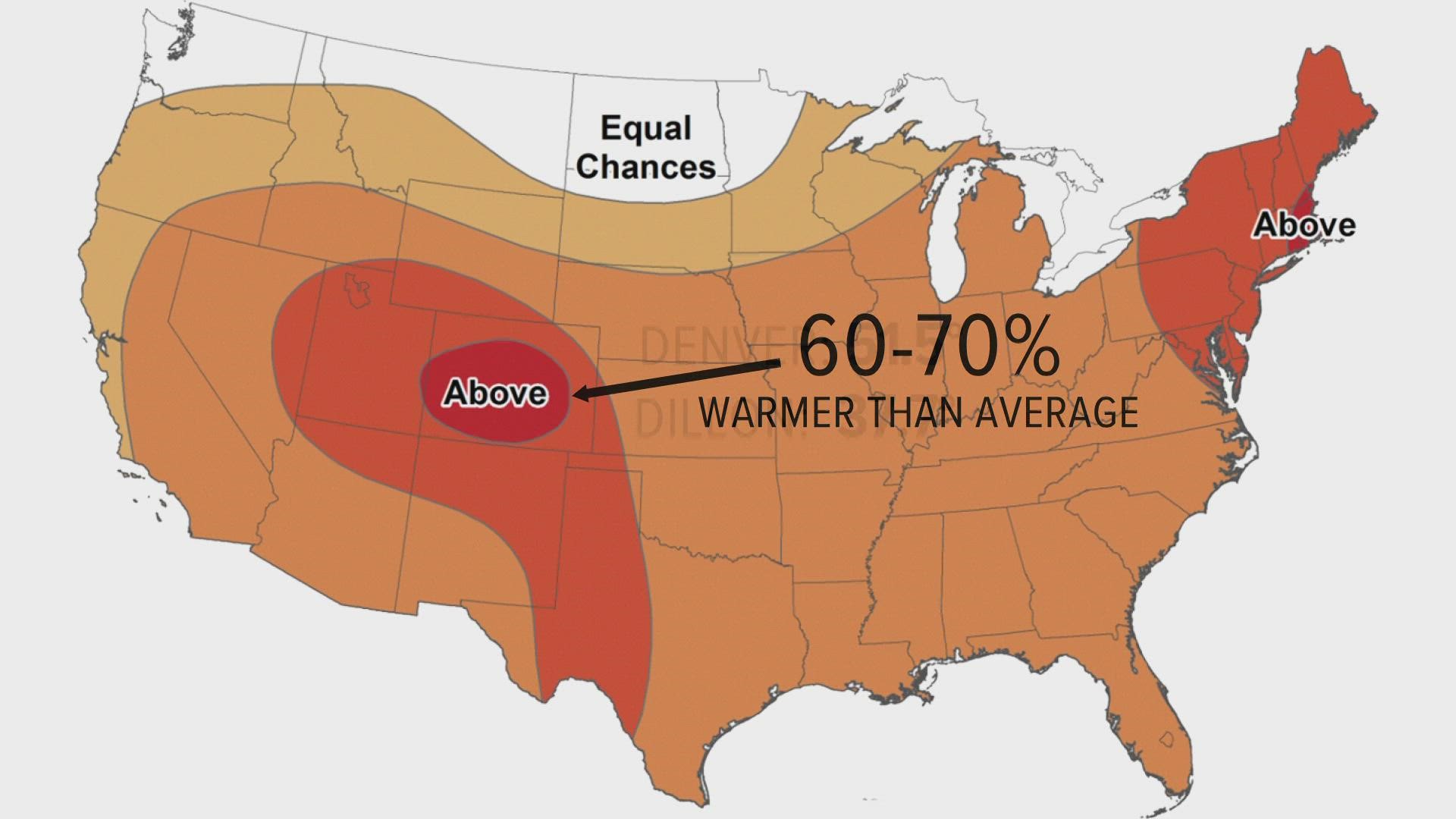
The temperature outlook map has a daunting red circle over much of Colorado. That means there’s a 60% to 70% chance for it to be warmer than average.


The average fall temperature in Denver is 51.5 degrees. In Dillon, it's 37.7 degrees. So this forecast is calling for the three-month average to be warmer than these averages.
And the precipitation outlook is calling for a 40% to 50% chance that all of Colorado will have a drier-than-average fall.


The average precipitation in Denver is 3.18 inches, and the average for Dillon is 3.24 inches.
The NOAA forecast doesn’t specifically mention snow, but warmer and drier would imply fewer chances for snow in both the mountains and the Front Range.


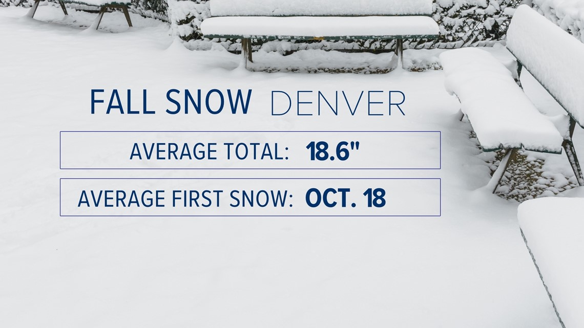
Denver averages 18.6 inches of fall snow, with the average first snow coming on Oct. 18. Last year was the first time in the city’s history that there was no measurable snow during the fall months.
Dillon averages 23.8 inches of fall snow, with the average first snow coming on Oct. 7.
SUGGESTED VIDEOS: Colorado Climate

