DENVER — El Niño weather patterns often bring colder and snowier-than-average conditions to the Colorado Front Range in the winter, but the fall months are commonly warmer and drier than average.
In Denver, it’s the seventh warmest start to fall in history as of Oct. 18. Fall in weather record-keeping starts on Sept. 1 and goes through November.
There’s also been less than an inch of rain in Denver so far this fall.
While this does appear to be a classic case of a slow start of El Niño, it can’t take all the blame. There is a fall warming and drying trend in Denver because of climate change. This is highlighted by the La Niña year of 2021, which was the second warmest and third driest fall of all time.
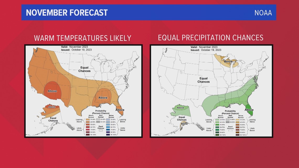
This year’s warm dry pattern could very well hold, at least through November. Warmer-than-average temperatures are likely according to NOAA's forecast, and there’s nothing shifting the odds one way or the other for precipitation.


If the El Niño pattern holds to tradition, relief might not come until about the middle of December.
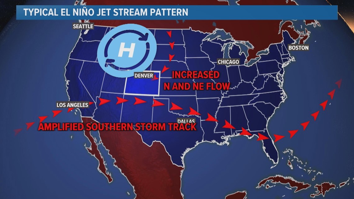
High pressure over the Colorado region has been forcing most of the cool and moist air to our northeast over the last month and a half, leaving the Front Range mostly warm and dry.
In a typical El Niño, that high pressure shifts to the northwest, sometime before the middle of December. That would give us a better chance for stormier weather to press into the Front Range over the winter months.


SUGGESTED VIDEOS: Colorado Climate

