DENVER, Colorado — It's always fun to do "Top of" lists at the end of the year, especially when we're transferring from the teen years to the 20s.
Below is my list of the most memorable weather photos that I have taken over the last 10 years.
Keep in mind that these are just moments that I have captured personally. I have seen many more photos over this decade that would top these, but these are just my pics.
Many of these did not occur during the most memorable weather events of this decade, but just beautiful moments contained in otherwise ordinary days.
#10 - Graveyard Mammatus (8 May 2017)

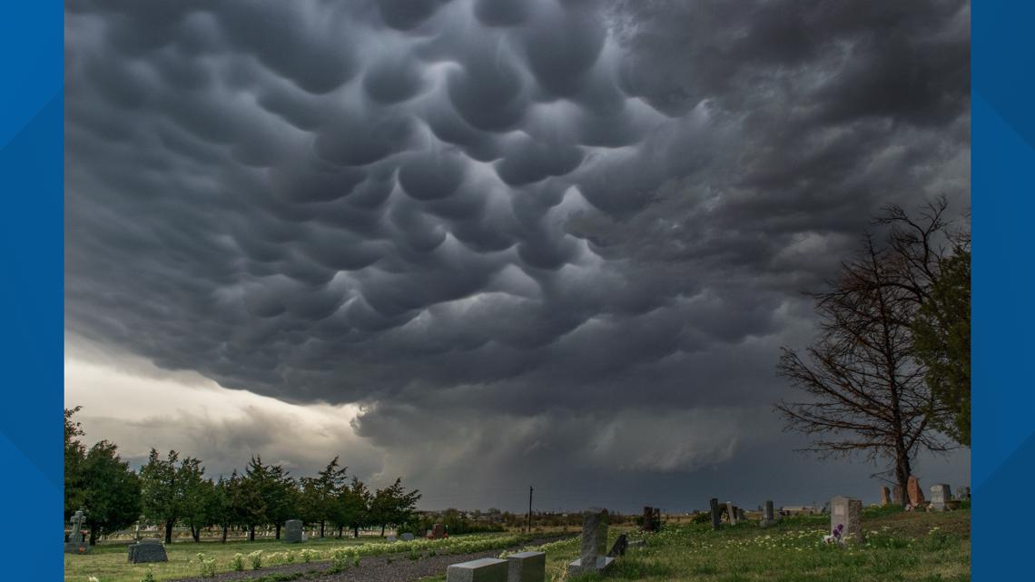
I knew this photo would always be one of my favorites the moment it was taken. It shows mammatus clouds on the backside of a thunderstorm with the Evergreen Cemetery in Deer Trail, Colorado, in the foreground.
This actually happened on a day that did go down as one of the most memorable weather days of the decade. At least in our area. The west Denver metro had just got a whipping with baseball size hail just about 20 minutes before this shot.
The May 8, 2017 storm was the most expensive hail storm in state history. I had just shot a funnel cloud on the Palmer Divide near Agate that appeared to set down on the ground briefly, and I was following the storms as they moved from southwest to northeast. This was not the most newsworthy part of the storm, but I great shot in the aftermath.
#9 - Arvada Kelvin-Helmholtz Waves (2 Nov 2018)

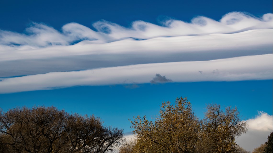
Kelvin-Helmholtz wave clouds are named after the two men that discovered the instability that causes them. This type of wave cloud is pretty common along the Front Range of Colorado, but to get really clear definition in them is a rare find.
Just on my way to the TV station one morning when several waves rolled over the top of this lenticular cloud on this day in November 2018. The curls were tall, and fairly symmetrical in size. I do feel like some of the other K-H waves I shot this decade may have had better curls, but there was always something a little off with the photos otherwise.
Items like a stop light, or a powerline in the shot, would be in the way. Or, I had to take the photo with a smartphone, so the quality was poor. Or, sometimes the foreground and quality were nice, but the waves weren't quite as well formed. This shot was a decent mix of attributes.
#8 - Autumn Dusting (24 Sep 2016)

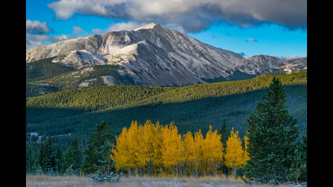
Some of the greatest Colorado photos are an autumn mix of fall colors and fresh white snow. That's exactly what I found one morning on Boreas Pass.
I usually do a color drive with my family sometime near the peak of fall colors. We chose this Saturday in 2016 before knowing there would be snow in the forecast.
This shot was just minutes after sunrise as the sun lit the fresh dusting of snow on Mt. Silverheels in Pike National Forest and provided just enough light to reveal a patch of gold on the ground. I believe this year, that was the first dusting of the season.
#7 - Bethel Supermoon (3 January 2018)

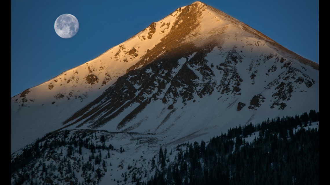
In Colorado, I photograph a lot of mountains. There are many ways our peaks can stand out from an ordinary day. Catch them covered in thick snowpack, or draped in dramatic clouds. Capturing the Alpenglow is a popular look.
On this morning, the first light of morning scraped the very top of Mt. Bethel just as the first of three supermoons in 2018 was setting behind the Rockies. It was a nice little moment.
#6 - The Horseshoe Meso (4 June 2015)

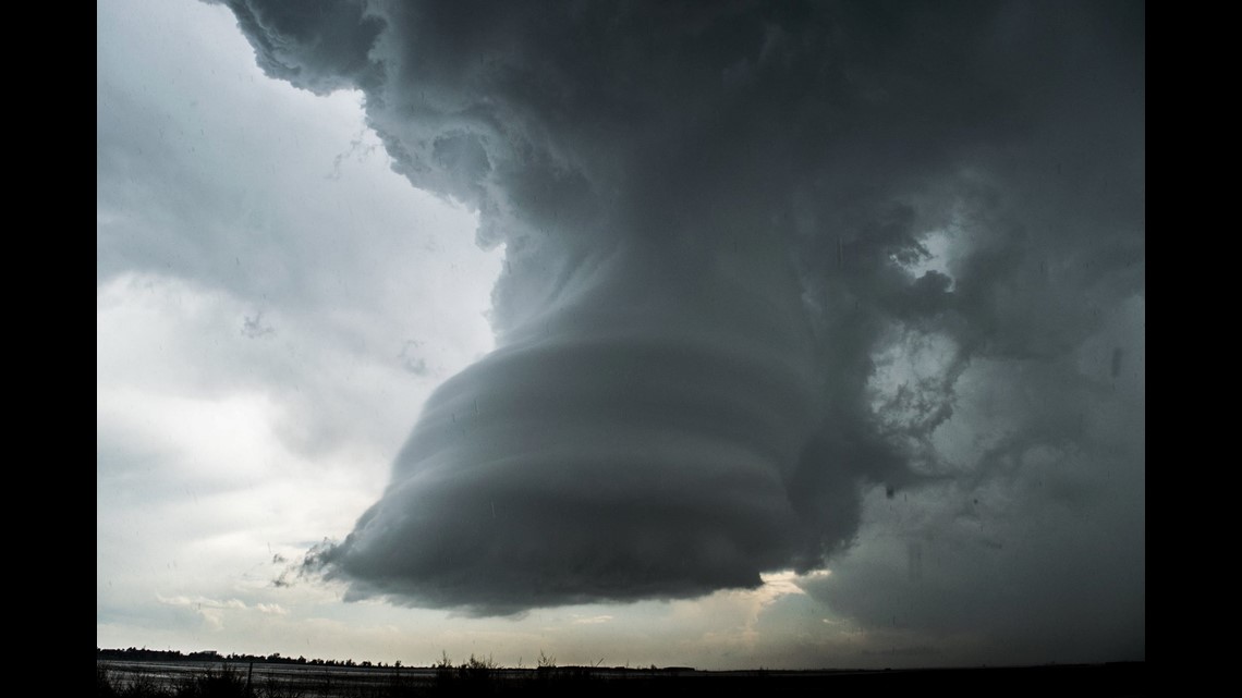
This was another kind of sidebar moment that occurred on a infamous day in Colorado weather history. June 4, 2015.
I was chasing a tornado warned storm in Adams County just south of Hoyt. When I came over the hill, looking west, I saw this wicked decaying mesocyclone. At first, it had a very thin tornado roping out underneath. It had to have been on the ground, as the meso was darn near touching down itself.
The tornado vanished by the time I could stop and get out my camera out of the truck . I do wish I would have just grabbed a quick shot with my smart phone before trying to fish out my tripod and video camera, because it was an amazing sight to see.
It still made for an awesome picture though. The mesocyclone is the center-most part of the thunderstorms circulation. Usually hidden behind the rest of the storms business, but this meso was completely in the clear and wound up tightly. The thunderstorm had abandon this circulation and was trying to create a new updraft.
I managed to catch the last fleeting glimpse of it as it was still spinning rapidly. The shape was somewhat unreal. To me it looked like a horse hoof with a shoe on it. It held this shape for less than five minutes, and before it disappeared completely, another roping funnel appeared.
I thought I surely had the visual of the day, but just as I got back into cell phone range, I heard that my partner Matt had another tornado on tape down near Simla. We split up that morning. He got south of I-70 and I got north. Well, we all know what Simla looked like.
But before I could even start pouting, I realized that outflow winds were pushing back to the west and initiating more thunderstorms near I-25. I made my way up down Highway 52 as rotation was building in a thunderstorm near Longmont. Just as I came over the ridge in Ft. Lupton, I saw the tornado the caused EF-3 damage on the Boulder/Larimer County line.
This shot was never seen on the news because of all the newsworthy impact from the other storms that day, but I look at it as a little hidden gem of Colorado Weather.
#5 - Spaceship Lenticulars (12 Feb 2015)

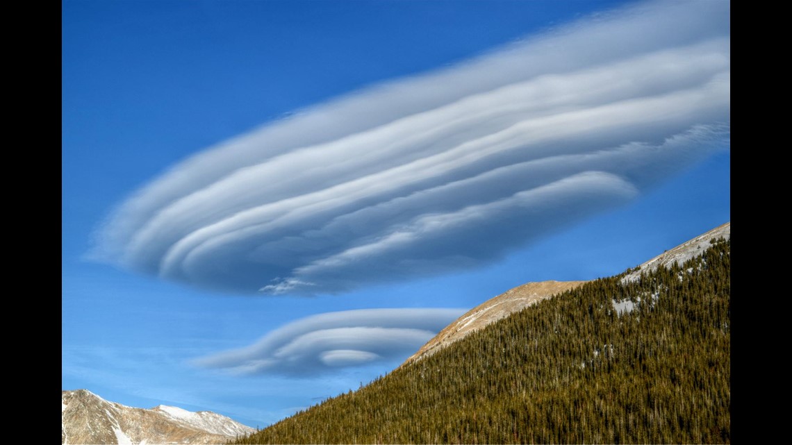
These Altocumulus Standing Lenticular clouds are very common in our state, especially around the mountain areas, but there are a few characteristics about these ones that makes them stand out.
You can see why these are sometimes called flying saucer clouds or alien motherships. They really do look like spaceships waiting to make first contact. And these are stationary clouds so the hovering helps convince you that these are lurking aliens.
The layering, or stacked appearance of these particular specimens are extremely well defined. I have only seen examples this good a handful of times in this decade.
What also makes these ones unique, is how there is no other cloud contamination. Often times there is a larger wave cloud above them, or even some puffy cumulus around them. That kind of camouflages them, and makes the photograph seem a little less attractive. In this case, they stood alone, only surrounded by blue skies.
This was also a great angle. These kind of lenticulars can look very different from a different angle. The view here was from Loveland Ski Area looking east.
#4 - Big Blue Monster (14 May 2018)

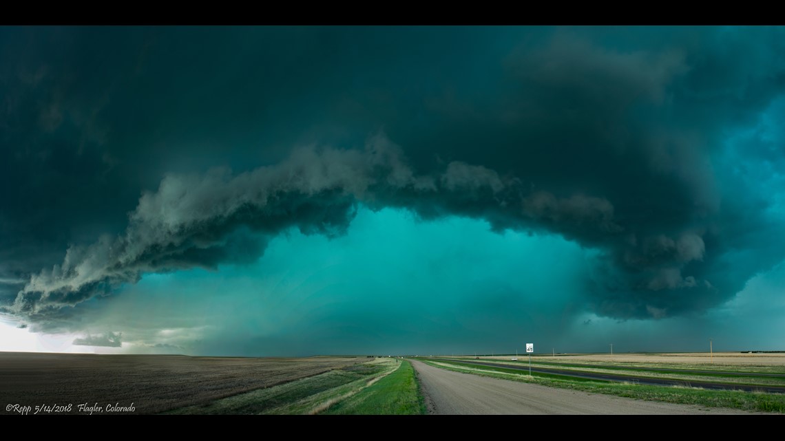
This big blue thunderstorm carried a tornado warning for several hours as it marched across the eastern plains of Colorado. It's signals a very large and intense hail core as the sunlight hits the thunderstorm just right.
I was following a nice clear slot it had for a while, but when it started to become outflow dominant, I got out in front of it just in time to grab this shot. I only had about two or three minutes before it caught back up to me.
It did put down some pretty large hail and strong wind gusts, but no damage was ever reported. This was a discrete supercell that lasted for more than seven hours.
#3 - Blizzard Art (13 Apr 2018)


The snowdrifts left behind on the landscape after a blizzard can be pretty amazing, but I've never seen a drift quite like this.
Every object on the ground, and standing around the drift will impact the shape of the final artwork. The wind will bend and curl around them depositing light snowflakes in place usually over the course of several hours if not days.
This blizzard will not go down in history as one of the strongest in Colorado but it sure was memorable to me. I was on my way to the Colorado/Nebraska state line, where the blizzard was forecast to hit hardest.
I got to Akron just before noon when all the roads started to shut down. That is where I would spent the next 24 hours. The Camacho family took me in, fed me beer and burritos, and gave me a warm place to stay for the night. The next day I was back on coverage when I came across this blizzard artwork on the north end of town.
#2 - The Imperial Supercell (27 May 2019)

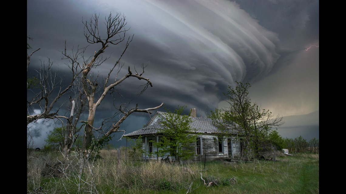
Memorial Day 2019 was another very long storm chase that started near Denver International Airport, and ended in Imperial, Nebraska. This was one of the most memorable chases I've ever been on. Not just because of the prize at the end, but the entire day was full of exciting storm visuals.
There were two storms I chased that day. The first put down a couple of small tornadoes in Colorado, and flared up and down several times before I switched to another storm near Holyoke.
That storm had a quick spin up initially, but as it moved into Nebraska, it started to exhale. I had to cut in front of the storm to get a good view of it, and ended up putting a couple of new dents in the Weather Titan because of that move, but it was well worth it.
The resulting display from this supercell was the best I had ever seen. The striations and structure was amazing. It was Memorial Day but I thought it may have been Independence Day with that monster mothership hovering over Imperial.
#1 - Rock Strike (7 Jun 2018)

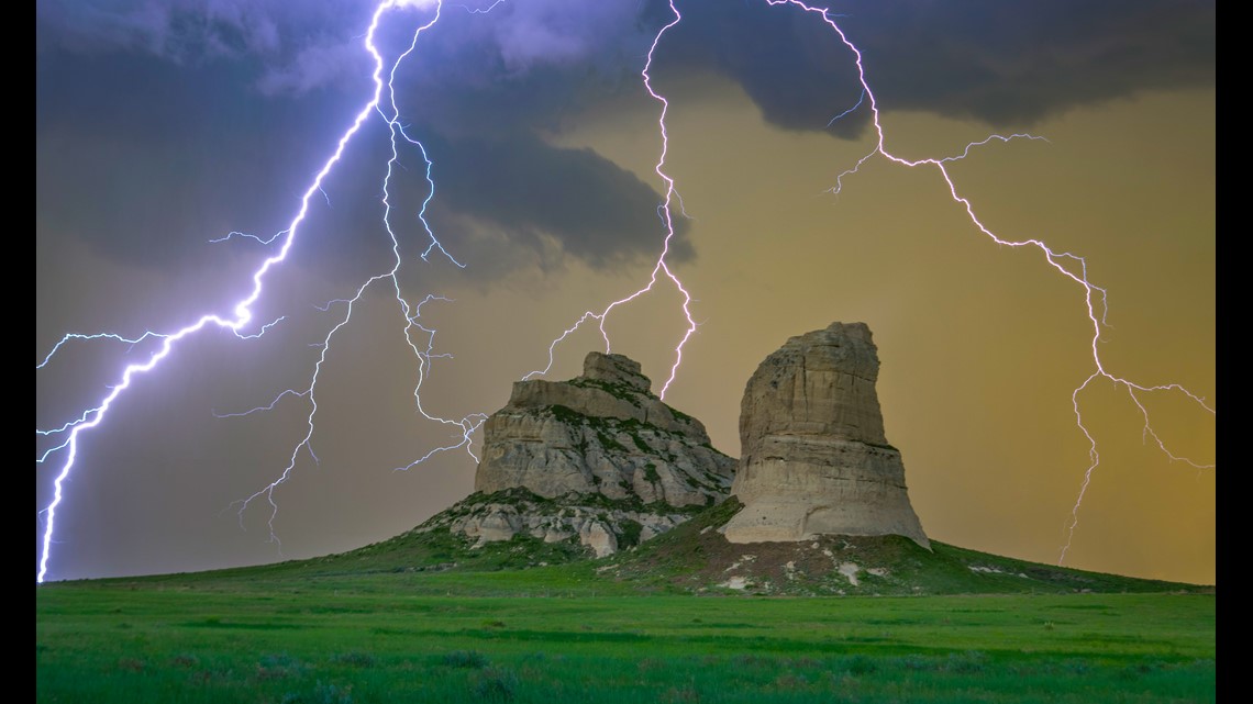
My top two favorite pictures of the past 10 years both took me to the outer reaches of the 9NEWS viewing area, but there is a good reason Nebraska has always been one of my favorite places to chase storms. The visuals hardly ever disappoint.
This was one of those days I wasn't sure if I was even going to go after any storms. Fortunately, the story I was working on for the news that day was in Sterling, Colorado. I figured if the forecast came together after the 5 o'clock news, then I would chase a few down.
Well after sending my story back to the TV station, I decided to follow a few storms that were just moving across the state line.
Right at sunset, a storm that was producing a crazy amount of cloud-to-ground lightning stokes was headed for the Wildcat Hills just southeast of Scottsbluff. Just a few years prior to this day, I had chased a storm in this area, and remember thinking to myself how beautiful the photos would have been if the storm was a little better put together. Well, this storm was producing, so I made a beeline for an outcropping of rocks I had stored in my memory banks.
They are called Courthouse and Jail Rocks, and I managed to get there just ahead of the storm. The lightning was frequent and intense. I my camera up just underneath a barbed wire fence, set the intervalometer to start taking 1-second exposures continuously, and hoped back in the truck.
I watched bolt after bolt decorate the cliffs. Surely the camera would have grabbed a few of those strikes. As the rain picked up, I took the camera back inside the truck and started sifting through the shots.
I remember the elation that came over me when I saw this moment captured on the viewfinder. The strange glow of sunset was filtered through this powerful lightning storm, and massive forked lightning stroke draped itself over that Nebraska rock formation. Just an amazing moment in an ordinary day.


