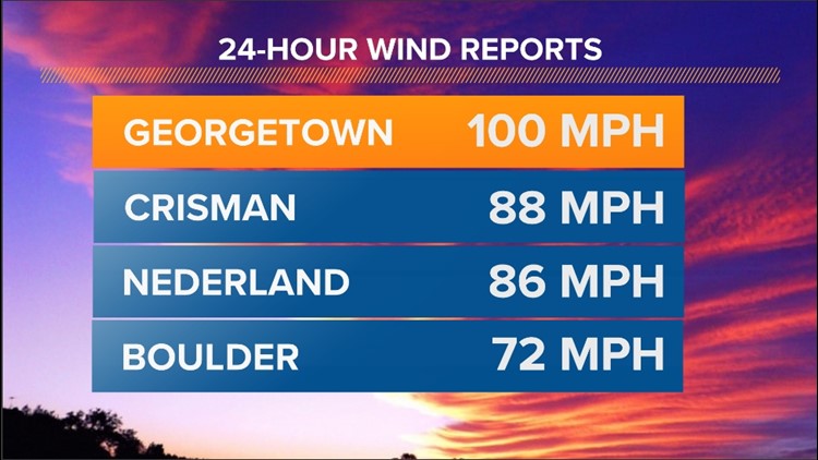
GEORGETOWN, Colo. — Winds howled overnight Sunday into Monday across Colorado, especially in the foothills and mountains west of Denver. Some parts of the state saw wind gusts as strong as 100 mph.
Georgetown recorded a 100 mph wind gust on Sunday night, and that was one of several 80 mph or higher wind gusts recorded in the foothills and mountains on Sunday night and Monday morning.
At the Mesa Laboratory on the southwest side of Boulder, a 72 mph wind gust blew through on Monday morning.
This is all part of a long-lived wind event that won't end until later Tuesday for the Front Range foothills before transitioning to more of a mountain wind event on Wednesday.
A Blizzard Warning -- remember, blizzards have more to do with wind than snow -- was also posted for the eastern San Juan mountains for Tuesday night and Wednesday. That's where 1-2 feet of snow could fall from our next storm, along with 80 mph winds. Travel will be near-impossible on Highway 160 into the San Juans over Wolf Creek Pass on Wednesday in particular.
Here's a look at some of the top wind reports that we've seen across Colorado over the past day:


A High Wind Warning remains in place for the Front Range foothills and some of Colorado's northern mountains until midday Tuesday. Gusts will likely re-intensify overnight Monday night and Tuesday morning, meaning it could be another loud night of strong winds from Boulder on west.
While strong winds often lead to increased fire danger, our recent snowstorms have kept our overall fire danger mostly in check. Fire danger may increase a bit on Tuesday, though, as strong winds stick around and last week's snow continues to quickly melt.
SUGGESTED VIDEOS: Colorado Climate


