COLORADO, USA — It's sort of like the Broncos being 1-0 on the season or the Rockies sweeping their first series of the regular season, so take it with a grain of salt.
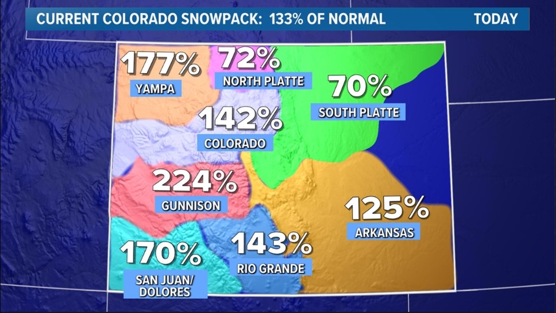
But, buoyed by a string of storms last week, Colorado's statewide snowpack is sitting at 33% above its season-to-date norm, based on official data from the Department of Agriculture.
Because the season is so early and snowpack data tracking only began a few weeks ago, tread lightly with this information. But it's helping some ski areas open perhaps a few days or even weeks earlier than expected.
Perhaps more importantly, if we get more snow in the next few weeks, it'll help build up statewide snowpack a tad earlier than usual.


Southern and western Colorado have especially benefitted from a run of recent early season storms, with the Gunnison River basin running at 224% (or more than double) of its season-to-date average.
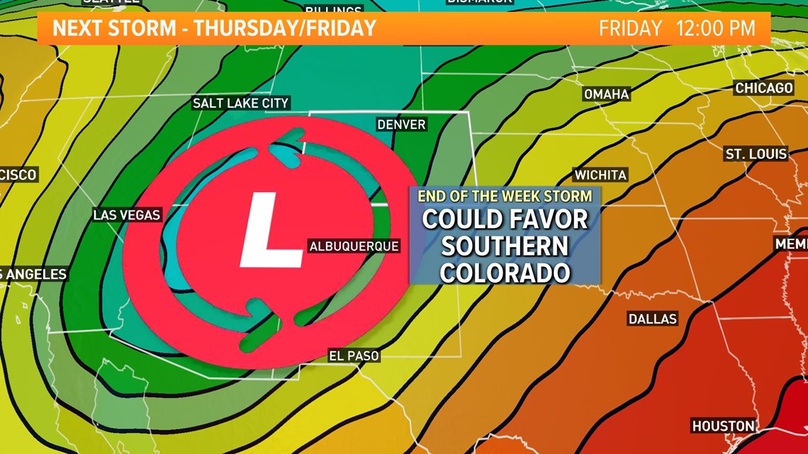
While we'll have a few snow-free days in the mountains this week, another storm should bring another round of early-season snow starting on Wednesday night.


That storm looks to favor the San Juan and Sangre de Cristo mountains in particular, potentially boosting snowpack in those ranges over the next few days. Most of the state's mountains should pick up at least some snow from the next storm, though.
SUGGESTED VIDEOS: Colorado Climate

