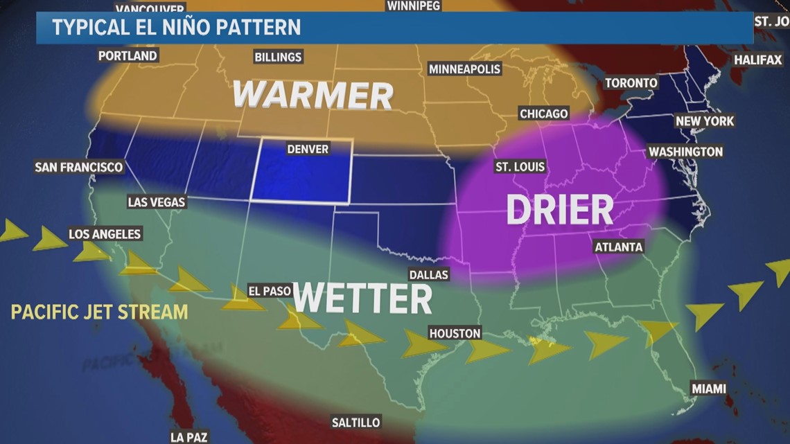
COLORADO, USA — A strong El Niño weather pattern has developed for the incoming winter. When there are much warmer than normal sea-surface temperatures in the equatorial Pacific Ocean, it alters the jet stream circulations resulting in certain weather patterns in the United States.
But Colorado is just outside of the influence of the most typical and reliable El Niño conditions. Just south of the warmer than average temperature influence and just north of the wetter than average precipitation influence.
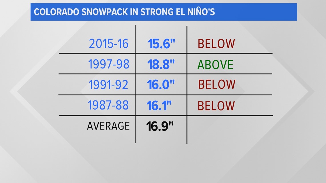
Despite there really being no reliable connection between El Niño and winter weather in our state, there are certain trends that are just consistent enough to hedge a winter forecast. For instance, statewide snowpack in the mountains tends to be below average.


In the last four strong El Niño winters, three have been below average; although just slightly below the average of 16.9 inches of snowpack. Snowpack is the measure of how much water is inside the snow that gets stored in the mountains over the winter.


While this is not a great trend for our water supply, it’s not terrible either, because overall, the snow has been very close to average during strong El Niños.
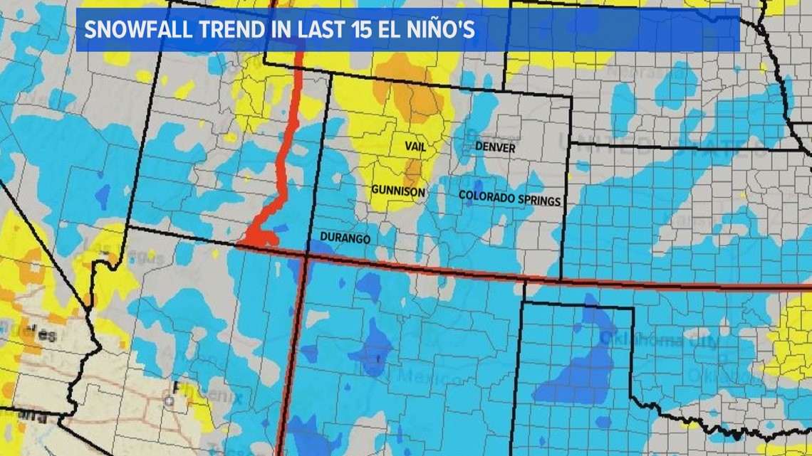
More specific snowfall data from the last 15 moderate to strong El Niños show that the bulk of Colorado's northern and central mountains tend to get below average snow, while the San Juan mountains usually get above average snow.


However, the term below average is often misconstrued for mountain areas. For instance, below average snow at Breckenridge Resort could still be 250 inches. While that is below the average of 300 inches per season, it's still a lot of snow.
SUGGESTED VIDEOS: Colorado Climate

