
DENVER — If a whole week of unusually warm weather right before Christmas triggers some wintery alarms in your subconscious – well your predictions are probably correct.
It’s nothing personal, that’s just how weather patterns usually work.
Starting Friday, a ridge of high pressure will start to build over the western U.S. and it is forecast to last until at least Dec. 21. That means no major weather disturbances will be possible in Colorado during that time.
But when that ridge comes crashing down, that will likely open the door for some big winter storms to roll through. Probably three or four of them in the last week of December.
There’s no way to tell yet if any of them will hit the Front Range but it does greatly increase the chances for a white Christmas.
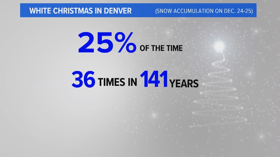
On average, Denver gets a white Christmas, which is defined by snow accumulation on Christmas Eve or Christmas Day, about 25% of the time or about once every four years.
But there hasn’t been a white Christmas in seven years.

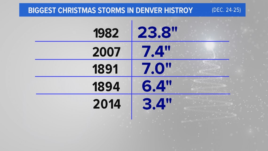
Big snowstorms are not too frequent in Denver and Christmas is no exception. There's only been two storms that have dropped more than 6 inches of snow on the Mile High City over the last 41 years, and only four in the last 141 years.
The biggest Christmas storm in Denver's history happened in 1982. The city got about two feet of snow on Christmas Eve that year. The official measurement was 23.8 inches.
Oh and for the record, it was freakishly warm right before that storm. It hit 69 degrees on Dec. 17 and it was 62 on Dec. 21, Altogether Denver was warmer than 50-degrees in seven of the eight days leading up to Christmas that year.

SUGGESTED VIDEOS: Colorado Climate