
DENVER — The last time there was no measurable rain in Denver, Boulder, Loveland or Fort Collins was May 23.
With rain on Monday, that makes 13 consecutive days with rain on the Front Range, and that rainy streak will likely last another 10 to 14 days.
The frequency and amount of rain has been unusual, so of course there’s an unusual weather pattern to blame – or credit depending on how you look at it.
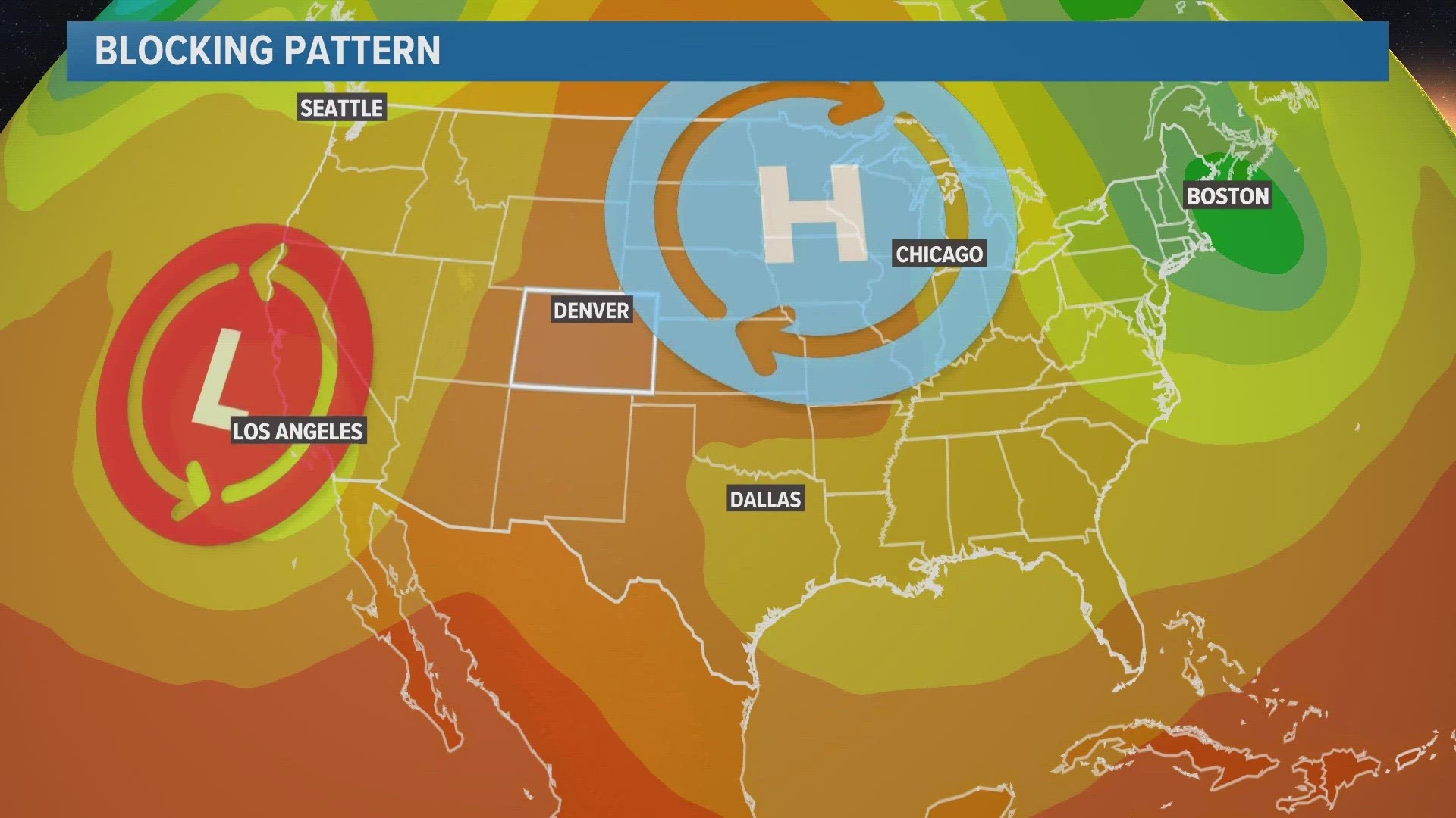
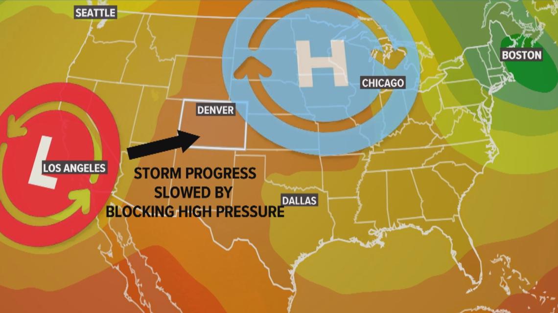
In meteorology, it’s called a blocking pattern. A persistent high pressure system over the upper Midwest part of the country has been blocking or slowing down the storm track to our west.
That makes our storms last longer, and it also charges our air with extra moisture.
The high and low pressure systems work in tandem to pull extra water vapor out of the Gulf of Mexico region and send it right into Colorado.

Here are a couple theories on why this pattern has been so stingy:
One, has to do with the massive Super Typhoon Mawar that formed in the west Pacific Ocean on May 19.
Scientific studies have shown that recurving typhoons in the Pacific amplify the pressure gradient over the U.S. The moisture and energy that gets added to the Pacific jet stream can bring a train of low pressure storm systems down the west coast into the Great Basin.
It also strengthens blocking high pressure systems that build in the northern U.S. or southern Canada.
Where that high pressure builds has a lot to do with how far east the typhoons recurve before bending back down in a trough, but perhaps there's something to be said for the intensity of the typhoon as well.
Super Typhoon Mawar was one of the strongest storm systems ever measured on the planet, reaching maximum sustained winds of 185 mph and dropping its central pressure down to 897 millibars.
Mawar could have had an immediate impact on the Pacific jet stream, and it will likely continue to have an impact on the weather in the United States over the coming days.
The other theory is an El Niño response. While the ocean temperatures in the equatorial Pacific have not officially reached El Niño conditions just yet, the atmosphere might already be responding to the changes.
This spring, the waters warmed just enough to declare the three-year La Niña finished, with neutral conditions taking over, but true El Niño conditions require a coupling with atmosphere along with the warmer than average sea surface temperatures.
El Niño weather patterns normally favor high pressure in the northern U.S.
The atmosphere is truly a fluid, and a disturbance on one side of the planet could have a trickle-down effect on the weather on the opposite side of the world.
SUGGESTED VIDEOS: Colorado Weather
MORE WAYS TO GET 9NEWS
Subscribe to our daily 9NEWSLETTER
Download the 9NEWS APP
iTunes: http://on9news.tv/itunes
Google Play: http://on9news.tv/1lWnC5n
ADD THE 9NEWS+ APP TO YOUR STREAMING DEVICE
ROKU: add the channel from the ROKU store or by searching for KUSA.
For both Apple TV and Fire TV, search for "9news" to find the free app to add to your account. Another option for Fire TV is to have the app delivered directly to your Fire TV through Amazon.