ILIFF, Colo. — The first Colorado tornado of the year was reported in Logan County on Monday afternoon.
It was a weak tornado near the town of Illiff that only lasted a few minutes, and no damage was reported.
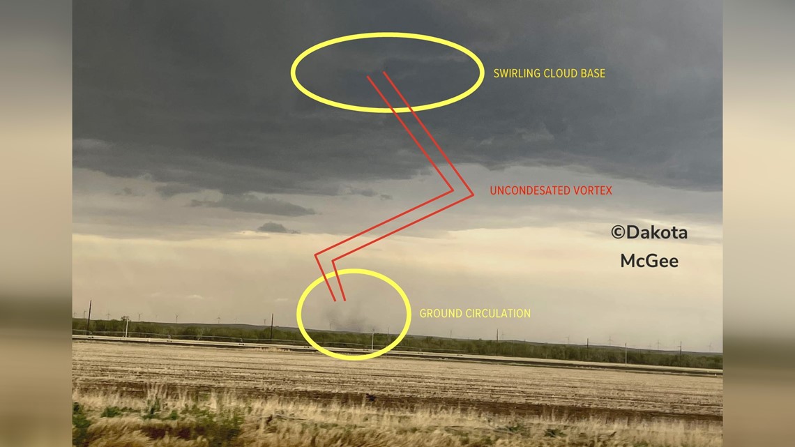
Storm spotter Dakota McGee said he saw a ground circulation underneath a thunderstorm base that had a little swirl to it, but the vortex of the tornado was invisible.
As a trained National Weather Service (NWS) spotter, McGee could tell that the ground circulation and the funnel were related and reported the tornado. A tornado is a rotating column of air that is connected to a cloud base and the ground, but the middle of the vortex doesn't have to be visible to know it's there.
It's actually quite common in Colorado for tornadoes to be partially invisible.


Because of our extremely dry air, there’s not always condensation in the vortex of a Colorado tornado to reveal the whole structure. Sometimes the only way we can see the whole vortex is if it’s sucking up enough dirt to reveal the spinning column.
While invisible vortexes make it difficult to spot some Colorado tornadoes, another factor makes them easier to spot in Colorado. Our tornadoes are usually very tall because the bases of our storms are higher up than most states.
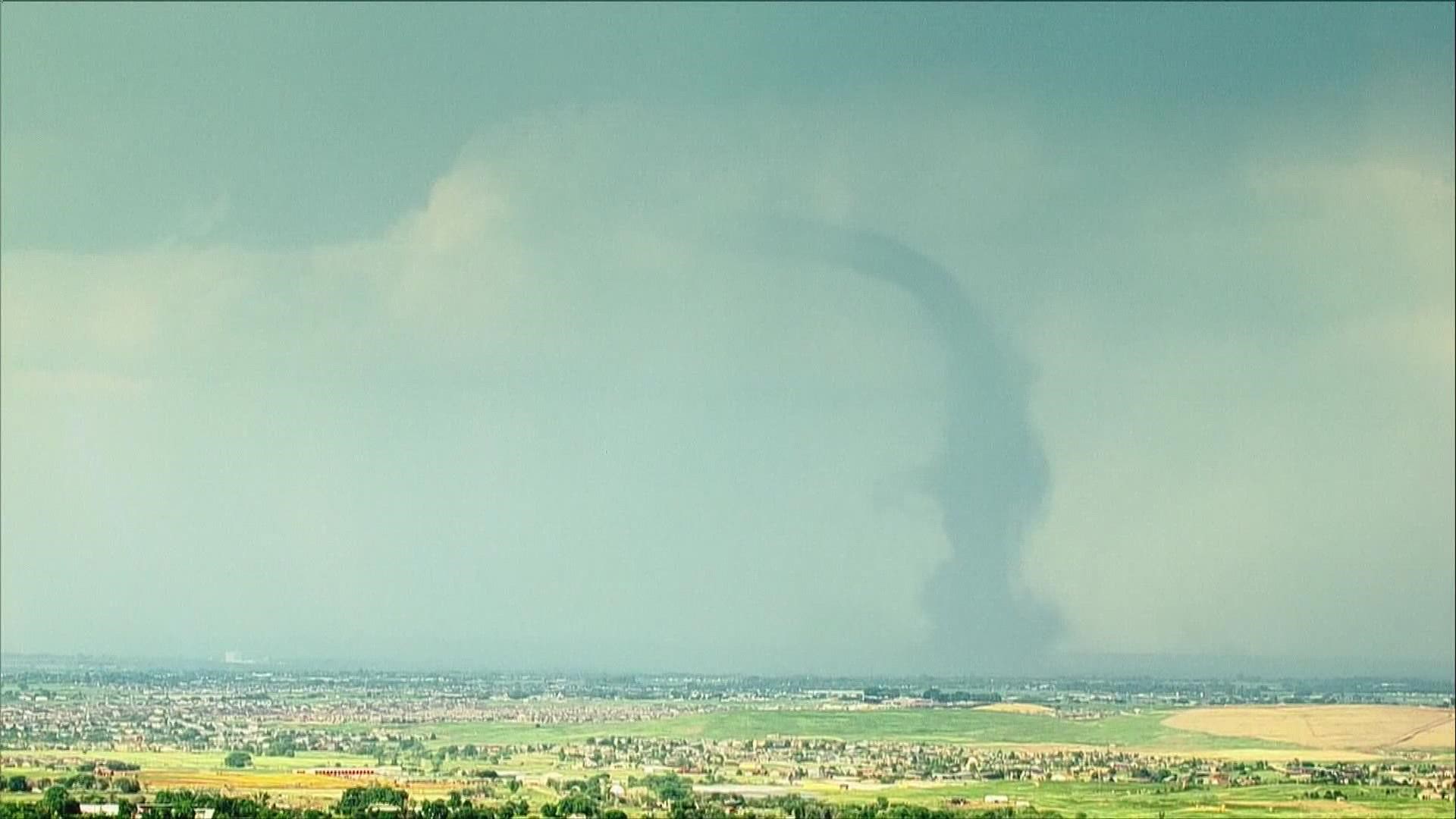
Last June, a tornado in Weld County was an estimated 10,000 feet tall. The NWS called it the most visible tornado in Colorado history, with it in view of nearly five million people.
LANDSPOUTS
The June 2021 Weld County tornado and Monday's Logan County tornado were also both landspouts. This means the spinning air originated on the ground and not in the storm, so they are invisible to radar until the circulation in the cloud base is established. So, there were no tornado warnings issued for either tornado until after witnesses called them in.
The circulation is usually near to the surface and usually spinning horizontally to the ground. When a thunderstorm moves over top or forms over that spinning air, the updraft of the storm pulls it up vertically, attaches it to the cloud base of the storm, and you get an instant tornado with no warning.
Fortunately, landspout tornadoes are usually pretty weak and only do minor damage. They are also sometimes called non-supercell tornadoes.
Supercell tornadoes form when the rotation begins inside the thunderstorm and works its way down to the ground. These tornadoes can be very violent, cause major damage, and are often deadly.
But because they are formed by thunderstorms, they can be easily identified on radar. The lead time is roughly about 14 minutes on average before supercell tornadoes reach the ground.
TORNADO CLIMATOLOGY
The small tornado near the town of Illiff on Monday will be recorded as Colorado’s first of what could be many confirmed tornadoes over the next few months.
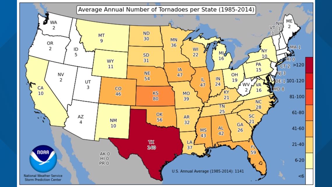
Colorado gets the eighth most tornadoes in the country with an average of 46 per year, but most of them are weak and happen away from the population centers.


About 63% of them are rated EF-0, like the one on Monday, which is the weakest on a scale of zero to five.
And 95% of our state’s tornadoes happen east of Interstate 25.
Mid-May is about the average time to see our first tornado in Colorado.
Almost all of our tornadoes happen over the three-month stretch between May and July, with June being our state's most active tornado month.
SUGGESTED VIDEOS: Severe Weather

