

NORFOLK, Va. —
Hurricane Beryl
Hurricane Beryl is now a Category 5 hurricane with winds of 160 mph, becoming the earliest Category 5 hurricane on record. In addition, Beryl is now tied with the strongest July hurricane, matching Hurricane Emily in 2005.

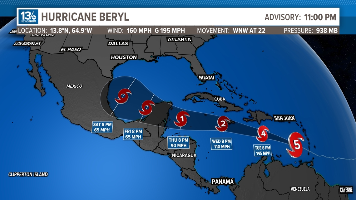
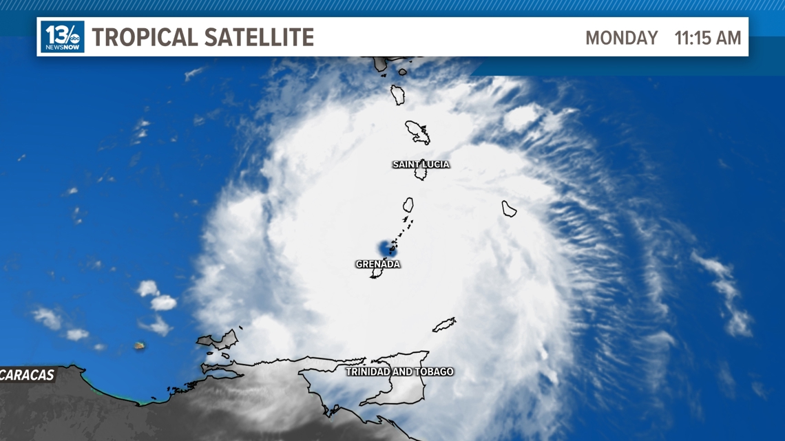
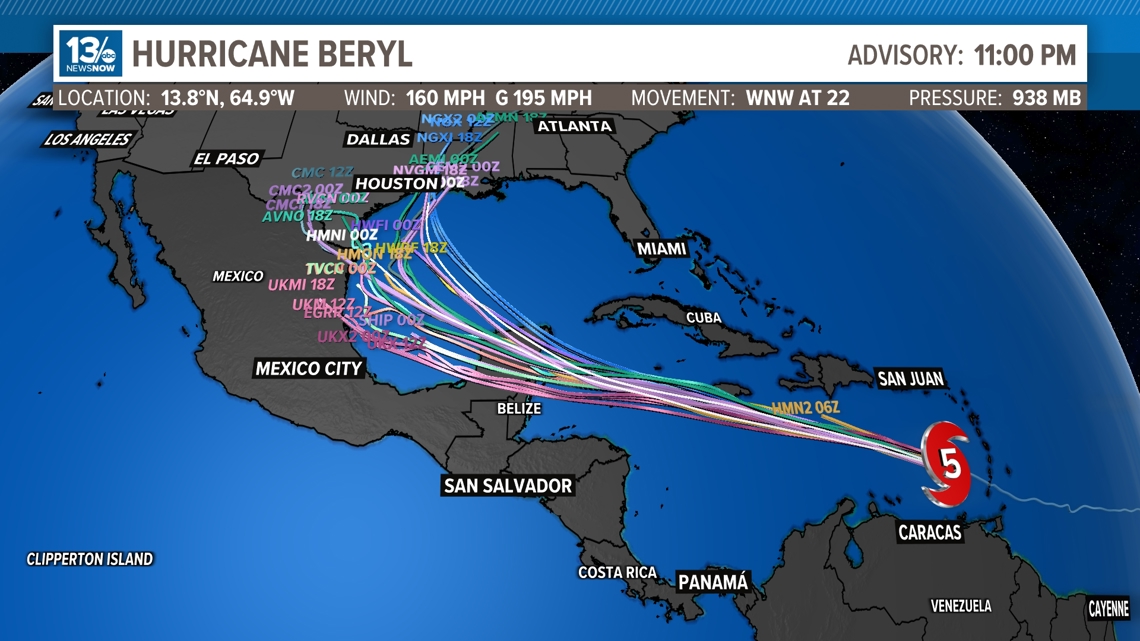
Beryl made landfall on Carriacou Island at 11:10 AM. The forecast track calls for Beryl to continue on a west-northwest path for the next several days. An increase in mid-level westerly shear is forecast by midweek, and this should cause some weakening while Beryl moves across the central and northwestern Caribbean Sea. However, Beryl is still forecast to remain a hurricane as it approaches the Yucatan Peninsula.

Models suggest Hurricane Beryl will continue on a west-northwestward track through the Caribbean and may impact Jamaica and possibly the Yucatan Peninsula later this week. An increase in mid-level westerly shear is forecast by midweek, and this should cause some weakening while Beryl moves across the central and northwestern Caribbean Sea.

Invest 96-L
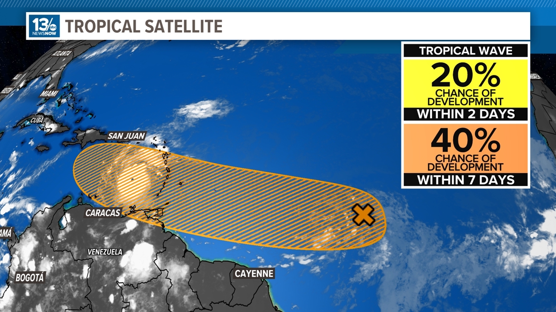
There is a bit less confidence that a tropical wave moving through the central tropical Atlantic will become our next named storms. Chances are still good that the system will develop. But the chances of development identified by the NHC continue to diminish, going down from 50% down to 40% over the next seven days.
An area of low pressure located over 1000 miles east-southeast of the Windward Islands, continues to produce disorganized showers and thunderstorms. Conditions only appear marginally conducive for additional development of this system, but a tropical depression could still form during the next few days while it moves generally westward at 15 to 20 mph across the central and western tropical Atlantic.

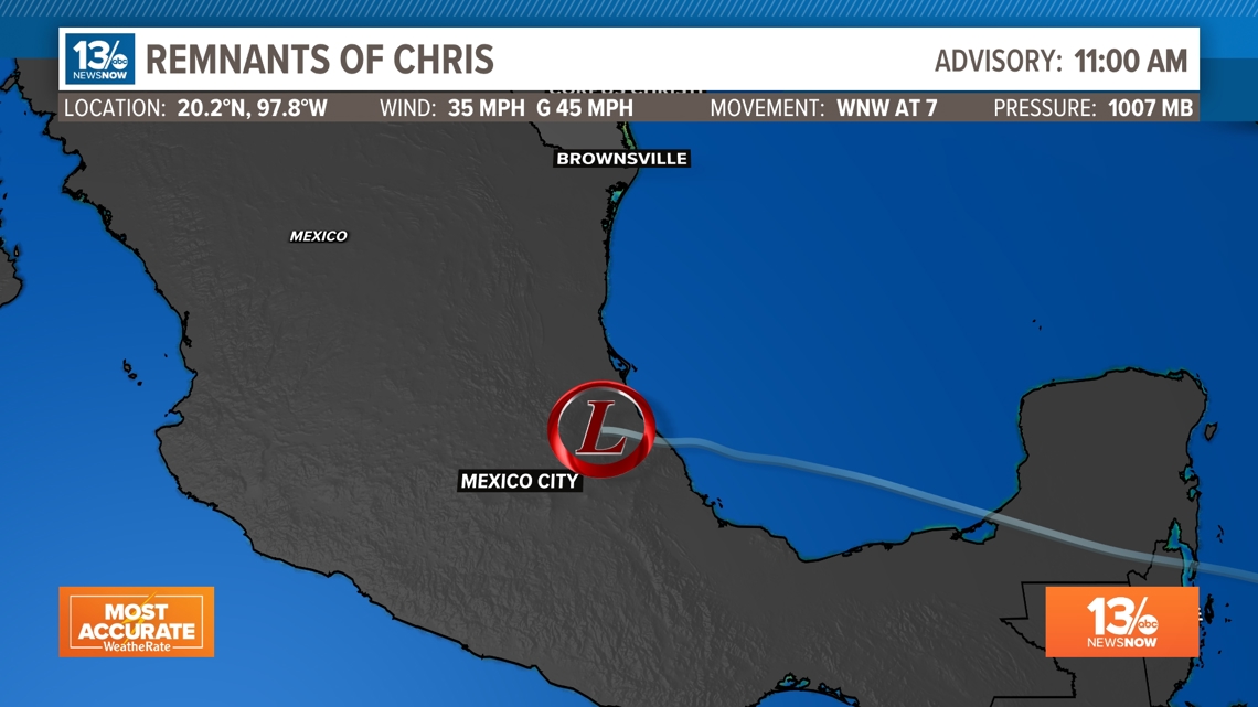
Chris? We hardly got to know you.
Invest 94L developed into Tropical Depression #3, which then became Tropical Storm Chris late Sunday evening. The storm almost immediately made a landfall as a weak tropical storm. By the 8 a.m. EDT update Monday, NHC had downgraded Chris to a depression over land.
At 11 a.m. EDT Chris was downgraded to a remnant low.
It will continue to weaken over land, but still produce life-threatening flooding tropical rains and possible landslides as the rain reaches higher terrain.

We are keeping close tabs on all the developments in the tropics, so continue to check back with us on 13News Now for updates.