COLORADO, USA — The spring storms have arrived! Rain, lightning, gusty winds and rumbles of thunder are tracking across the northeastern plains this evening. The Denver metro area is left with mostly cloudy skies and breezy winds for the rest of tonight.
Around 3:30 p.m. Thursday, Centennial Airport reported gusts of 50+ knots in the area.
At Denver International Airport, 50-60 mph wind gusts caused some flight delays, as well as inbound flights forced to conduct a go-around before landing.
As of 9 p.m. Thursday, there were four cancellations out of the airport and 516 total delays due to the weather conditions.
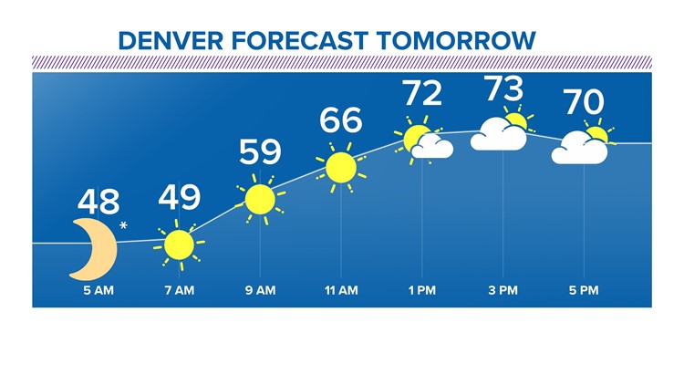
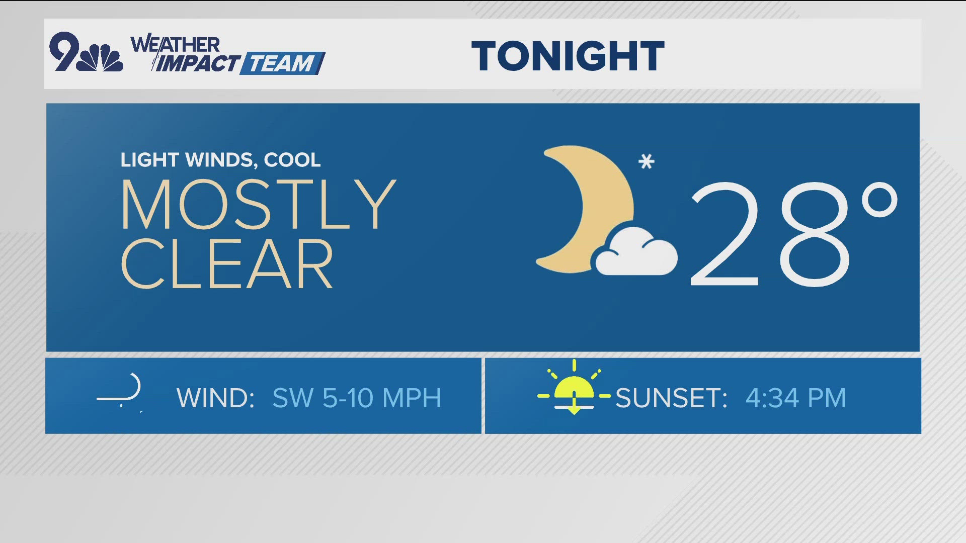
Skies will gradually clear overnight into Friday morning as lows dip into the mid-40s around the I-25 corridor.
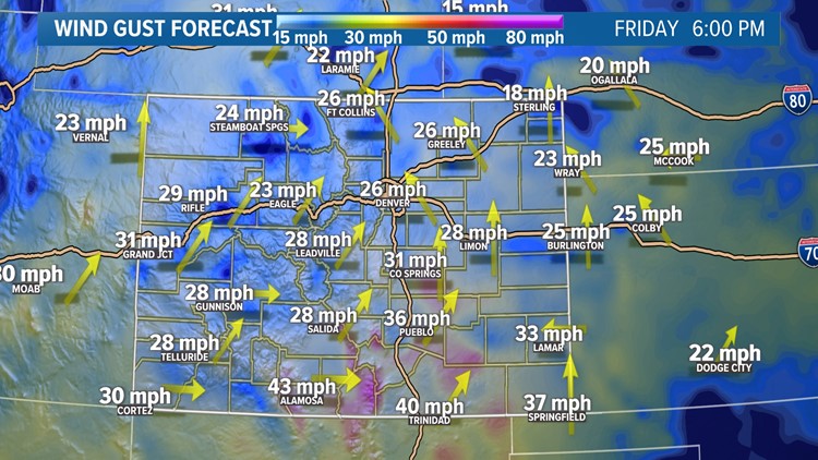
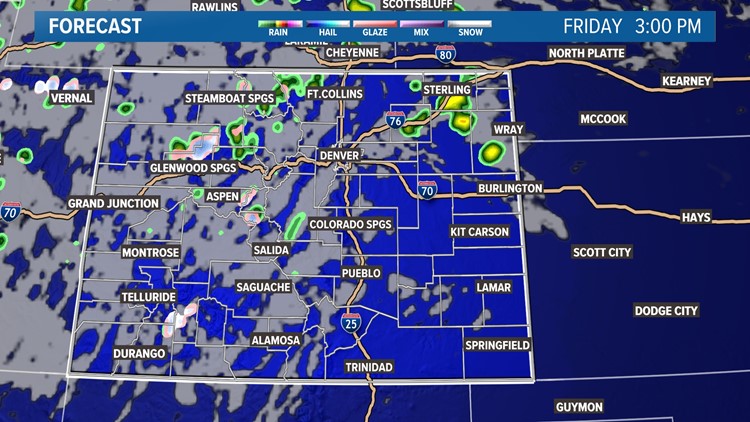
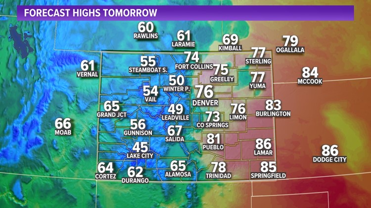
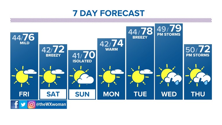
Look for mostly sunny skies around Denver Friday along with another warm-up! Highs will soar into the mid-70s during the afternoon.
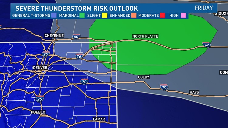
Storms will mainly be confined to the mountains, foothills and northeastern plains. We could see some severe cells with large hail, damaging winds and heavy downpours along Interstate 76 heading into Nebraska.
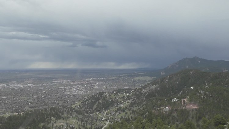
>WATCH: Sky9 captures thunderstorms across the Front Range
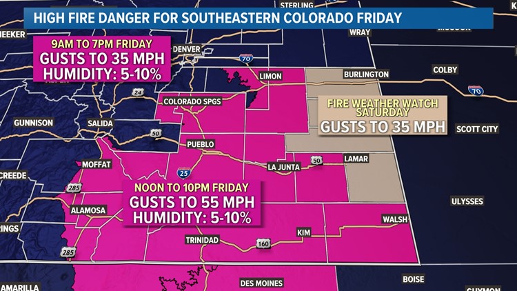
Meanwhile in southeastern Colorado, strong winds will ramp up fire danger. Gusts will be up to 35 mph around Elbert and Lincoln counties while southern Colorado sees 55 mph gusts in the afternoon and evening.
Slightly cooler temperatures are on tap this weekend but it'll still be quite pleasant! Look for lower 70s with isolated afternoon/evening storms both Saturday and Sunday.
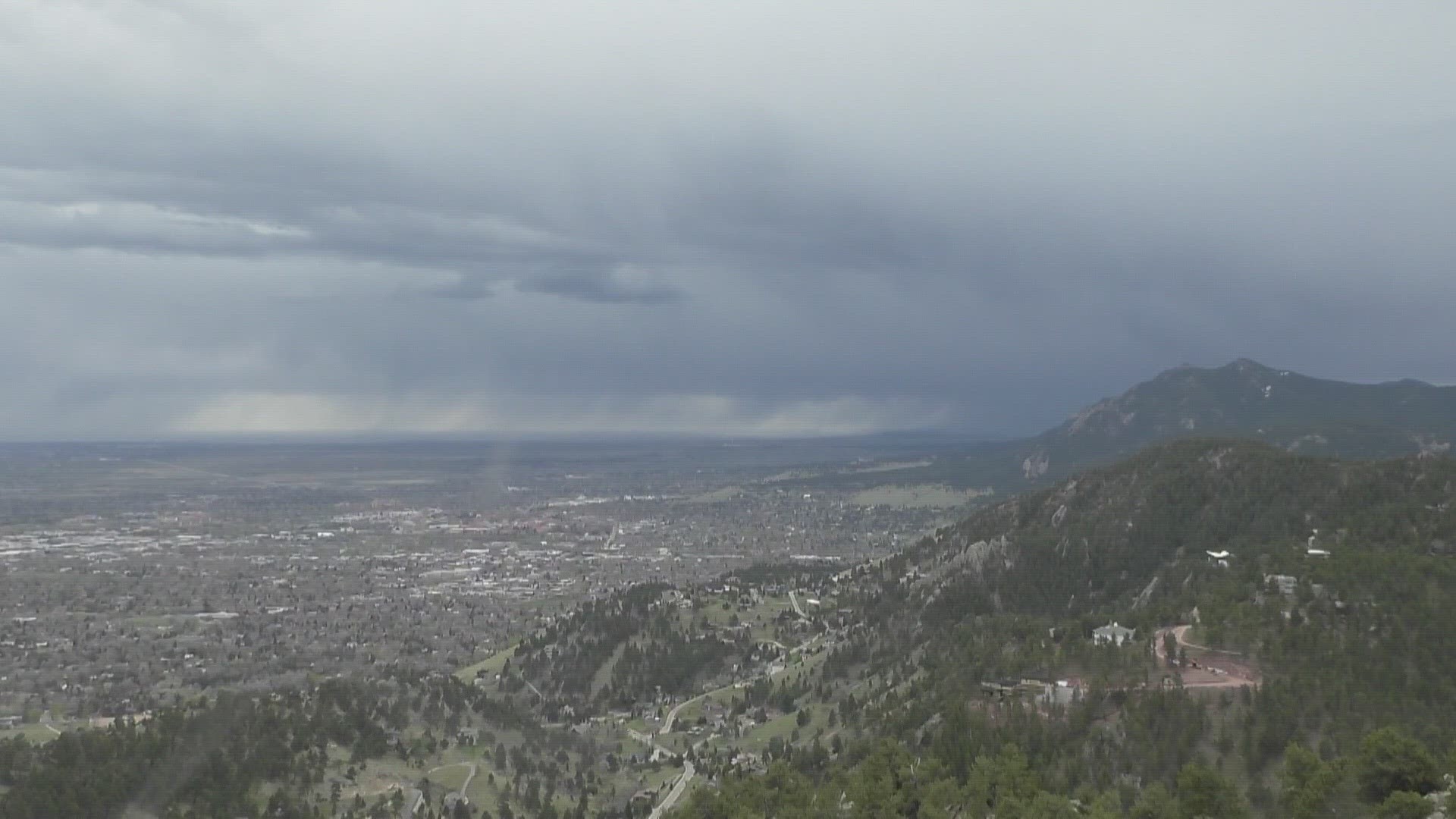
>WATCH: Storms roll into Boulder