Rain showers Thursday evening will change over to snow early Friday morning around the Denver metro area and southern suburbs.
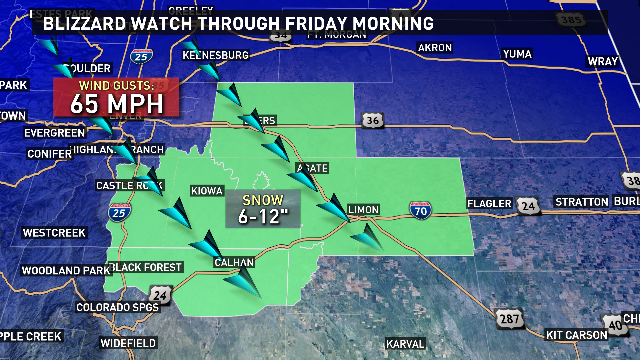
Wind chill readings will be in the low 20s, as powerful northerly winds and wet snow will affect the Front Range Friday morning.
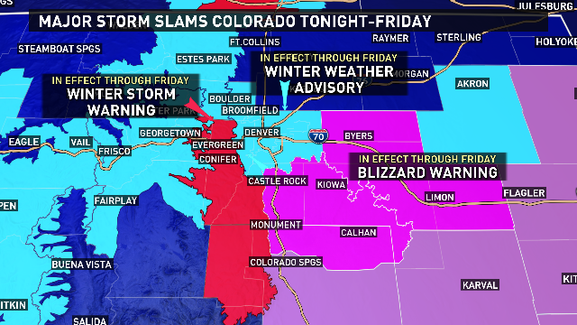
A Blizzard Warning is in effect from Castle Rock to the south and Watkins to the east with 65 mph winds and 7 to 14 inches of snow. Blowing and drifting snow could cause some highways and interstates to shut down for a short time Friday morning because of very low visibility.
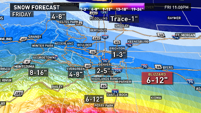
Because this is such a warm system, there is a lot of melting expected with this snow after it lands. Here is our latest snow forecast, please check back often for updates.
- Northeastern Metro Denver: 2 to 4 inches
- Central-West metro Denver: 2 to 6 inches
- Fort Collins-Loveland-Greeley: Trace to 1 inch
- Northern Foothills: 4 to 8 inches
- Southern Foothills: 8 to 16 inches
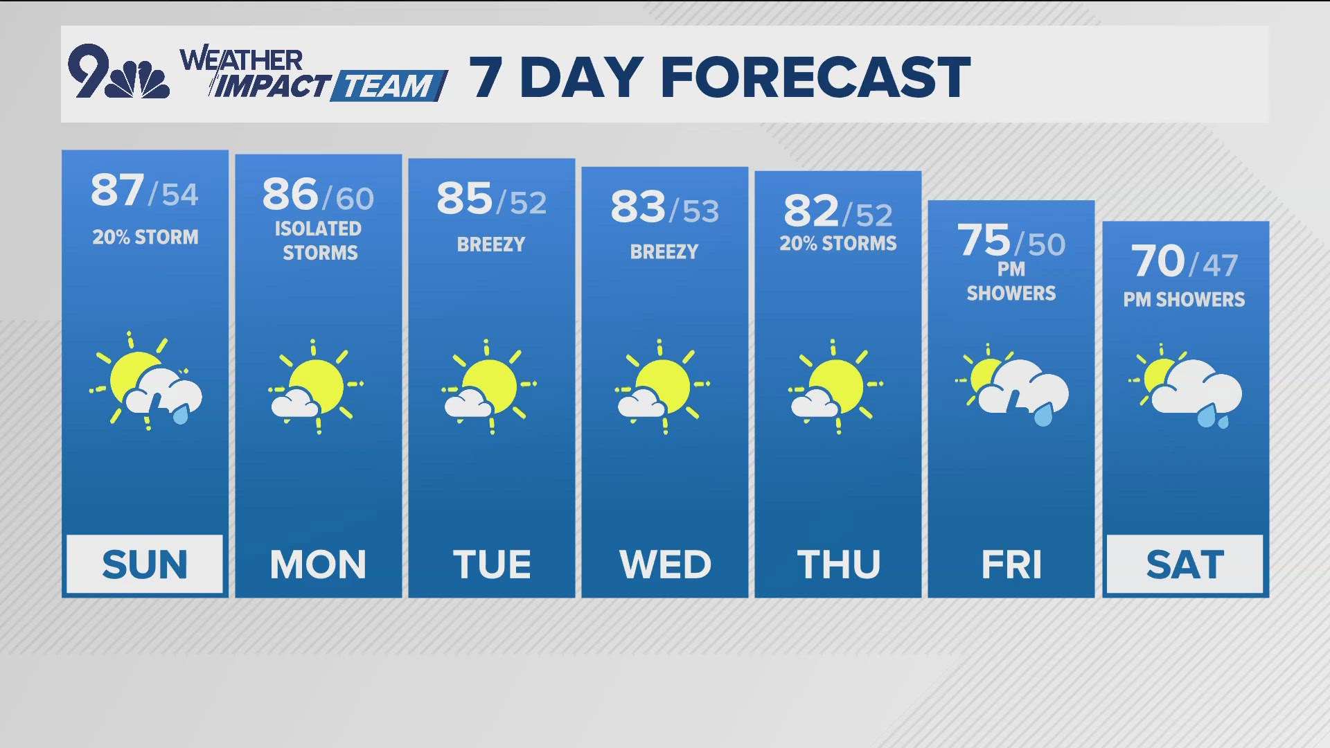
Skies will be clearing Friday afternoon. Look for a mild, dry Saturday with another round of showers Sunday.
FULL FORECAST: http://on9news.tv/2hcqpHZ