
COLORADO, USA — Severe thunderstorms made their way across northeastern Colorado Tuesday, delaying flights at Denver International Airport and causing damage to roads in Elbert County.
As of 9:45 p.m., 681 flights had been delayed and 29 flights were cancelled Tuesday at DIA, according to FlightAware.
The National Weather Service issued a severe thunderstorm watch for most of the northeastern corner of the state for large hail, 70+ mile per hour winds and the possibility of a few tornadoes. The watch is in effect until 1 a.m. Wednesday.
Brief downpours and small hail were reported across the Front Range, including in Boulder, Fort Collins, Parker and Castle Rock.
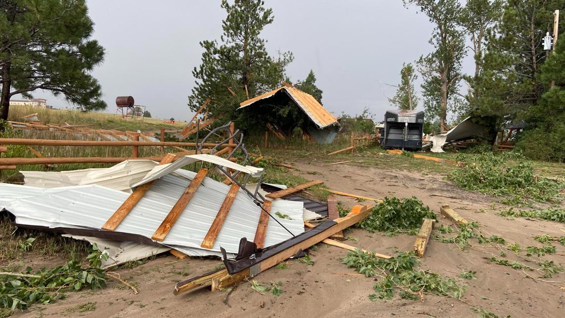
Elizabeth Fire said the storms damaged an outbuilding in the area of PR160 and CR21, northeast of the town. The resident's home was not damaged, and no one was hurt.
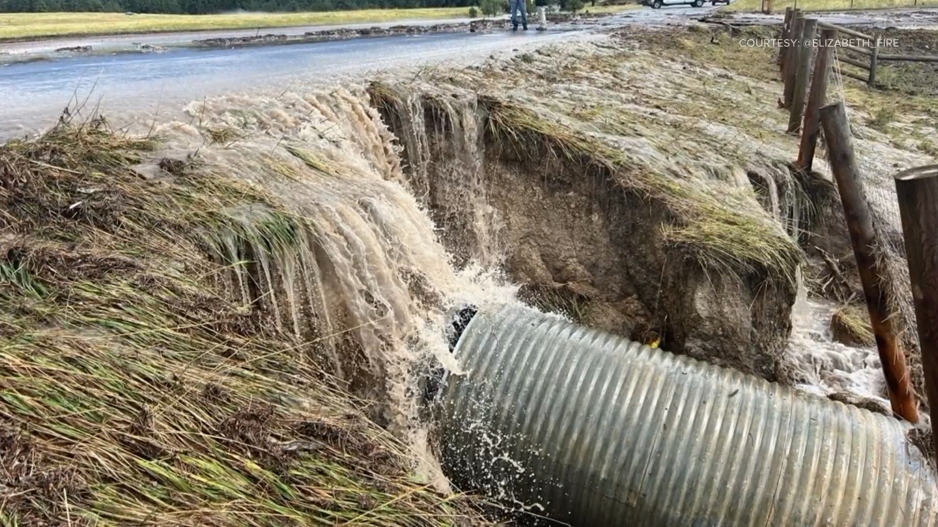
Roads in the area were damaged by floodwaters.

Flash flooding was also a concern Tuesday, especially in burn scars. The NWS said the storms were capable of producing 1-2" of rain in 30-45 minutes.
Current radar:
A ridge of high pressure slowly starts to build back in starting Wednesday. That said, we'll still have enough leftover moisture for some storms on Wednesday, though probably with lower coverage and a lower severe threat than Tuesday's. Highs will stay in the mid-to-upper 80s through Thursday, before our ridge starts to push in much warmer air for Friday and the upcoming weekend.
Look for highs in the 90s Friday through early next week and a generally dry pattern, though storms move back into the picture for next Monday and Tuesday.