BOULDER, Colo. — The big worry for the National Weather Service's Boulder office ahead of the chill down and winter weather headed for Colorado Wednesday is the potential rapid icing of roads.
Forecasters predict a rapid temperature drop heading into the rest of the evening - especially when the sun goes down.That rapid drop in temperature will lead to travel troubles across the state.
According to the National Weather Service, near-zero visibility is expected in the mountains especially near ridges and passes.
"Plan for a Very Slow & Difficult Commute Wednesday Afternoon & Evening," reads a bolded text placard regarding travel times on the National Weather Service's website.
The National Weather Service - and most of the state's municipalities - are worried about driving conditions and the abilities of drivers themselves.
A lot of people, especially Colorado "natives" and those that have been driving on snow for years, think they do not need good driving reminders. Everyone needs to remind themselves: drive slowly, defensively and wear a seatbelt.
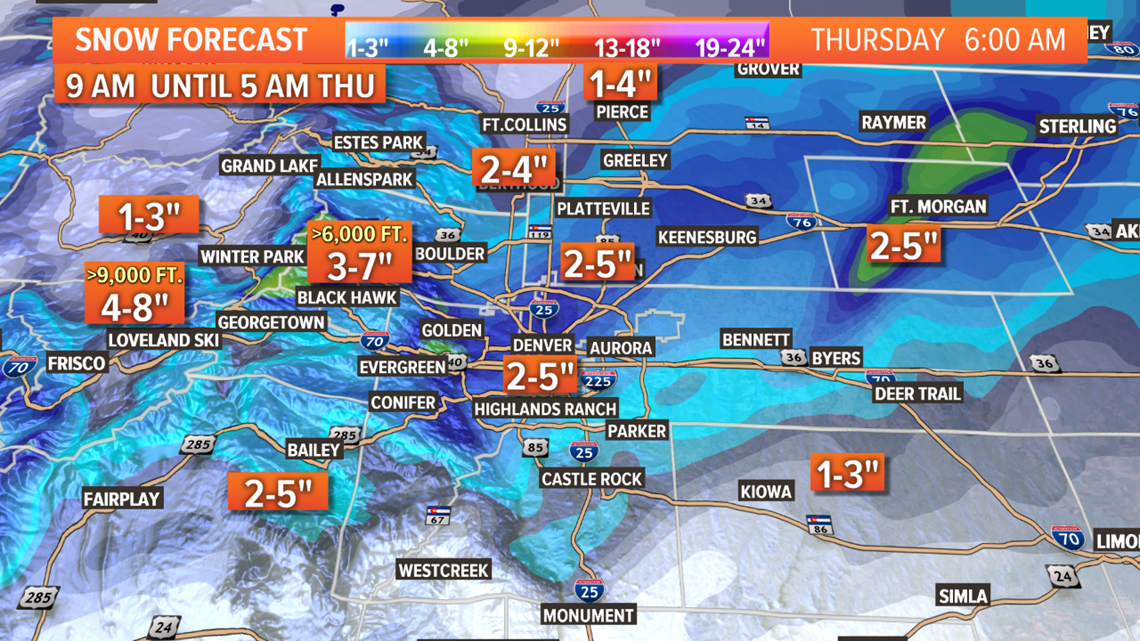
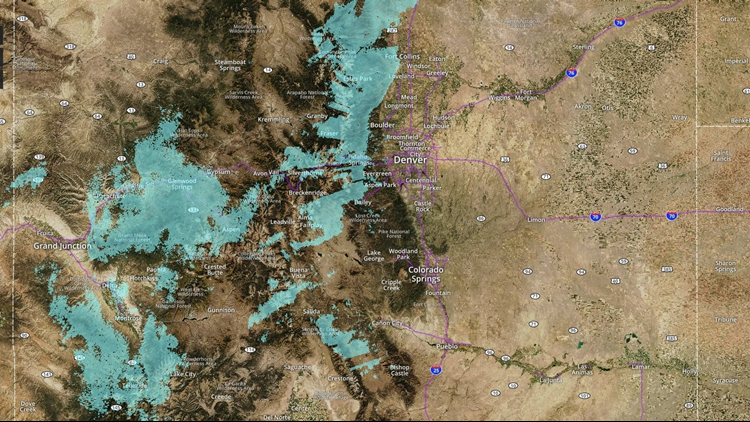
Snow is expected to continue over the mountains throughout the morning hours before spreading over the northeast plains of Colorado Wednesday afternoon, the NWS said. Snow will continue throughout the night in the region, but begin tapering off post-midnight. The plains can expect to see snowfall continuing until the later Thursday morning hours.
INTERACTIVE RADAR | Snow, cold temps arrive in Colorado


Additional snow accumulations in the mountains are believed to be around 4 to 8 inches throughout with some areas getting more. The plains should see anywhere from 2 to 5 inches by early Thursday morning, according to the NWS.
Roads are expected to get icy beginning this afternoon as the temperature drops into the teens as the sun gets higher in the sky for the plains and high country.
Come Thursday, the winter storm will leave the state, the NWS said. Lingering snow showers look like they'll pop an inch or two of snow before leaving later in the afternoon.
Despite the winter storm leaving the plains, residents there shouldn't expect any real warm-ups temperature-wise. An arctic airmass will be left over the plains in the storm's wake. Forecasted highs are only expected to reach the teens, the NWS said. Very cold temperatures are expected to continue into Friday.
LIVE VIDEO | Traffic and weather conditions around Colorado
Friday and Saturday are bringing gradual warming for most of the state thanks to a weaker high-pressure system. Expect another "weather disturbance" moving over the state Saturday night, bringing with it another couple of inches for the mountains.
TRAFFIC REPORT | Traffic trouble expected for Denver metro area as winter storm rolls through Colorado
SUGGESTED VIDEOS | Local stories from 9NEWS


