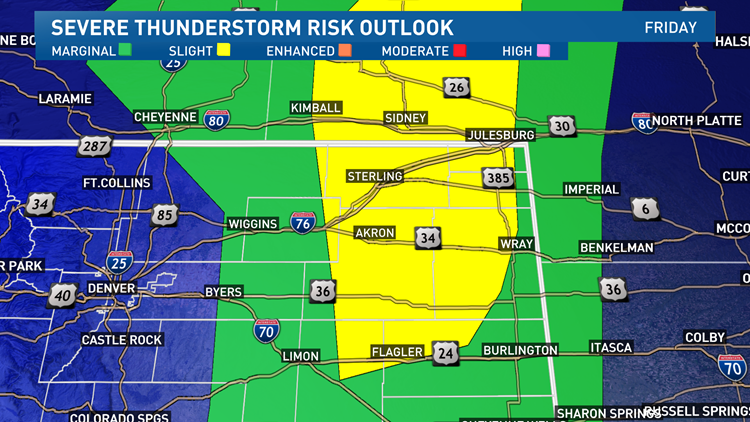
COLORADO, USA — The ingredients for dangerous severe weather is coming together for the eastern plains of Colorado and the Nebraska panhandle Friday.
The will be a sharp dividing line between warm, moist air to the east, and cooler, drier air to the west. This area will be the focus of storm initiation likely starting at about 2 or 3 p.m.
The flow of upper air is generally from the southwest today, so storm motion should follow that regime.
High resolution models are showing several waves of south-to-north moving severe thunderstorms training from northeast Colorado into the Nebraska panhandle between 3 p.m. and 10 p.m.
The threats will be for large hail -- golf ball size or larger.
There was baseball size hail reported in Weld County Thursday and I would not be surprised to see that again Friday.
Damaging thunderstorm wind gusts in excess of 70 mph will also be possible, along with a high tornado threat.
The Storm Prediction Center has placed part of our area under a 5% tornado risk. On most active severe weather days in Colorado, there is less than a 2% chance of getting hit by a tornado.
9NEWS will have updates on the storm potential online and on TV Friday afternoon. For the latest weather alerts, download the 9NEWS app.
SUGGESTED VIDEOS: Latest from 9NEWS


