KUSA - Did the phrase “bomb cyclone” get your attention? No, it’s not a term made up just to scare people on the internet.
In fact, it’s an actual scientific phenomenon that is the aftermath of another fun word: “bombogenesis.” The National Oceanic and Atmospheric Administration describes this as a “popular term that describes a midlatitude cyclone that rapidly intensifies.”
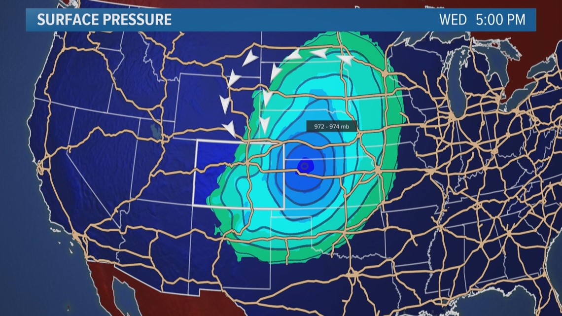
This creates a bomb cyclone, which is defined as when barometric pressure drops by 24 millibars in 24 hours. What does a pressure drop like this mean?


Basically, the lower the pressure, the stronger the storm, and that spells high winds and heavy snow. A bomb cyclone like this is rare over places like Colorado, but the combination of a warm, humid air mass that was over Denver colliding with an Arctic one to the north is what led to the rapid drop in pressure and intensification of the storm.
As predicted, Wednesday's storm started with rain in the morning, then transitioned to snow. Extreme wind gusts picked up, with a report of 80 mph gusts out at DIA at 11 a.m. In the metro area, strong winds and the heaviest snow continued between 11 a.m. and 3 p.m.
RELATED: What exactly is a blizzard, anyway?
RELATED: Front Range weather forecast
Somewhere between 4 to 8 inches of snow fell in Denver metro area Wednesday afternoon, with higher totals in the northwest mountains, Eastern Plains and southwest corner of the state.
A Blizzard Warning remains in effect for Denver until midnight on Thursday due to the strong winds. That warning extends to Thursday at noon on the Eastern Plains.
Wind speeds in the city will slowly subside through Thursday afternoon.
SUGGESTED VIDEOS | Local stories from 9NEWS


