DENVER — The Climate Prediction Center issued a La Niña advisory Thursday saying that there's a 75% chance the climate pattern will last through the northern hemisphere winter.
While there is not a strong teleconnection directly to Colorado, it usually means below-average snowfall for southern Colorado and the Front Range.
La Niña and El Niño are related climate patterns. Technically they are the cool and warm phase of the El Niño / Southern Oscillation (ENSO) cycle.
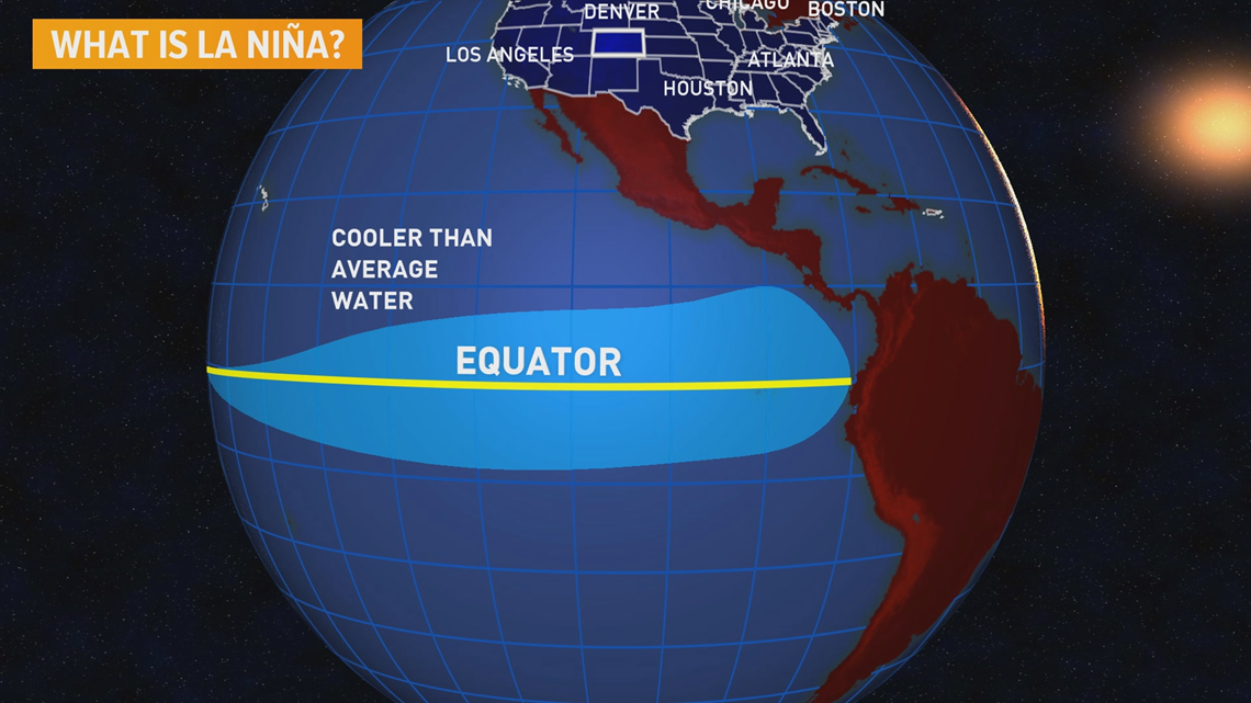
The phase is determined by the sea-surface temperatures in the Pacific Ocean along the equator. When the surface of that water is cooler than average, it is called a La Niña.


Most of the cooling is caused by strong easterly winds coming off of South America which brings up cooler water from deeper in the ocean, a process called upwelling.
That cooler water triggers a new weather pattern by limiting rising air over that region. That, in turn, changes the way that air moves through the upper atmosphere.
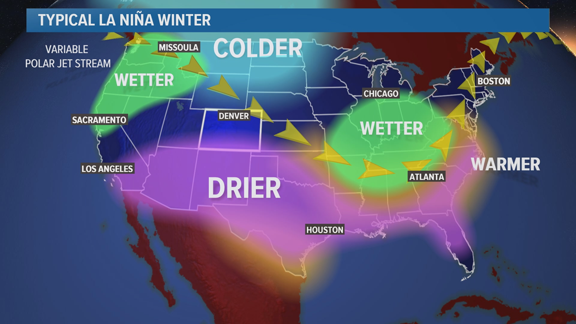
A large blocking high-pressure system usually sets up over the Pacific Ocean west of California and forces the polar jet stream move up and around the Gulf of Alaska. This pattern promotes sinking air, which is warm and dry, to fall over the southwestern United States.


In a typical La Niña winter, the bulk of the colder air stays to the north, and the drier air stays to the south of Colorado. However, the southern part of the state has been frequently impacted by drier winters, and so has the Front Range.
The last two La Niña winters in Denver have produced two of the least snowy seasons in history.
In 2017-18, Denver only got 25.7 inches of snow – That’s the 5th lowest amount of snow in Denver history.
In 2016-17, the 21.8 inches was the second-lowest snow total in the 137-year history of Denver weather records.
The connection between La Niña and dry winters in Denver isn’t 100% but the numbers are strong. Out of the last 22 La Niña winters, 18 of those yielded below-average snow in Denver.
Denver is one of the snowiest cities in America though, averaging 56.6 inches of snow every year, so they could get four and a half feet of snow, and that would still be considered a below-average winter.
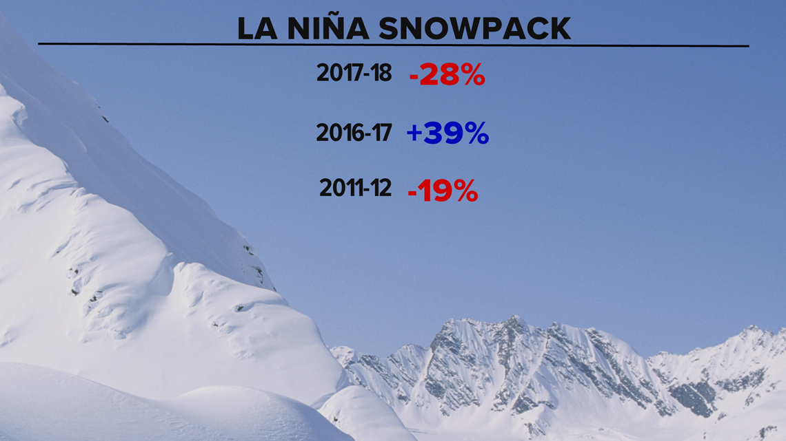
The connection is not as strong when you look at the amount of snowpack in the mountains. Only about 60% of La Niñas resulted in below-average snowpack, and it looks like most of those were mainly due to lower amounts in the southern mountains.
However, three out of the last five La Niñas have resulted in below-average mountain snowpack.


The driest winter ever recorded in the mountains was 2001-02. The winter condition that year was neutral; neither an El Niño or a La Niña was present.
NOAA climate scientists say there is a 75% chance that La Niña conditions will last all the way into the spring.
SUGGESTED VIDEOS: Science is Cool

