DENVER — Parts of Westminster got a foot of snow last Monday, and just 18 miles from there in Brighton, zero snow was reported. While a very localized but powerful, and long-lasting convective band of snow was mostly to blame for that, terrain played a role in enhancing that band.
An area of elevated land to the north of the Denver metro called the Cheyenne Ridge is very influential in determining how snow showers form in northeast Colorado.
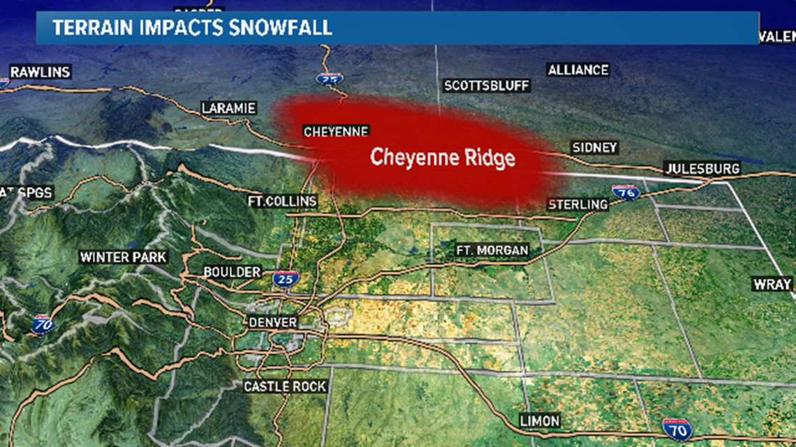
It is located between the South Platte and North Platte river basins, including parts of Logan and Weld Counties in Colorado, part of Laramie County in Wyoming, and the southwestern part of the Nebraska Panhandle.
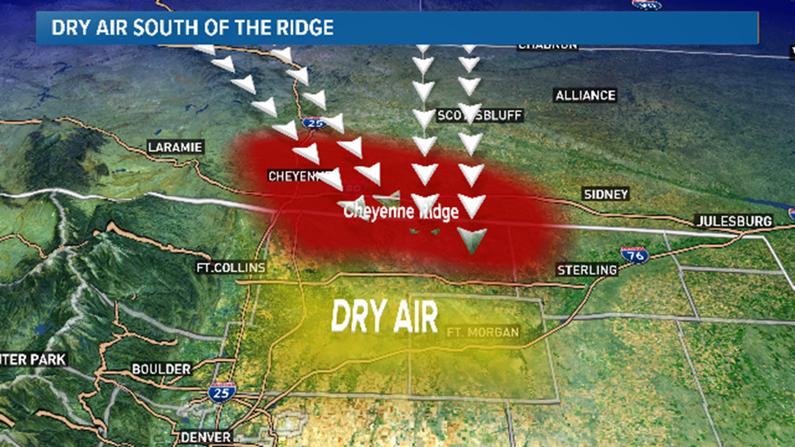
Common wind directions in the winter are from the north or the northwest. In this case, areas just south of this ridge like Ft. Collins, Greeley, and Ft. Morgan will get drier air, and less snow.
Air warms and dries as it sinks.

A southeast wind is ideal for big snow on the Cheyenne Ridge and the areas just to the south.
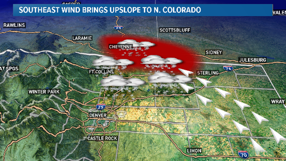
The way the air is redirected by this ridge is also important. It happened on Monday as the northwest flow hit the Cheyenne Ridge and curved back to the east, enhancing the upslope around the Boulder Turnpike.
Air moving up the slope cools and condenses into storm clouds.
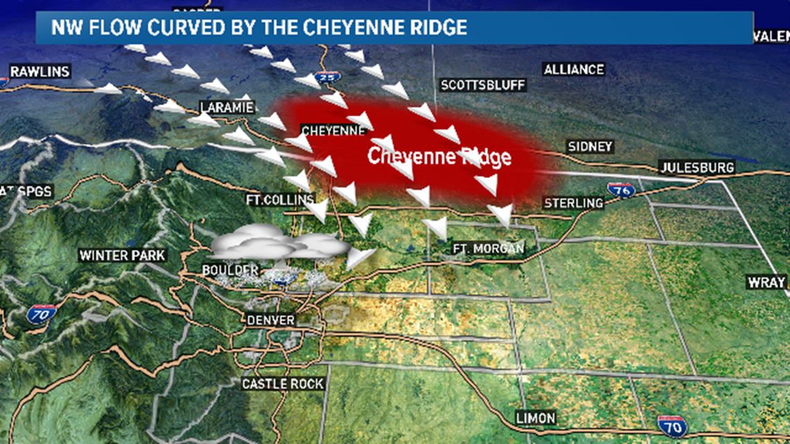
On rare occasions, this interaction can cause a full clockwise circulation around east Boulder County that can persist for several hours. This feature can deliver strong upslope conditions to the parts of the Denver metro and the foothills between Evergreen and Ward. This phenomenon is called the 'Longmont Anticyclone,' due to the area in which it sets up.
In the case of last Monday, it was only a partial circulation with no northerly return flow, so it does not fit into the conditions necessary for a Longmont Anticyclone.
There is another ridge to the south of the Denver area called the Palmer Divide. North winds here ride up the slope and cause bigger snowfall. But as the air rides down the other side, it dries out the Colorado Springs area.
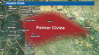
Favorable wind direction this year has painted the Palmer Divide white with snow, clearly visible from satellite for most of January. That’s something we didn’t see too much of the previous two years.
The foothills benefit from a wind direction with any type of easterly component, due east is usually the best.

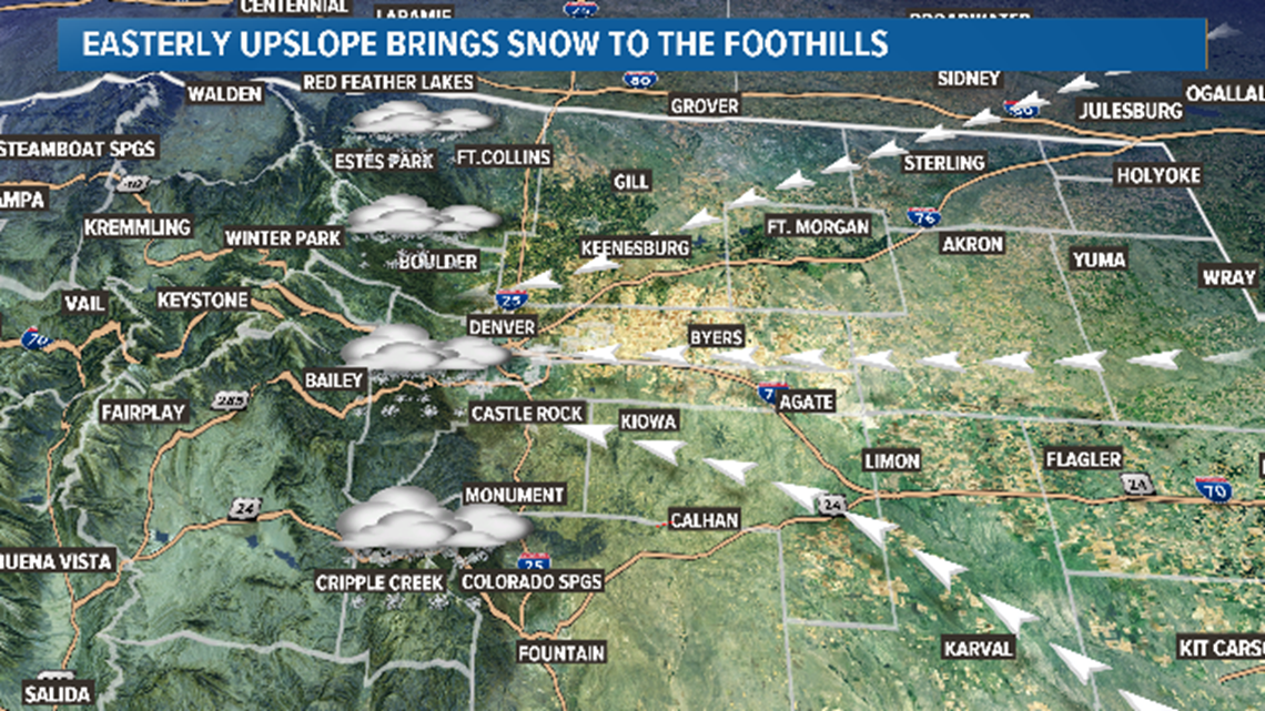
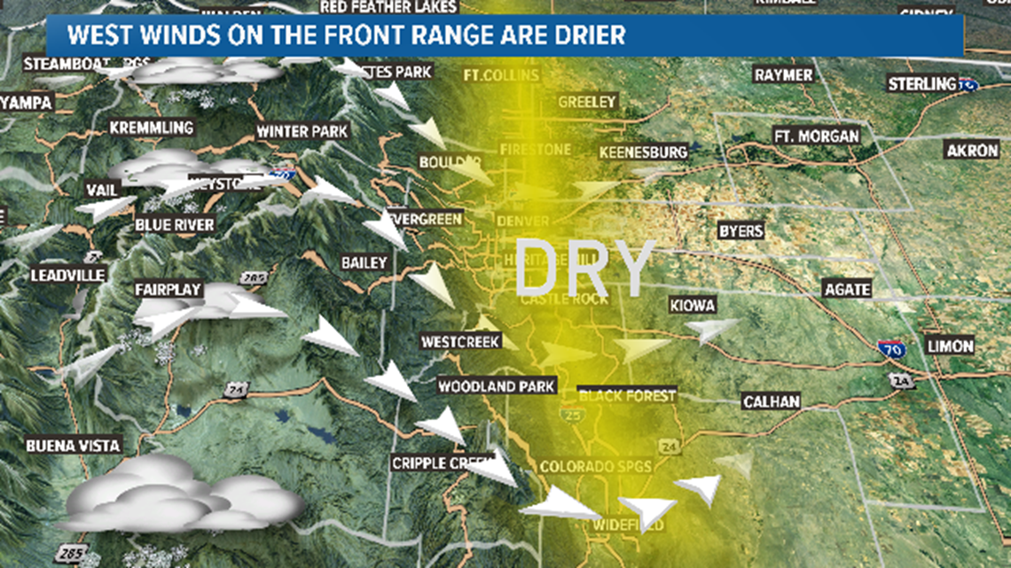
A westerly wind coming over the Continental Divide keeps the Front Range warmer and drier.
Due to terrain, the west and south Denver Metro averages much higher snow totals.