DENVER — The lower the pressure of a storm, simply put, the stronger the storm. So when we're talking about a "bomb cyclone," that means a storm is strengthening really quickly.
A "bomb cyclone" – or bombogenesis, the official origin of the term – means a storm's central pressure drops by 24 millibars or more in a 24-hour period.
Part of the storm heading to the East Coast this weekend pushed through the Front Range on Thursday, leading to a quick 2.8 inches of snow in Denver and a few localized totals topping 6 inches.
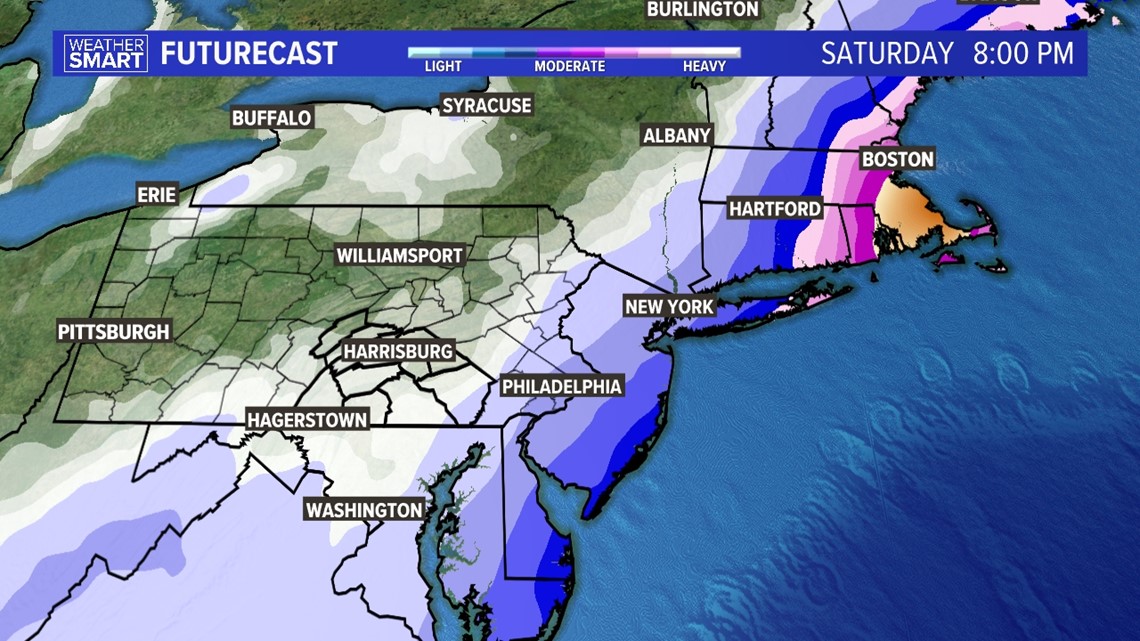
Thursday's Colorado storm will merge with another to create the recipe for a likely "bomb cyclone" this weekend along the East Coast, and one that could deliver feet of snow and hurricane-force winds to parts of New England and the Mid-Atlantic.


As of early Thursday morning, all the major weather models are showing a rapidly intensifying nor’easter off the east coast on Friday into Saturday.
The GFS model has the least aggressive solutions. On Friday afternoon, the central pressure is projected on the GFS model to be 1011 millibars off the coast of South Carolina. 24 hours later, the storm is off the coast of New England and drops 39 millibars.
The storm’s rapid intensification makes this a tricky forecast for the northeast. All the major cities will be cold enough for snow, but the cut-off between major snow accumulations and smaller totals will be tight. This leaves millions of people on the edge of their seats as forecasts are fine-tuned.
Alex Calamia from WLTX contributed to the reporting of this story.
SUGGESTED VIDEOS: Storms and severe weather

