DENVER — The seemingly relentless snow across eastern Colorado in recent weeks is starting to make a difference on Colorado's drought situation.
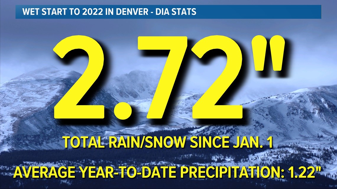
After Denver's biggest precipitation event in nearly 10 months on Wednesday and Thursday, Denver is now at more than double its year-to-date precipitation average. With 2.72 inches of total rain and snow since Jan. 1, Denver's more than double its 1.22 inch year-to-date precipitation average.
On Wednesday and Thursday alone, Denver saw 0.62 inches of total precipitation. That made it (by far) the city's biggest precipitation event since May 30 of last year.
All of those statistics are based on data from Denver International Airport, which serves as Denver's official climate site.


It's not just Denver or the Front Range, though.
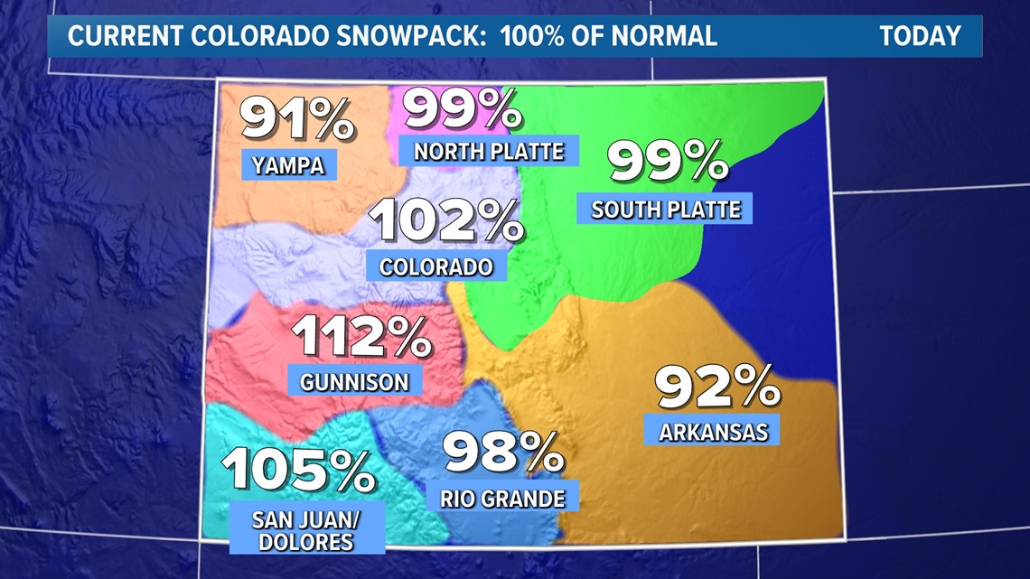
Snowpack across Colorado mountains has gradually ticked up in recent weeks, thanks to a consistent stream of small-to-medium sized storms. This week's storm helped snowpack levels in the South Platte and Arkansas River basins in particular.
Some parts of the Front Range foothills saw over 20 inches of snow from this week's storm.
For the first time in a few weeks, Colorado statewide snowpack levels moved back to 100% of its season-to-date average on Thursday.


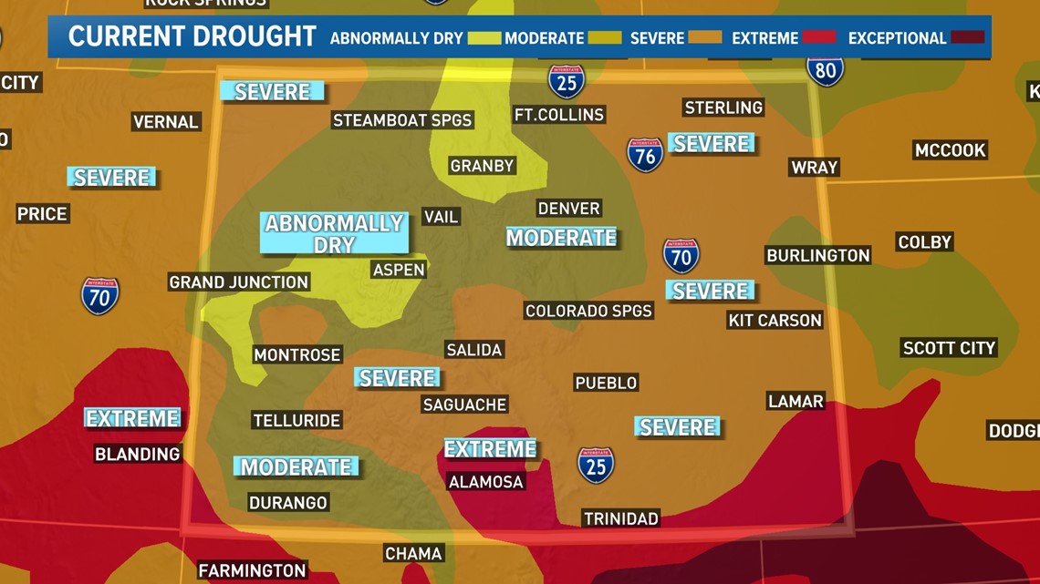
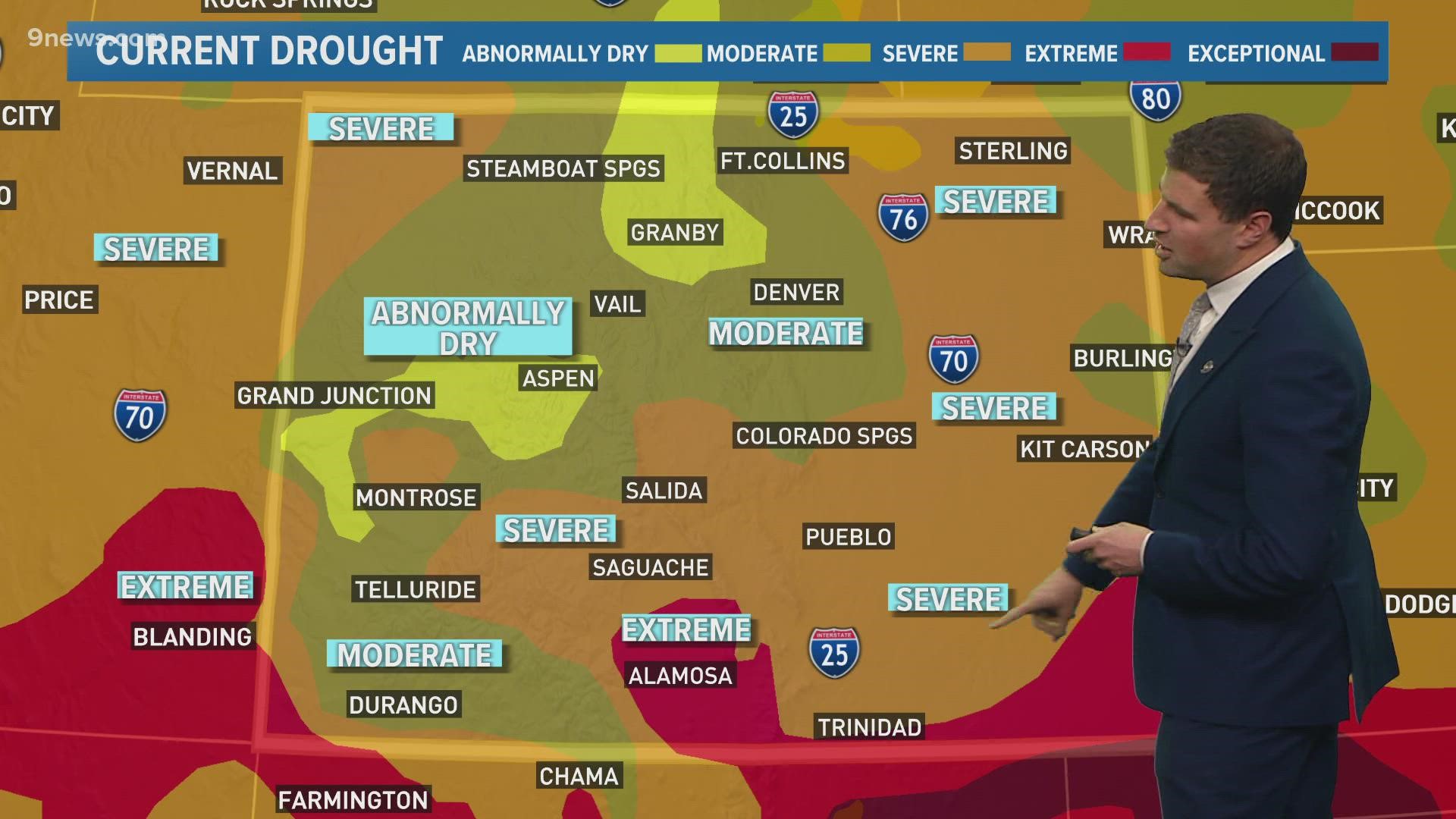
That all said, most of Colorado remains in either a moderate or severe drought, based on the official U.S. Drought Monitor's most recent update on Thursday. However, that's a substantial improvement from December and January, when much of the state was in an extreme or exceptional drought, the two highest categories on the Drought Monitor's five-tier scale.
It's also worth noting that this week's update doesn't include any of the rain or snow that fell on Wednesday or Thursday.


There's more needed precipitation on the way. A potential blizzard early next week should bring healthy snow to parts of Colorado's mountains, and it'll also bring strong winds to parts of the Eastern Plains.
SUGGESTED VIDEOS: Science & Weather

