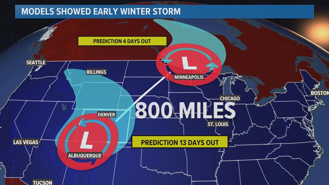
DENVER — Colorado's first sizeable winter storm of the season appeared in the computer forecast models about 13 days ago -- before October even started -- and social media started buzzing.
Online posts showed that a significant snowfall was coming to the Colorado mountains on Oct. 12, and they even showed the first snow accumulation of the season in Denver.
Well, it turns out there will be a winter storm on that date, but those initial computer model solutions were off by about 800 miles. Colorado will just get scraped by the bottom of the storm, dropping temperatures slightly for most of the state.


As the winter weather season approaches, you should know the true expectations and usefulness of winter forecasts.
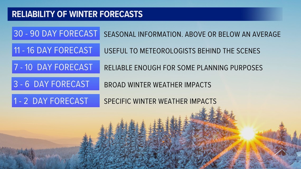
Thirty to 90-day forecasts are actually very accurate, but can only tell you if the precipitation or temperature will be above or below the average during that time span.
It’s the 11 to 16-day forecasts where computer models start to break down more specific timing and impacts, but that information can be very misleading to the public and should only be used by professional meteorologists in recognizing initial atmospheric patterns.
Seven to 10 days in advance, the forecast becomes clearer, and the weather information is just reliable enough to be used for some planning purposes.
The three to six-day forecast has a high degree of accuracy with broad impacts, like showing parts of a region or state where snow accumulation is likely.
It’s only the one to two-day forecast where specific information becomes reliable -- for example, the amount of snow that will fall in a small area like Denver.


The main reason computer forecast models gain accuracy the closer a storm gets is the number and quality of observations being fed into the model about the current state of the atmosphere.
The end solution of a computer model relies greatly upon its starting point. If the current state of the atmosphere is even slightly inaccurate, the end solution will be very inaccurate.
Well, in the 11 to 16-day timeframe, technically, the storm or the bend in the jet stream hasn't even formed yet. So the computer model is not only speculating where a storm will go and how it will behave, but it's also speculating about how the storm will even form in the first place.
In the five to 10-day period, a storm may be in the development stages. But at that time, a storm that will hit Colorado would be out in the Pacific Ocean somewhere, or maybe partially in the Arctic or northern reaches of Canada.
Those are places that do not have a lot of weather stations gathering information about the storm. So it is common to have bad initiation data, resulting in a bad storm solution.
When the storm is in the one to four-day timeframe, it's over populated land, usually the Pacific Northwest or southern Canada. Numerous high-quality weather stations, weather balloons and commercial airplanes are feeding measurements directly into the computer models, and quality storm solutions will result.
The average first snowfall in Denver is Oct. 18, so winter snow forecasting will likely start in our area soon.
The 9NEWS weather team uses a seven-day forecast, and they usually start reporting specific snowfall impacts starting about 48 hours before the storm hits the area.
SUGGESTED VIDEOS: Colorado Climate

