CLEAR CREEK COUNTY, Colo. — Snow typically starts accumulating on the mountain peaks of Colorado in October, which means we now have six months of snowpack.
Hydrologists keep a close eye on that mountain snowpack, so they can estimate the amount of water that will run into our reservoirs when it melts.
There are 115 automated snow telemetry (Snotel) stations spread out across the state, near the headwaters of our major river systems.
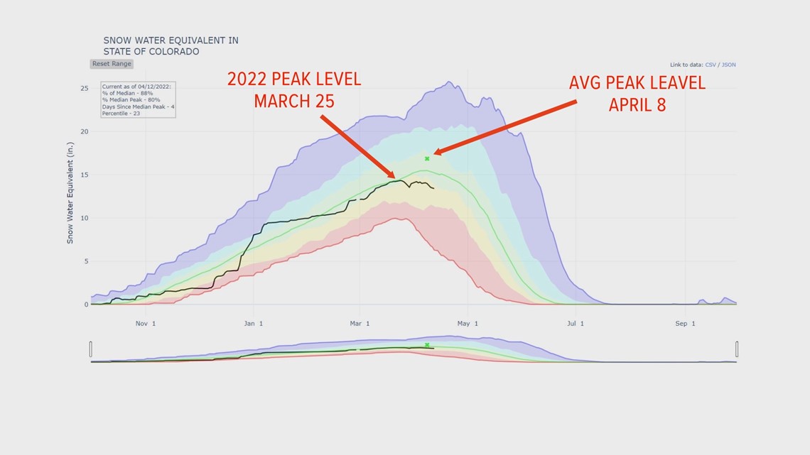
On average, the snowpack in Colorado reaches its peak around April 8. That’s when the longer days and warmer temperatures start to melt the snow fast enough that the snowpack will likely not build back to where it was at its highest point.
That’s even with storms like the one on Tuesday and Wednesday, which could bring 12 inches of snow or more.
This season, statewide snowpack reached its peak level a little early, on March 25. That can also lead to an early melt out, which on average happens in the last week of June.


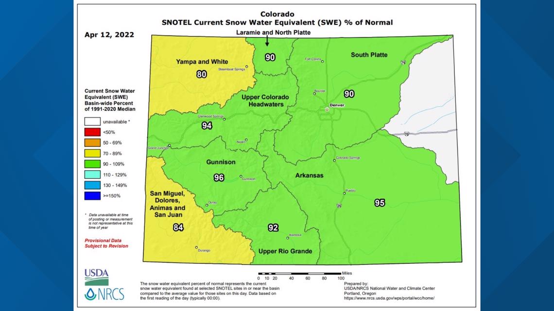
The statewide snowpack numbers are currently a little below average, and these numbers change with the daily historical average so hydrologists can track how fast the snow is melting.
So, sometimes the daily snowpack percentages can reach above 100% but still not come anywhere near as high as back on March 25, when it peaked.
For example, on May 20, the average snow-water equivalent in the mountains might just be 2 inches, and if we get a 24-inch wet spring storm with 2 inches of water in it, the snowpack numbers would go up above 100% if there was any snow on the ground before the storm. But that would not get anywhere near the 14.6 inches of snow-water equivalent that was there on March 25.


Snowpack numbers can also be used to project drought conditions and wildfire danger, but it all depends on how fast the snow melts and evaporates. Remember, we had more snowpack in the mountains in April 2020 and ended up with the worst wildfire season in history.
SUGGESTED VIDEOS: Snow in Colorado

