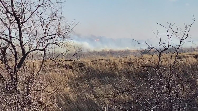
BOULDER COUNTY, Colo — Following the devastating and historic foothills wildfires on Thursday, winds should gradually improve Thursday night.
That said, the fires appear to be simultaneously creating their own weather - making forecasts for the affected areas exceptionally difficult. Due to the intense heat of the Marshall Fire in particular, there are still some periodic stronger gusts around the fire.
As of Thursday night, though, the strongest winds had mostly relaxed around the Marshall Fire in particular.
Winds are typically caused by sharp differences between high and low pressure, and air flows from high to low pressure.
Hot fire gases expand, creating rising pressure. That creates a sharper difference in pressure (known as a pressure gradient) with the surrounding air mass.
That, in turn, can help a wildfire essentially 'create' its own weather, and it can extend the strong winds that fires thrive off of to expand and grow.
In other words, the fire's weather will be difficult to predict. Erratic winds are likely throughout the duration of the night, with localized strong gusts and changing wind directions likely through the overnight hours.
Despite the fires creating their own weather, after wind gusts that topped 100 mph on Thursday afternoon along the Front Range foothills, winds were significantly calmer as of 10 p.m. on Thursday, and they'll continue to do so overnight.
Obviously, it's far too late, but firefighting conditions will improve as the night wears on due to a combination of lighter winds, increasing relative humidity and colder temperatures.
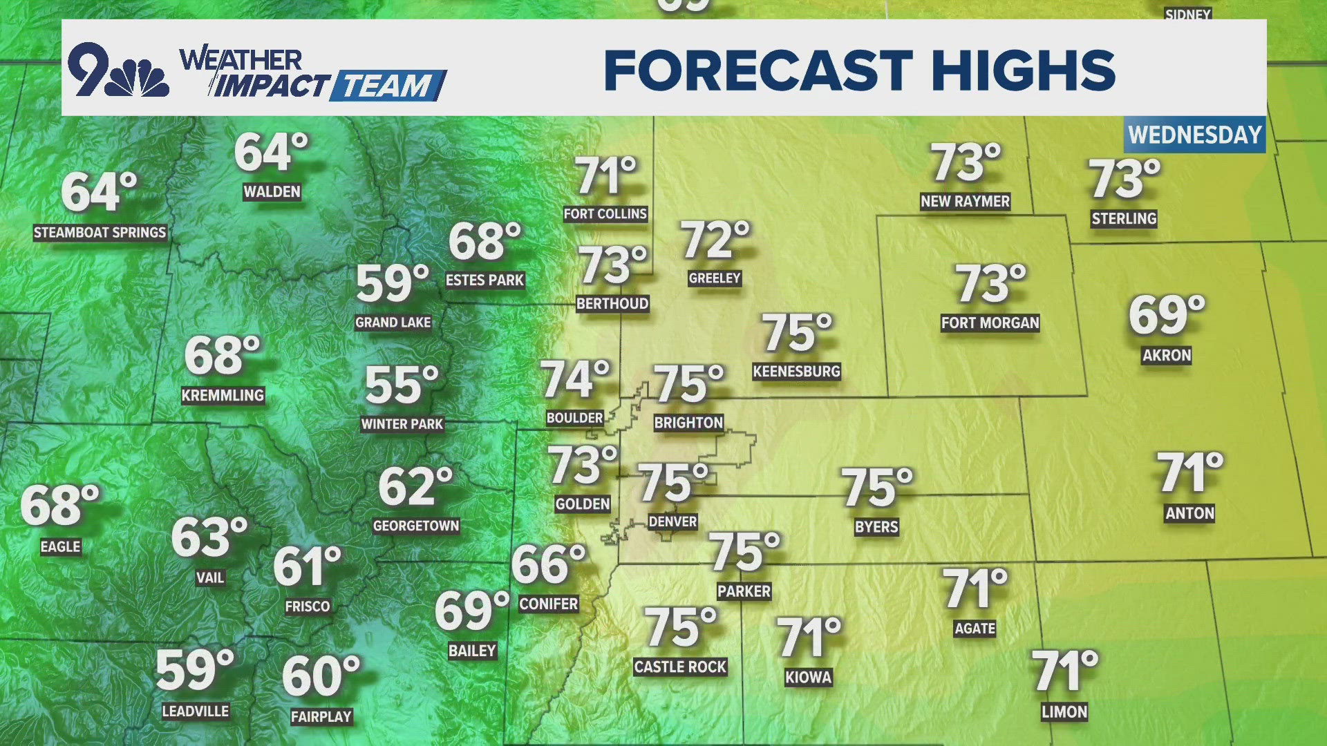
Winds in the Boulder area and along the Front Range foothills should below 30 mph in most areas after midnight on Friday morning.
Again, though, please keep in mind some of these forecasts may be subject to change, due to the erratic nature of the fire itself.
Cold temperatures and snow should move into the area by late Friday morning, which should help firefighters significantly.
RELATED: WATCH LIVE: Entire towns of Superior and Louisville ordered to evacuate due to multiple grass fires
By Friday morning, a sharp cold front will move into northern Colorado, and that'll crash temperatures and snow should develop around midday.
For more details on the forecast, click here.
SUGGESTED VIDEOS: Severe Weather