KUSA – Haiti is slowly recovering after Hurricane Matthew came ashore earlier this month, killing hundreds of people. The storm surge and flooding caused the most damage. Now, a Colorado company that specializes in satellites has developed a way to measure the impact of water after a natural disaster.
"We spend a lot of time thinking about how to convert pixels into useful information," said Kevin Lausten, DigitalGlobe’s director of Geospatial Big Data.
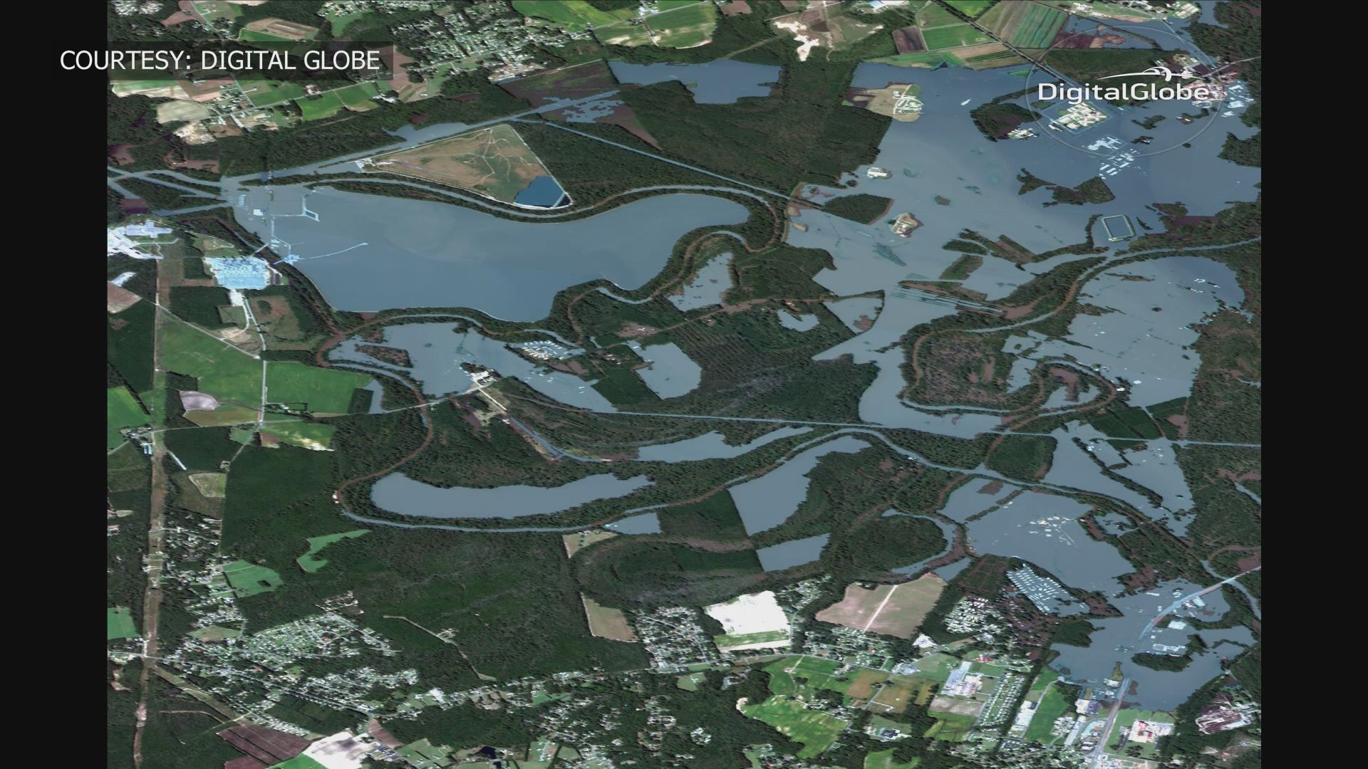
Westminster-based DigitalGlobe has four satellites orbiting the Earth and their work includes offering up before and after images of disaster areas to government agencies first responders and the public.
"One of the biggest problems in Haiti right now is getting people resources who don't have access to clean water, food, medicine,” said Kevin Bullock, DigitalGlobe’s director of business development. “So, knowing where the impacted areas were and knowing how many people are impacted, allows humanitarian relief agencies to get the resources out to the people who need it most. It’s basically a big logistics problem."
They’re using something new, a type of "water algorithm" that can help human eyes pinpoint new bodies of water, like the flooding which came in the aftermath of Hurricane Matthew in the Caribbean and the Carolinas.
"We're collecting imagery and processing it to detect water, but other areas that are interesting are, where are the human settlements, where are the structures, where are the roads?" Lausten said.
That program is able to map where infrastructure used to be, like roads. It can also calculate the depth of water -- something human eyes would not be able to do.
"The difference is scale,” Lausten said. “We collect 3,000,000 square kilometers of imagery every day. So, to have a human step in and try to identify the location where water exists takes days to weeks, but with a machine, we can do it minutes to seconds."
DigitalGlobe's images are open sourced, meaning they make them available to anyone who wants to look at them. You can even volunteer to help map the differences in before and after pictures following a disaster by going to DigitalGlobe’s tomnod.com