DENVER — Perhaps the most important snow story of the season has been unfolding in the Western mountains. After two consecutive winters with extremely dry conditions, the Colorado River basin has come to life with snow.
Nearly 2 feet of snow has fallen in Denver since the beginning of fall (23.9 inches). That’s the snowiest start to a season in three years, after 29 inches of snowfall in 2019 from Sept. 1 through the end of December.
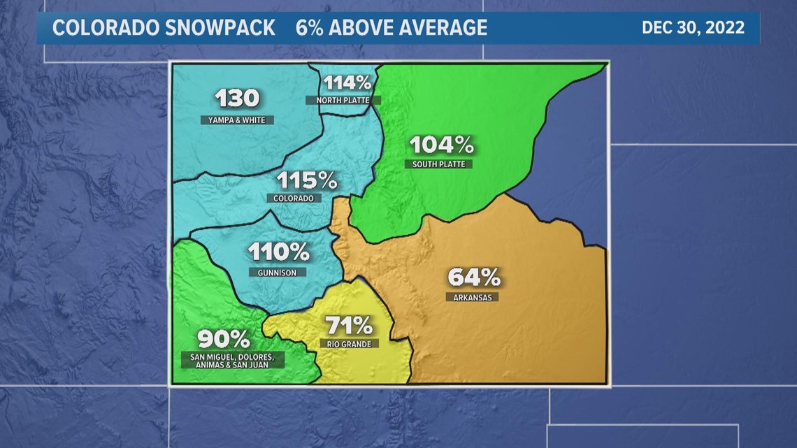
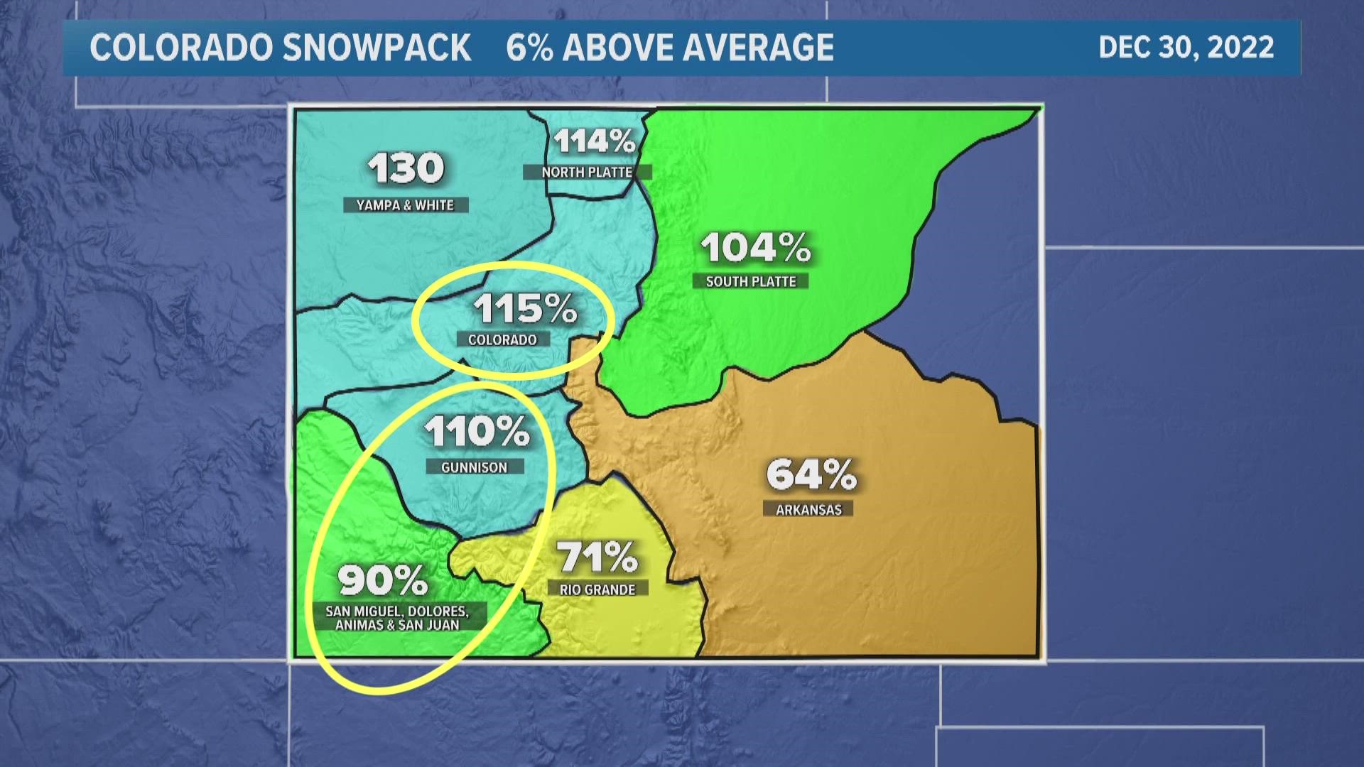
The snowpack at the headwaters of the Colorado River basin is 15% above average so far this season. The snowpack in southwest Colorado also feeds into the Colorado River and that region is in good shape, especially having averaged a big boost with this most recent storm system in the San Juans.


But the snowpack is even higher to our west. Utah, southwestern Wyoming and Idaho have well above average snowpack so far.
That's good news for the Colorado River system and Lake Powell, which hit its lowest levels in history over the summer. But hydrologists warn that the reservoir will need several consecutive big snow years to even make a dent in that water deficit.
Even the big winter of 2019 couldn’t make up for the amount of water that was released from Lake Powell that year.
And farther west, the biggest snow of the season has been in the Sierra Nevada range. Snowpack in some spots there is about double the average for this time of year.
That's good news for parts of Nevada and California that have been struggling with exceptional and extreme long-term drought conditions.
However, the biggest snow story in the country this season might be in the Buffalo, New York, area where Lake Erie has been a lake-effect snow machine. More than 100 inches of snow has fallen at the Buffalo-Niagara Airport so far (101.6 inches) – the most in history, and their records go back 80 years.
SUGGESTED VIDEOS: Latest from 9NEWS

