BOULDER, Colo. — It’s possible that last month’s Marshall Fire cannot be traced to a single cause and was instead sparked at multiple ignition points in multiple locations and fed by hurricane-force winds, a wildfire expert told 9Wants to Know.
Among those possibilities is that the sequence of events late on the morning of Dec. 30 unfolded in multiple ways – that high winds kicked up an underground coal fire burning near the surface, caused nearby power lines to arc, and whipped up a smoldering trash fire.
“We have to look at all the possible ignition sources,” said Brenda Rice, a wildfire investigator who spent 26 years with the U.S. Forest Service.
Rice led the investigation into the 2002 Coal Seam Fire near Glenwood Springs, which was sparked by a long-burning underground coal fire – one of the possible causes being examined for the Marshall Fire.
In addition to that underground coal fire, flames erupted that morning on land owned by a religious group known as Twelve Tribes, which includes several pieces of property near the intersection of Marshall Road and Colorado Highway 93 about a mile south of Boulder. Cell phone video shot by a neighbor during the fire’s early stages showed a shed on fire on the Twelve Tribes property.
Investigators later got a warrant to search the property, but they’ve made no arrests and haven’t pinpointed exactly what started the fire in an investigation that has been described as complex and is expected to take several more weeks.
At the same time, the winds that roared through the area – estimated at 80 to 100 mph – could also have played havoc with power lines.
Rice, now a wildfire consultant, believes it’s possible all of those factors were in play the day the Marshall Fire erupted.
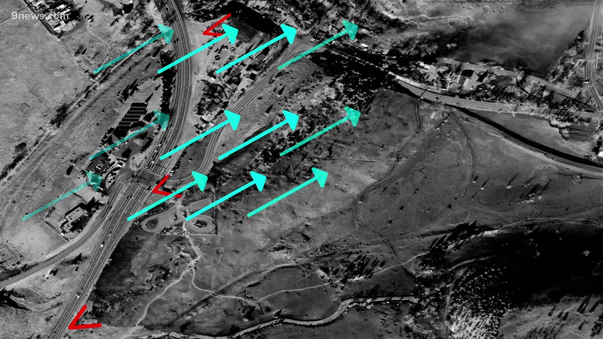
Rice examined a satellite photograph of the burn patterns in the area where it began near Marshall Road and Colorado Highway 93, identifying three potential ignition points.
One is the site of that shed fire on Twelve Tribes’ property. Two others are along Highway 93 – one at its intersection with Marshall Road, one farther south.
In both of those places along the highway, she identified a “distinctive V pattern” – a burn scar pointing to the area where a fire started.
Power and communications lines run along the highway in that area. And while officials have said no electrical lines were down in that area when the fire started, they don’t have to fall to the ground to cause trouble.
Power lines that touch each other in high winds can arc and throw sparks – and they can even send molten metal to the ground.
And while wildfires can skip across the landscape, Rice said the wind pattern in the area – from the west and southwest – does not suggest that one of the potential ignition points she identified caused the others.
For instance, the wind could not have taken embers from the possible ignition points along the highway to the shed – or vice-versa, she said.
All of that is why Rice told 9Wants to Know she believes it’s possible that the wind whipped up a smoldering underground coal fire burning near the surface, caused powerlines to drop sparks or hot metal on the ground, and spread what may have been a long-smoldering fire on the Twelve Tribes property – three separate events that could have occurred in a short time.
The common denominator in all three was the wind.
“Did the wind influence a coal seam vent?” she asked. “Did it influence a burn pile that had been left burning from three days previous? And wind is very much a factor when it comes to power line fires -- just look at PG&E in California. It’s – it’s a big deal.”
The 2018 Camp Fire in California, started by sparks from Pacific Gas & Electric transmission lines, burned 153,000 acres, destroyed 18,800 structures and killed 85 people.
The investigators working to determine how the Marshall Fire started are expected to need several more weeks before reaching a definitive conclusion.
Contact 9Wants to Know investigator Kevin Vaughan with tips about this or any story: kevin.vaughan@9news.com or 303-871-1862.
SUGGESTED VIDEOS: Marshall Fire Coverage

