GARFIELD COUNTY, Colo. — Six burn scars in Colorado have elevated chances of flooding on Thursday due to increased moisture and the chance of storms in the state.
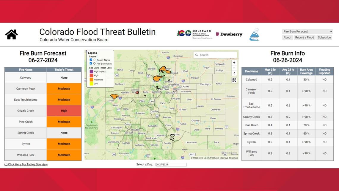
Five burn scar areas are listed as having moderate threat of flooding, according to the Colorado Flood Threat Bulletin.
Those burn scars and their locations are: Cameron Peak in Larimer County, East Troublesome in Grand and Larimer counties, Pine Gulch in Garfield and Mesa counties, Sylvan in Eagle County, and Williams Fork in Grand County.
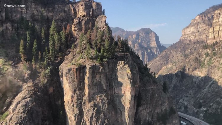
The Grizzly Creek burn scar in Garfield County is listed as a high flood threat for Thursday. This burn scar, which runs along Glenwood Canyon along the Interstate 70 corridor, has seen multiple flood events and closures in the last three-plus years since the Grizzly Creek Fire scorched more than 32,000 acres in 2020.
Forecasters said afternoon storms could be capable of producing short-term heavy rain, and multiple rounds of moderate rains. That rainfall could trigger debris and mud flows, and flash flooding for low-lying roads.
The flood threat forecast said the Cameron Peak, East Troublesome, Grizzly Creek, Sylvan and Williams Fork burn scar areas could see varying rainfall rates.

FULL WEATHER FORECAST: Heavy rain possible for parts of Colorado
OAK RIDGE FIRE: Southern Colorado wildfire grows to more than 1,000 acres
SUGGESTED VIDEOS: Colorado Weather
> Share your photos or video with 9NEWS through “Near Me” on the free 9NEWS app! DOWNLOAD APP FOR IPHONE HERE or DOWNLOAD APP FOR ANDROID HERE.