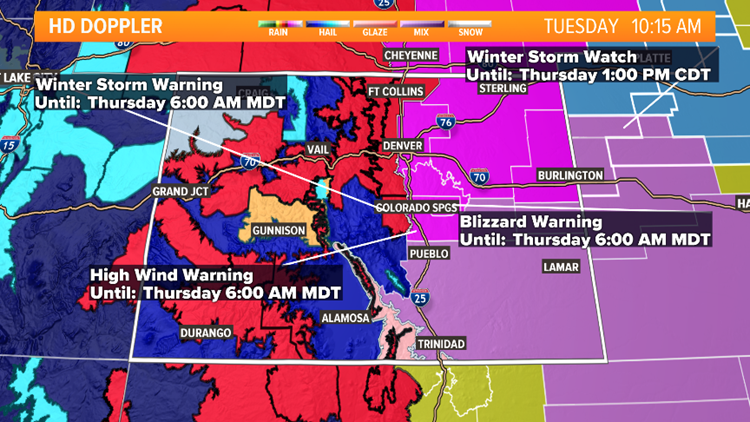
Blizzard conditions are expected shortly for much of the Denver metro area Wednesday morning as a winter storm covers the entire northeastern quarter of the state.
Between gusty winds and heavy snowfall, the metro area should expect difficult travel conditions. With that in mind, we put together a list of your most frequently asked questions when a winter storm is headed our way. Meteorologist Kylie Bearse has the answers.
RELATED: Front Range weather forecast
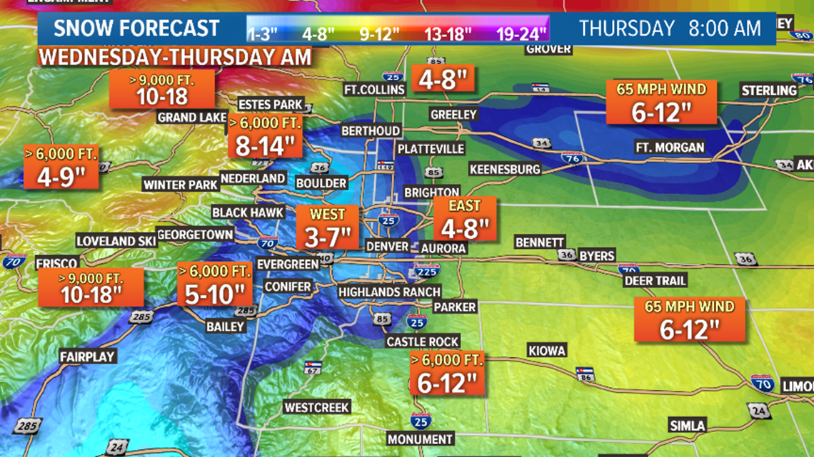
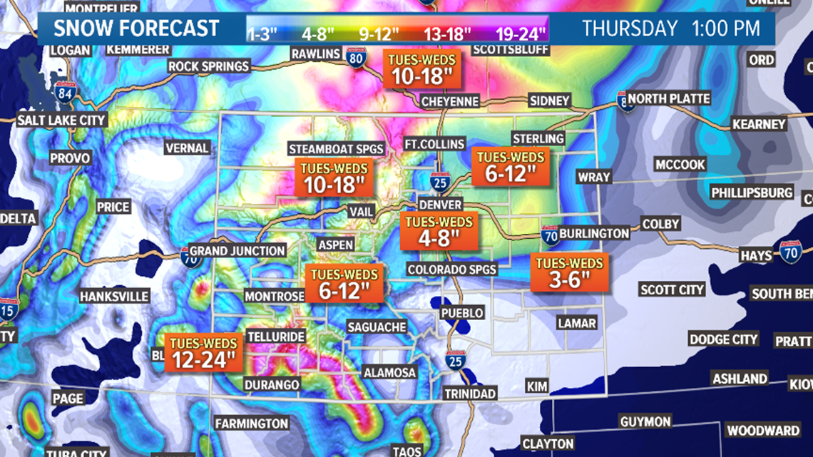
How much will it snow?
Below are the forecasted totals. However, it is difficult to get exact totals from this storm because of the wind.


What time will it start?
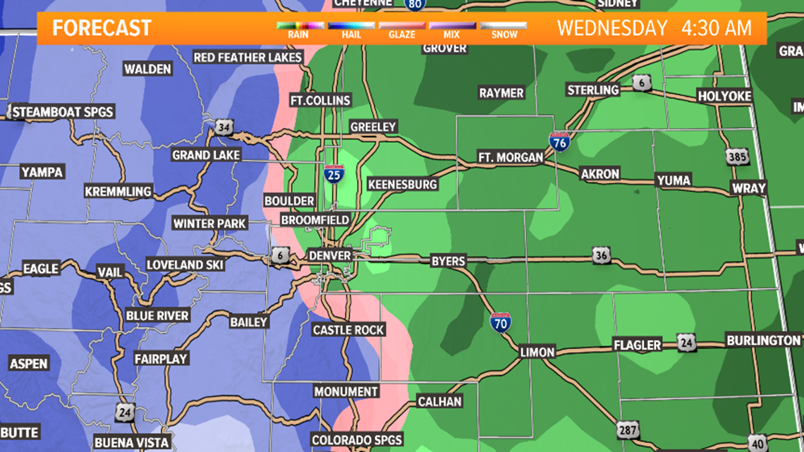
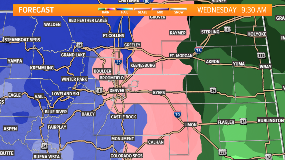
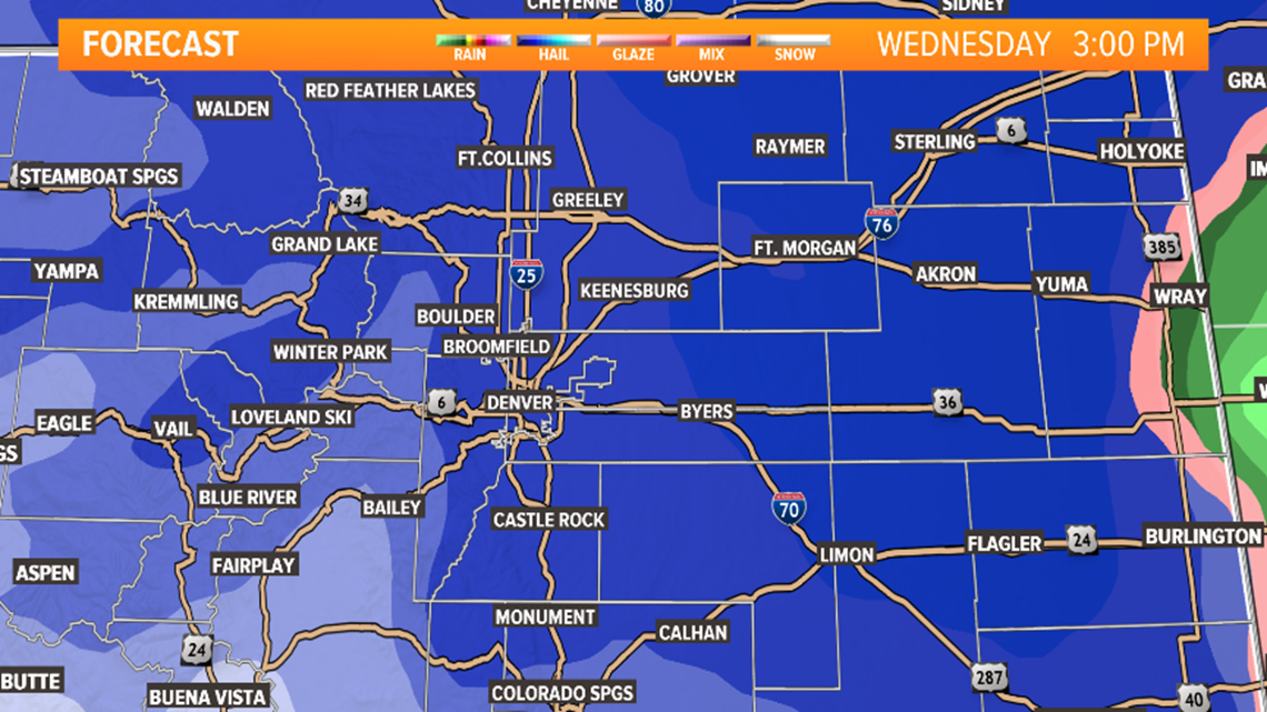
That depends on where you are. This system will first start as rain Wednesday morning, before transitioning to snow. We'll see the metro area transition to snow first, then the plains by the afternoon. It looks like the heaviest snow will be in the metro area from 11 a.m. to 3 p.m.



When will it end?
This also depends on where you are. In general, most of the snow will wrap up overnight. We could see it stop even earlier for the west metro, depending on downsloping winds that could slow and stop the snow. The Eastern Plains are under a blizzard warning until noon Thursday, so expect conditions to be difficult through the morning, with gusty winds.
What's a "bomb cyclone"?
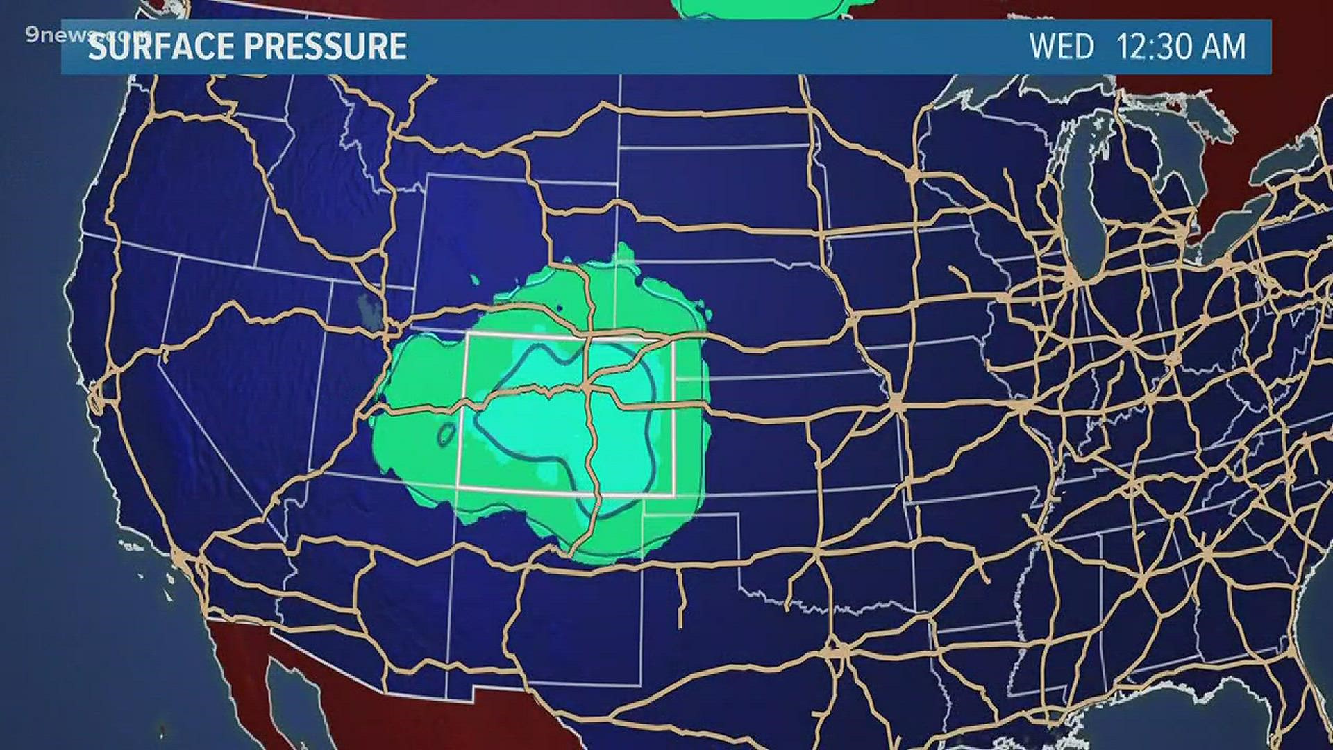
A bomb cyclone is a real meteorological term. Bombogenesis is when a midlatitude cyclone rapidly intensifies 24 mb in 24 hours. This storm does have that potential! I personally don't love this term because it can get sensationalized on social media, but it is technically accurate and certainly looks likely with storm.
What defines a blizzard?
It's more about wind than anything else! Official National Weather Service definition is sustained wind 35 mph and higher and considerable falling/blowing snow for three hours or longer.
RELATED: What exactly is a blizzard, anyway?
How windy will it get?
Check out potential wind speeds in your area in our graphic below!


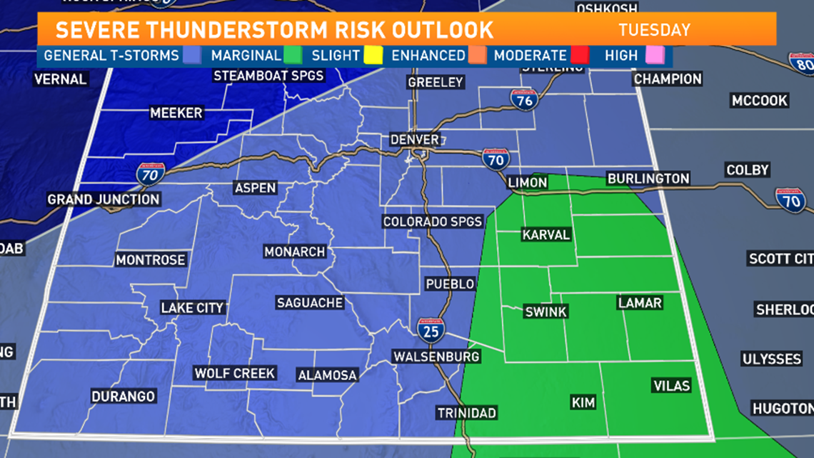
Will I see thunderstorms?
Maybe! There's a chance for convective activity and potentially even an isolated severe storm. Storms in southeastern Colorado could see damaging winds and large hail.

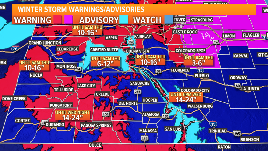
What about southwestern Colorado?
You'll be done with the storm by Wednesday night and could see up to two feet in spots!

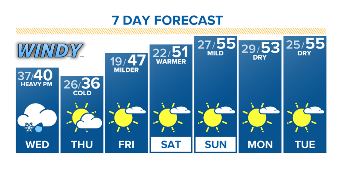
When will we warm up again?
Things are looking much milder from Friday through the weekend and into early next week!

SUGGESTED VIDEOS | Local stories from 9NEWS


