
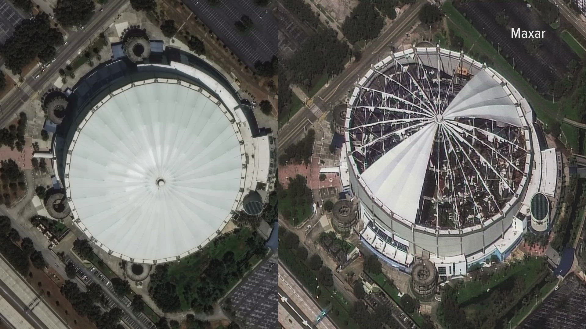
DENVER — A Colorado company is sharing striking new images highlighting the devastation of hurricanes Helene and Milton.
Maxar Technologies is based in Westminster and operates 8 satellites photographing the Earth.
Those images are primarily used by private companies for mapping purposes, and by the U.S. Government for national security purposes, but Chief Operations Officer Jeff Robertson said they can be valuable resources after natural disasters.
“In events like Helene and Milton that are covering broad areas, we can quickly see impacts across very broad areas,” he said.
Robertson said the satellites allow them to see the same spot on the globe up to 15 times a day, providing clear before and after images from the storms.
“That becomes important when you really need to see the change and want to see what continues to change in that area,” he said.
Robertson said they’re sharing those images free of charge with local agencies in the Southeast who need them for recovery purposes.
“We look at images and we provide them all the way through to the insights, so that they can focus on what they do best,” he said. “We help point them to the areas of greatest need. So, we're very pleased to provide that support.”