COLORADO, USA — Enjoy the spring-like weather in Colorado on Wednesday because it's not going to last.
The warmer temperatures will stick around through Wednesday, but then it will turn colder again with some snow likely spreading from the mountains onto portions of the plains late Wednesday night into Thursday.
The big story for the Front Range will be yet another exceptional sharp temperature drop. After highs near 70 degrees on Wednesday afternoon, temperatures will plunge into the teens for Thursday night into Friday morning. It will stay chilly through Friday and the upcoming weekend, with highs only in the 30s.
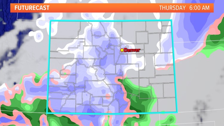
The sharp temperature drop will be accompanied by at least some rain and snow for the Front Range. A cold front will bring in a mix of rain and snow overnight Wednesday into Thursday morning.
It'll start as rain for lower elevations, including the Denver area, before flipping to wet snow during or just before the Thursday morning commute.

The snow probably won't pile up to much for the Denver area, with Wednesday's warm temperatures making it difficult for any snow to stick on Thursday morning. A slushy few inches could fall in the foothills, where there will be more moisture and slightly colder temperatures.
Accumulations in Denver will probably be an inch or less; though again, the foothills west of town could see more. Boulder, Golden, and the foothills could see 1 to 3 inches on Thursday morning.
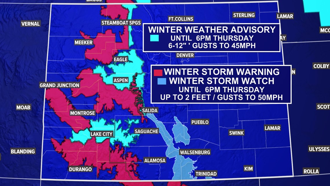
Meanwhile in the mountains, another sizeable storm is in the offing for Wednesday and Thursday. Winter Storm Warnings and Winter Weather Advisories are up for much of the high country above 7,000 feet in elevation. As much as 2 feet worth of snow could fall in the high country, with the majority of it coming on Wednesday afternoon and night.


Travel could be especially difficult on Wednesday afternoon and night in the high country, especially south of I-70. Monarch and Wolf Creek Passes could be especially difficult drives during that time.
After the 50-degree drop in Denver between Wednesday and Thursday, the chilly temperatures will continue on Friday and into the weekend.
FORECAST: Full forecast
CLOSURES: Full list of closures
ALERTS: Latest Colorado weather alerts
Then we’re back to partly cloudy skies Friday and Saturday with highs staying well below normal for this time of year. Chances for snow return for Saturday night, Sunday and Monday with highs continuing below seasonal norms.
That storm looks to bring the potential for significant snow to southeastern Colorado, though it's still early.
WEATHER LINE 9: Updated weather info at 303-871-1492.
SUGGESTED VIDEOS: Snow in Colorado
MORE WAYS TO GET 9NEWS
Subscribe to our daily 9NEWSLETTER
Download the 9NEWS APP
iTunes: http://on9news.tv/itunes
Google Play: http://on9news.tv/1lWnC5n
ADD THE 9NEWS+ APP TO YOUR STREAMING DEVICE
ROKU: add the channel from the ROKU store or by searching for KUSA.
For both Apple TV and Fire TV, search for "9news" to find the free app to add to your account. Another option for Fire TV is to have the app delivered directly to your Fire TV through Amazon.